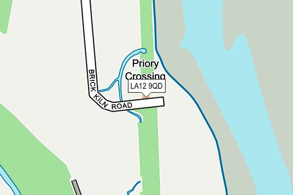
LA12 9QD lies on Priory Crossing in Ulverston. LA12 9QD is located in the Ulverston electoral ward, within the unitary authority of Westmorland and Furness and the English Parliamentary constituency of Barrow and Furness. The Sub Integrated Care Board (ICB) Location is NHS Lancashire and South Cumbria ICB - 01K and the police force is Cumbria. This postcode has been in use since January 1980.


GetTheData
Source: OS OpenMap – Local (Ordnance Survey)
Source: OS VectorMap District (Ordnance Survey)
Licence: Open Government Licence (requires attribution)
| Easting | 330719 |
| Northing | 476289 |
| Latitude | 54.177696 |
| Longitude | -3.062936 |
GetTheData
Source: Open Postcode Geo
Licence: Open Government Licence
| Street | Priory Crossing |
| Town/City | Ulverston |
| Country | England |
| Postcode District | LA12 |
| ➜ LA12 open data dashboard ➜ See where LA12 is on a map | |
GetTheData
Source: Land Registry Price Paid Data
Licence: Open Government Licence
Elevation or altitude of LA12 9QD as distance above sea level:
| Metres | Feet | |
|---|---|---|
| Elevation | 10m | 33ft |
Elevation is measured from the approximate centre of the postcode, to the nearest point on an OS contour line from OS Terrain 50, which has contour spacing of ten vertical metres.
➜ How high above sea level am I? Find the elevation of your current position using your device's GPS.
GetTheData
Source: Open Postcode Elevation
Licence: Open Government Licence
| Ward | Ulverston |
| Constituency | Barrow And Furness |
GetTheData
Source: ONS Postcode Database
Licence: Open Government Licence
| January 2024 | Anti-social behaviour | On or near Park/Open Space | 337m |
| November 2023 | Violence and sexual offences | On or near Park/Open Space | 337m |
| August 2023 | Violence and sexual offences | On or near Park/Open Space | 337m |
| ➜ Get more crime data in our Crime section | |||
GetTheData
Source: data.police.uk
Licence: Open Government Licence
| Conishead Priory (Priory Road) | Bardsea | 784m |
| Conishead Priory (Priory Road) | Bardsea | 801m |
| Hazeldene (Prioiry Road) | Ulverston | 1,220m |
| West Mount (Priory Road) | Ulverston | 1,229m |
| Glaxo Main Gate (North Lonsdale Road) | Sandside | 1,255m |
| Ulverston Station | 2.8km |
GetTheData
Source: NaPTAN
Licence: Open Government Licence
| Percentage of properties with Next Generation Access | 100.0% |
| Percentage of properties with Superfast Broadband | 0.0% |
| Percentage of properties with Ultrafast Broadband | 0.0% |
| Percentage of properties with Full Fibre Broadband | 0.0% |
Superfast Broadband is between 30Mbps and 300Mbps
Ultrafast Broadband is > 300Mbps
| Percentage of properties unable to receive 2Mbps | 0.0% |
| Percentage of properties unable to receive 5Mbps | 0.0% |
| Percentage of properties unable to receive 10Mbps | 100.0% |
| Percentage of properties unable to receive 30Mbps | 100.0% |
GetTheData
Source: Ofcom
Licence: Ofcom Terms of Use (requires attribution)
GetTheData
Source: ONS Postcode Database
Licence: Open Government Licence


➜ Get more ratings from the Food Standards Agency
GetTheData
Source: Food Standards Agency
Licence: FSA terms & conditions
| Last Collection | |||
|---|---|---|---|
| Location | Mon-Fri | Sat | Distance |
| Saltcoates | 17:15 | 11:15 | 1,114m |
| Priory Road, Primrose Hill | 11:00 | 11:00 | 1,117m |
| Canal Foot | 17:30 | 11:15 | 1,489m |
GetTheData
Source: Dracos
Licence: Creative Commons Attribution-ShareAlike
| Facility | Distance |
|---|---|
| Ulverston Golf Club Bardsea, Ulverston Golf | 1.2km |
| Gsk Sports & Social Club North Lonsdale Road, Ulverston Grass Pitches, Health and Fitness Gym, Sports Hall, Squash Courts | 1.3km |
| Ulverston Health Club North Lonsdale Road, Ulverston Health and Fitness Gym | 1.7km |
GetTheData
Source: Active Places
Licence: Open Government Licence
| School | Phase of Education | Distance |
|---|---|---|
| Sandside Lodge School Springfield Road, Ulverston, LA12 0DZ | Not applicable | 1.4km |
| Croftlands Infant School Oakwood Drive, Ulverston, LA12 9JU | Primary | 2.2km |
| Croftlands Junior School Oakwood Drive, Ulverston, LA12 9JU | Primary | 2.2km |
GetTheData
Source: Edubase
Licence: Open Government Licence
| Risk of LA12 9QD flooding from rivers and sea | Low |
| ➜ LA12 9QD flood map | |
GetTheData
Source: Open Flood Risk by Postcode
Licence: Open Government Licence
The below table lists the International Territorial Level (ITL) codes (formerly Nomenclature of Territorial Units for Statistics (NUTS) codes) and Local Administrative Units (LAU) codes for LA12 9QD:
| ITL 1 Code | Name |
|---|---|
| TLD | North West (England) |
| ITL 2 Code | Name |
| TLD1 | Cumbria |
| ITL 3 Code | Name |
| TLD12 | East Cumbria |
| LAU 1 Code | Name |
| E07000031 | South Lakeland |
GetTheData
Source: ONS Postcode Directory
Licence: Open Government Licence
The below table lists the Census Output Area (OA), Lower Layer Super Output Area (LSOA), and Middle Layer Super Output Area (MSOA) for LA12 9QD:
| Code | Name | |
|---|---|---|
| OA | E00098035 | |
| LSOA | E01019388 | South Lakeland 012A |
| MSOA | E02004026 | South Lakeland 012 |
GetTheData
Source: ONS Postcode Directory
Licence: Open Government Licence
| LA12 9GP | Brick Kiln Road | 287m |
| LA12 9RX | Priory Road | 464m |
| LA12 9EQ | Sandhall | 745m |
| LA12 9EH | Sandhall Cottages | 794m |
| LA12 9QH | Red Lane | 996m |
| LA12 9EG | Sandside | 1089m |
| LA12 9QG | 1147m | |
| LA12 9QJ | Town End Cottages | 1170m |
| LA12 9QB | Oxenholme Cottages | 1216m |
| LA12 9QE | Priory Road | 1279m |
GetTheData
Source: Open Postcode Geo; Land Registry Price Paid Data
Licence: Open Government Licence