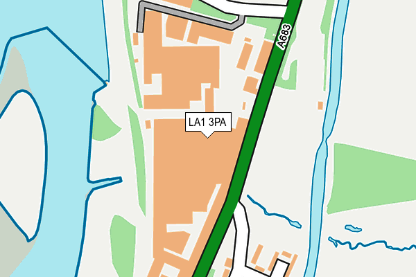
LA1 3PA is located in the Bulk electoral ward, within the local authority district of Lancaster and the English Parliamentary constituency of Lancaster and Fleetwood. The Sub Integrated Care Board (ICB) Location is NHS Lancashire and South Cumbria ICB - 01K and the police force is Lancashire. This postcode has been in use since January 1980.


GetTheData
Source: OS OpenMap – Local (Ordnance Survey)
Source: OS VectorMap District (Ordnance Survey)
Licence: Open Government Licence (requires attribution)
| Easting | 348413 |
| Northing | 463087 |
| Latitude | 54.061143 |
| Longitude | -2.789621 |
GetTheData
Source: Open Postcode Geo
Licence: Open Government Licence
| Country | England |
| Postcode District | LA1 |
| ➜ LA1 open data dashboard ➜ See where LA1 is on a map ➜ Where is Lancaster? | |
GetTheData
Source: Land Registry Price Paid Data
Licence: Open Government Licence
Elevation or altitude of LA1 3PA as distance above sea level:
| Metres | Feet | |
|---|---|---|
| Elevation | 10m | 33ft |
Elevation is measured from the approximate centre of the postcode, to the nearest point on an OS contour line from OS Terrain 50, which has contour spacing of ten vertical metres.
➜ How high above sea level am I? Find the elevation of your current position using your device's GPS.
GetTheData
Source: Open Postcode Elevation
Licence: Open Government Licence
| Ward | Bulk |
| Constituency | Lancaster And Fleetwood |
GetTheData
Source: ONS Postcode Database
Licence: Open Government Licence
| June 2022 | Other theft | On or near Petrol Station | 156m |
| June 2022 | Anti-social behaviour | On or near Petrol Station | 156m |
| June 2022 | Public order | On or near Petrol Station | 156m |
| ➜ Get more crime data in our Crime section | |||
GetTheData
Source: data.police.uk
Licence: Open Government Licence
| Langdale Rd (Caton Road) | Lansil | 80m |
| Langdale Rd (Caton Road) | Lansil | 84m |
| Grizedale Rd (Langdale Road) | Newton | 152m |
| Grizedale Road (Langdale Road) | Newton | 271m |
| Scafell Road (Langdale Road) | Newton | 329m |
| Lancaster Station | 1.8km |
| Bare Lane Station | 3.3km |
GetTheData
Source: NaPTAN
Licence: Open Government Licence
GetTheData
Source: ONS Postcode Database
Licence: Open Government Licence


➜ Get more ratings from the Food Standards Agency
GetTheData
Source: Food Standards Agency
Licence: FSA terms & conditions
| Last Collection | |||
|---|---|---|---|
| Location | Mon-Fri | Sat | Distance |
| Lansil Industrial Estate | 17:30 | 10:30 | 270m |
| Lansil Industrial Estate | 17:30 | 270m | |
| Aldrens Lane | 16:15 | 12:45 | 430m |
GetTheData
Source: Dracos
Licence: Creative Commons Attribution-ShareAlike
| Facility | Distance |
|---|---|
| Lansil Sports And Social Club Caton Road, Lancaster Golf | 357m |
| Skerton Community High School (Closed) Owen Road, Lancaster Grass Pitches, Sports Hall, Artificial Grass Pitch | 726m |
| Skerton St Lukes C Of E Primary School Slyne Road, Lancaster Grass Pitches | 835m |
GetTheData
Source: Active Places
Licence: Open Government Licence
| School | Phase of Education | Distance |
|---|---|---|
| St Josephs Catholic Primary School, Lancaster Aldrens Lane, Lancaster, LA1 2DU | Primary | 655m |
| Chadwick High School Mainway, Skerton, Lancaster, LA1 2AY | Not applicable | 669m |
| Castle View Primary Academy Keswick Road, Lancaster, LA1 3LE | Primary | 841m |
GetTheData
Source: Edubase
Licence: Open Government Licence
| Risk of LA1 3PA flooding from rivers and sea | Low |
| ➜ LA1 3PA flood map | |
GetTheData
Source: Open Flood Risk by Postcode
Licence: Open Government Licence
The below table lists the International Territorial Level (ITL) codes (formerly Nomenclature of Territorial Units for Statistics (NUTS) codes) and Local Administrative Units (LAU) codes for LA1 3PA:
| ITL 1 Code | Name |
|---|---|
| TLD | North West (England) |
| ITL 2 Code | Name |
| TLD4 | Lancashire |
| ITL 3 Code | Name |
| TLD44 | Lancaster and Wyre |
| LAU 1 Code | Name |
| E07000121 | Lancaster |
GetTheData
Source: ONS Postcode Directory
Licence: Open Government Licence
The below table lists the Census Output Area (OA), Lower Layer Super Output Area (LSOA), and Middle Layer Super Output Area (MSOA) for LA1 3PA:
| Code | Name | |
|---|---|---|
| OA | E00127346 | |
| LSOA | E01025092 | Lancaster 013B |
| MSOA | E02005233 | Lancaster 013 |
GetTheData
Source: ONS Postcode Directory
Licence: Open Government Licence
| LA1 3NP | Grizedale Road | 169m |
| LA1 3PB | Newton Terrace | 190m |
| LA1 3NW | Coniston Road | 237m |
| LA1 3QY | Lansil Way | 249m |
| LA1 3NR | Langdale Road | 263m |
| LA1 3NN | Scafell Road | 316m |
| LA1 3NY | Caton Road | 384m |
| LA1 3NA | Cartmel Road | 397m |
| LA1 3NB | Ennerdale Close | 400m |
| LA1 3NS | Langdale Place | 413m |
GetTheData
Source: Open Postcode Geo; Land Registry Price Paid Data
Licence: Open Government Licence