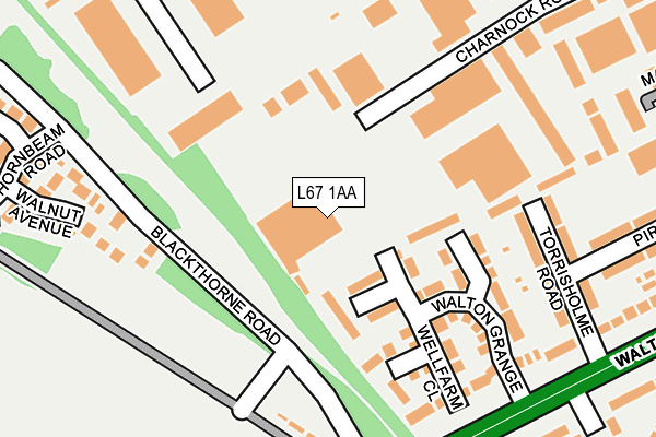
L67 1AA is located in the Walton electoral ward, within the metropolitan district of Liverpool and the English Parliamentary constituency of Liverpool, Walton. The Sub Integrated Care Board (ICB) Location is NHS Cheshire and Merseyside ICB - 99A and the police force is Merseyside. This postcode has been in use since January 1980.


GetTheData
Source: OS OpenMap – Local (Ordnance Survey)
Source: OS VectorMap District (Ordnance Survey)
Licence: Open Government Licence (requires attribution)
| Easting | 337457 |
| Northing | 395271 |
| Latitude | 53.450470 |
| Longitude | -2.943225 |
GetTheData
Source: Open Postcode Geo
Licence: Open Government Licence
| Country | England |
| Postcode District | L67 |
| ➜ L67 open data dashboard ➜ Where is Liverpool? | |
GetTheData
Source: Land Registry Price Paid Data
Licence: Open Government Licence
Elevation or altitude of L67 1AA as distance above sea level:
| Metres | Feet | |
|---|---|---|
| Elevation | 30m | 98ft |
Elevation is measured from the approximate centre of the postcode, to the nearest point on an OS contour line from OS Terrain 50, which has contour spacing of ten vertical metres.
➜ How high above sea level am I? Find the elevation of your current position using your device's GPS.
GetTheData
Source: Open Postcode Elevation
Licence: Open Government Licence
| Ward | Walton |
| Constituency | Liverpool, Walton |
GetTheData
Source: ONS Postcode Database
Licence: Open Government Licence
| June 2022 | Anti-social behaviour | On or near Charnook Road | 85m |
| June 2022 | Violence and sexual offences | On or near Blackthorne Road | 204m |
| June 2022 | Violence and sexual offences | On or near Blackthorne Road | 204m |
| ➜ Get more crime data in our Crime section | |||
GetTheData
Source: data.police.uk
Licence: Open Government Licence
| Forsythia Close (Blackthorne Road) | Walton | 136m |
| Forsythia Close (Blackthorne Road) | Walton | 137m |
| Blackthorne Road (Walton Hall Avenue) | Walton | 218m |
| Richard Kelly Drive (Walton Hall Avenue) | Walton | 258m |
| Abingdon Grove (Richard Kelly Drive) | Walton | 282m |
| Rice Lane Station | 1.5km |
| Walton (Merseyside) Station | 1.6km |
| Orrell Park Station | 1.8km |
GetTheData
Source: NaPTAN
Licence: Open Government Licence
GetTheData
Source: ONS Postcode Database
Licence: Open Government Licence


➜ Get more ratings from the Food Standards Agency
GetTheData
Source: Food Standards Agency
Licence: FSA terms & conditions
| Last Collection | |||
|---|---|---|---|
| Location | Mon-Fri | Sat | Distance |
| Cavendish Drive | 16:00 | 12:00 | 1,263m |
| Rice Lane | 16:00 | 12:00 | 1,304m |
| Walton Vale Post Office | 16:45 | 12:00 | 1,824m |
GetTheData
Source: Dracos
Licence: Creative Commons Attribution-ShareAlike
| Facility | Distance |
|---|---|
| Leisure United Jeffrey Humble Long Lane, Walton, Liverpool Grass Pitches, Sports Hall, Health and Fitness Gym, Artificial Grass Pitch | 535m |
| The Queen Mary School (Closed) Long Lane, Walton, Liverpool Grass Pitches | 598m |
| Liverpool Walton Soccer Centre Walton Hall Avenue, Liverpool Grass Pitches | 676m |
GetTheData
Source: Active Places
Licence: Open Government Licence
| School | Phase of Education | Distance |
|---|---|---|
| Leamington Community Primary School Leamington Road, Norris Green, Leamington Community Primary School, Liverpool, L11 7BT | Primary | 639m |
| Florence Melly Community Primary School Bushey Road, Liverpool, L4 9UA | Primary | 796m |
| Cavendish View School 99, Cavendish drive, Liverpool, L9 1NB | Not applicable | 938m |
GetTheData
Source: Edubase
Licence: Open Government Licence
The below table lists the International Territorial Level (ITL) codes (formerly Nomenclature of Territorial Units for Statistics (NUTS) codes) and Local Administrative Units (LAU) codes for L67 1AA:
| ITL 1 Code | Name |
|---|---|
| TLD | North West (England) |
| ITL 2 Code | Name |
| TLD7 | Merseyside |
| ITL 3 Code | Name |
| TLD72 | Liverpool |
| LAU 1 Code | Name |
| E08000012 | Liverpool |
GetTheData
Source: ONS Postcode Directory
Licence: Open Government Licence
The below table lists the Census Output Area (OA), Lower Layer Super Output Area (LSOA), and Middle Layer Super Output Area (MSOA) for L67 1AA:
| Code | Name | |
|---|---|---|
| OA | E00176773 | |
| LSOA | E01032510 | Liverpool 008F |
| MSOA | E02001354 | Liverpool 008 |
GetTheData
Source: ONS Postcode Directory
Licence: Open Government Licence
| L9 6GF | Carlake Grove | 66m |
| L9 6GE | Dinglebrook Road | 84m |
| L9 6GB | Harbreck Grove | 109m |
| L9 6GD | Wellfarm Close | 160m |
| L9 6GA | Hillbrook Drive | 177m |
| L9 1HZ | Forsythia Close | 193m |
| L9 6AS | Torrisholme Road | 201m |
| L9 6AT | Torrisholme Road | 221m |
| L9 1JG | Walnut Avenue | 256m |
| L4 9UU | Walton Hall Avenue | 280m |
GetTheData
Source: Open Postcode Geo; Land Registry Price Paid Data
Licence: Open Government Licence