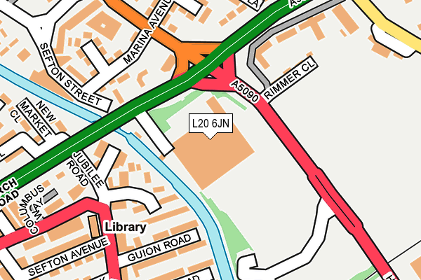
L20 6JN is located in the Litherland electoral ward, within the metropolitan district of Sefton and the English Parliamentary constituency of Bootle. The Sub Integrated Care Board (ICB) Location is NHS Cheshire and Merseyside ICB - 01T and the police force is Merseyside. This postcode has been in use since May 2010.


GetTheData
Source: OS OpenMap – Local (Ordnance Survey)
Source: OS VectorMap District (Ordnance Survey)
Licence: Open Government Licence (requires attribution)
| Easting | 333853 |
| Northing | 397373 |
| Latitude | 53.468920 |
| Longitude | -2.997928 |
GetTheData
Source: Open Postcode Geo
Licence: Open Government Licence
| Country | England |
| Postcode District | L20 |
| ➜ L20 open data dashboard ➜ See where L20 is on a map ➜ Where is Litherland? | |
GetTheData
Source: Land Registry Price Paid Data
Licence: Open Government Licence
Elevation or altitude of L20 6JN as distance above sea level:
| Metres | Feet | |
|---|---|---|
| Elevation | 20m | 66ft |
Elevation is measured from the approximate centre of the postcode, to the nearest point on an OS contour line from OS Terrain 50, which has contour spacing of ten vertical metres.
➜ How high above sea level am I? Find the elevation of your current position using your device's GPS.
GetTheData
Source: Open Postcode Elevation
Licence: Open Government Licence
| Ward | Litherland |
| Constituency | Bootle |
GetTheData
Source: ONS Postcode Database
Licence: Open Government Licence
| June 2022 | Shoplifting | On or near Richmond Court | 121m |
| June 2022 | Public order | On or near Richmond Court | 121m |
| June 2022 | Vehicle crime | On or near Hawthorne Road | 162m |
| ➜ Get more crime data in our Crime section | |||
GetTheData
Source: data.police.uk
Licence: Open Government Licence
| Hawthorne Road (Church Road) | Litherland | 75m |
| Church Road (Hawthorne Road) | Litherland | 85m |
| Church Road (Hawthorne Road) | Litherland | 101m |
| Marina Avenue (Hawthorne Road) | Litherland | 157m |
| Linacre Road (Bridge Road) | Linacre | 184m |
| Seaforth & Litherland Station | 0.6km |
| Bootle New Strand Station | 1.7km |
| Waterloo (Merseyside) Station | 2km |
GetTheData
Source: NaPTAN
Licence: Open Government Licence
GetTheData
Source: ONS Postcode Database
Licence: Open Government Licence


➜ Get more ratings from the Food Standards Agency
GetTheData
Source: Food Standards Agency
Licence: FSA terms & conditions
| Last Collection | |||
|---|---|---|---|
| Location | Mon-Fri | Sat | Distance |
| Ruthven Road | 17:00 | 12:00 | 390m |
| Ascot Avenue | 17:00 | 12:00 | 704m |
| Mereton Village | 17:00 | 12:00 | 770m |
GetTheData
Source: Dracos
Licence: Creative Commons Attribution-ShareAlike
| Facility | Distance |
|---|---|
| St Wilfrid's Catholic High School (Closed) Orrell Road, Litherland , Liverpool Sports Hall, Grass Pitches | 271m |
| St Philips Ce Primary School Church Road, Litherland, Liverpool Grass Pitches | 406m |
| Orrell Mount Park Orrell Road, Bootle Grass Pitches, Artificial Grass Pitch | 660m |
GetTheData
Source: Active Places
Licence: Open Government Licence
| School | Phase of Education | Distance |
|---|---|---|
| English Martyrs' Catholic Primary School School Lane, Litherland, Liverpool, L21 7LX | Primary | 337m |
| St Philip's Church of England Controlled Primary School Church Road, Litherland, Liverpool, L21 8NZ | Primary | 406m |
| St Elizabeth's Catholic Primary School Webster Street, Litherland, Liverpool, L21 8JH | Primary | 661m |
GetTheData
Source: Edubase
Licence: Open Government Licence
The below table lists the International Territorial Level (ITL) codes (formerly Nomenclature of Territorial Units for Statistics (NUTS) codes) and Local Administrative Units (LAU) codes for L20 6JN:
| ITL 1 Code | Name |
|---|---|
| TLD | North West (England) |
| ITL 2 Code | Name |
| TLD7 | Merseyside |
| ITL 3 Code | Name |
| TLD73 | Sefton |
| LAU 1 Code | Name |
| E08000014 | Sefton |
GetTheData
Source: ONS Postcode Directory
Licence: Open Government Licence
The below table lists the Census Output Area (OA), Lower Layer Super Output Area (LSOA), and Middle Layer Super Output Area (MSOA) for L20 6JN:
| Code | Name | |
|---|---|---|
| OA | E00035548 | |
| LSOA | E01007016 | Sefton 034D |
| MSOA | E02001462 | Sefton 034 |
GetTheData
Source: ONS Postcode Directory
Licence: Open Government Licence
| L21 8QB | Richmond Court | 104m |
| L21 8NH | Ocean Road | 131m |
| L21 8NT | Bridge Road | 133m |
| L21 8PJ | Delta Road | 140m |
| L21 8LQ | Rimmer Close | 151m |
| L21 2PB | Bridge Road | 171m |
| L21 8ND | Guion Road | 174m |
| L21 7LE | Church Road | 179m |
| L21 8NJ | Linacre Road | 180m |
| L21 8LP | Rimmer Close | 184m |
GetTheData
Source: Open Postcode Geo; Land Registry Price Paid Data
Licence: Open Government Licence