St Wilfrid's Catholic High School (Closed) - Litherland
St Wilfrid's Catholic High School (Closed) is located in Litherland , Liverpool (L21).
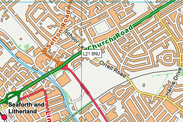
| Address | Orrell Road, Litherland , Liverpool, L21 8NU |
| Car Park | Yes |
| Car Park Capacity | 20 |
| Management Type | School/College/University (in house) |
| Management Group | Education |
| Owner Type | Voluntary Aided School |
| Owner Group | Education |
| Education Phase | Secondary |
| Closure Date | 31st Aug 2012 |
| Closure Reason | Unclassified |
Facilities
| Closure Date | 31st Aug 2012 |
| Closure Reason | Unclassified |
| Accessibility | Sports Club / Community Association |
| Management Type | Not Known |
| Year Built | 1972 |
| Changing Rooms | Yes |
| Year Changing Rooms Refurbished | 2007 |
| Date Record Checked | 1st Feb 2013 |
| Opening Times | Detailed Timings |
Facility specifics
| Area | 594m² |
| Floor Matting | Don't Know |
| Gymnastics Trampoline Use | Don't Know |
| Length | 0m |
| Moveable Balance Apparatus | Don't Know |
| Moveable Large Apparatus | Don't Know |
| Moveable Rebound Apparatus | Don't Know |
| Width | 0m |
| Moveable Trampolines | Don't Know |
| Small Apparatus | Don't Know |
| Swinging and Hanging Apparatus | Don't Know |
| Closure Date | 31st Aug 2012 |
| Closure Reason | Unclassified |
| Accessibility | Private Use |
| Management Type | Not Known |
| Year Built | 1972 |
| Changing Rooms | Yes |
| Year Changing Rooms Refurbished | 2010 |
| Date Record Checked | 1st Feb 2013 |
| Opening Times | Detailed Timings |
Facility specifics
| Area | 180m² |
| Floor Matting | Don't Know |
| Gymnastics Trampoline Use | Don't Know |
| Length | 0m |
| Moveable Balance Apparatus | Don't Know |
| Moveable Large Apparatus | Don't Know |
| Moveable Rebound Apparatus | Don't Know |
| Moveable Trampolines | Don't Know |
| Width | 0m |
| Small Apparatus | Don't Know |
| Swinging and Hanging Apparatus | Don't Know |
| Closure Date | 31st Aug 2012 |
| Closure Reason | Unclassified |
| Accessibility | Private Use |
| Management Type | Not Known |
| Year Built | 1972 |
| Changing Rooms | Yes |
| Date Record Checked | 1st Feb 2013 |
| Opening Times | Detailed Timings |
Facility specifics
Contact
Where is St Wilfrid's Catholic High School (Closed)?
| Sub Building Name | |
| Building Name | |
| Building Number | 0 |
| Dependent Thoroughfare | |
| Thoroughfare Name | Orrell Road |
| Double Dependent Locality | |
| Dependent Locality | Litherland |
| PostTown | Liverpool |
| Postcode | L21 8NU |
St Wilfrid's Catholic High School (Closed) on a map

St Wilfrid's Catholic High School (Closed) geodata
| Easting | 334123.53 |
| Northing | 397385.86 |
| Latitude | 53.46907 |
| Longitude | -2.993856 |
| Local Authority Name | Sefton |
| Local Authority Code | E08000014 |
| Parliamentary Constituency Name | Bootle |
| Parliamentary Constituency Code | E14000581 |
| Region Name | North West |
| Region Code | E15000002 |
| Ward Name | Litherland |
| Ward Code | E05000943 |
| Output Area Code | E00035553 |
About this data
This data is open data sourced from Active Places Power and licenced under the Active Places Open Data Licence.
| Created On | 13th May 2008 |
| Audited On | 26th Jan 2015 |
| Checked On | 1st Feb 2013 |
