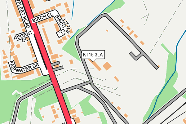
KT15 3LA is located in the New Haw electoral ward, within the local authority district of Runnymede and the English Parliamentary constituency of Runnymede and Weybridge. The Sub Integrated Care Board (ICB) Location is NHS Surrey Heartlands ICB - 92A and the police force is Surrey. This postcode has been in use since January 1980.


GetTheData
Source: OS OpenMap – Local (Ordnance Survey)
Source: OS VectorMap District (Ordnance Survey)
Licence: Open Government Licence (requires attribution)
| Easting | 505824 |
| Northing | 162619 |
| Latitude | 51.352803 |
| Longitude | -0.481721 |
GetTheData
Source: Open Postcode Geo
Licence: Open Government Licence
| Country | England |
| Postcode District | KT15 |
| ➜ KT15 open data dashboard ➜ See where KT15 is on a map ➜ Where is New Haw? | |
GetTheData
Source: Land Registry Price Paid Data
Licence: Open Government Licence
Elevation or altitude of KT15 3LA as distance above sea level:
| Metres | Feet | |
|---|---|---|
| Elevation | 20m | 66ft |
Elevation is measured from the approximate centre of the postcode, to the nearest point on an OS contour line from OS Terrain 50, which has contour spacing of ten vertical metres.
➜ How high above sea level am I? Find the elevation of your current position using your device's GPS.
GetTheData
Source: Open Postcode Elevation
Licence: Open Government Licence
| Ward | New Haw |
| Constituency | Runnymede And Weybridge |
GetTheData
Source: ONS Postcode Database
Licence: Open Government Licence
| October 2023 | Bicycle theft | On or near Parking Area | 334m |
| July 2023 | Burglary | On or near Parking Area | 334m |
| May 2023 | Violence and sexual offences | On or near Parking Area | 334m |
| ➜ Get more crime data in our Crime section | |||
GetTheData
Source: data.police.uk
Licence: Open Government Licence
| Regent Close (Byfleet Road) | New Haw | 161m |
| Regent Close (Byfleet Road) | New Haw | 196m |
| Byfleet & New Haw Railway Station (Byfleet Road) | New Haw | 284m |
| Byfleet & New Haw Railway Station (Byfleet Road) | New Haw | 309m |
| Marshall Place (Woodham Lane) | New Haw | 524m |
| Byfleet & New Haw Station | 0.3km |
| Weybridge Station | 1.9km |
| West Byfleet Station | 2.2km |
GetTheData
Source: NaPTAN
Licence: Open Government Licence
GetTheData
Source: ONS Postcode Database
Licence: Open Government Licence


➜ Get more ratings from the Food Standards Agency
GetTheData
Source: Food Standards Agency
Licence: FSA terms & conditions
| Last Collection | |||
|---|---|---|---|
| Location | Mon-Fri | Sat | Distance |
| Byfleet Road | 17:15 | 11:00 | 283m |
| Wintersells Road | 18:30 | 12:00 | 521m |
| 2 Woodham Lane | 17:15 | 11:30 | 625m |
GetTheData
Source: Dracos
Licence: Creative Commons Attribution-ShareAlike
| Facility | Distance |
|---|---|
| Brooklands Spa Brooklands Drive, Weybridge Health and Fitness Gym | 769m |
| Topgolf Surrey Moated Farm Drive, Addlestone Health and Fitness Gym, Golf | 978m |
| Heathervale Recreation Ground Parkside, New Haw, Addlestone Grass Pitches, Outdoor Tennis Courts | 1km |
GetTheData
Source: Active Places
Licence: Open Government Licence
| School | Phase of Education | Distance |
|---|---|---|
| Byfleet Primary School King's Head Lane, Byfleet, West Byfleet, KT14 7AT | Primary | 1km |
| Brooklands College Heath Road, Weybridge, KT13 8TT | 16 plus | 1.6km |
| The Grange Community Infant School The Avenue, New Haw, Addlestone, KT15 3RL | Primary | 1.7km |
GetTheData
Source: Edubase
Licence: Open Government Licence
| Risk of KT15 3LA flooding from rivers and sea | Medium |
| ➜ KT15 3LA flood map | |
GetTheData
Source: Open Flood Risk by Postcode
Licence: Open Government Licence
The below table lists the International Territorial Level (ITL) codes (formerly Nomenclature of Territorial Units for Statistics (NUTS) codes) and Local Administrative Units (LAU) codes for KT15 3LA:
| ITL 1 Code | Name |
|---|---|
| TLJ | South East (England) |
| ITL 2 Code | Name |
| TLJ2 | Surrey, East and West Sussex |
| ITL 3 Code | Name |
| TLJ25 | West Surrey |
| LAU 1 Code | Name |
| E07000212 | Runnymede |
GetTheData
Source: ONS Postcode Directory
Licence: Open Government Licence
The below table lists the Census Output Area (OA), Lower Layer Super Output Area (LSOA), and Middle Layer Super Output Area (MSOA) for KT15 3LA:
| Code | Name | |
|---|---|---|
| OA | E00156476 | |
| LSOA | E01030681 | Runnymede 010A |
| MSOA | E02006402 | Runnymede 010 |
GetTheData
Source: ONS Postcode Directory
Licence: Open Government Licence
| KT15 3JZ | Byfleet Road | 134m |
| KT15 3JU | Little Birch Close | 152m |
| KT15 3LB | Byfleet Road | 199m |
| KT15 3LD | Byfleet Road | 210m |
| KT15 3JT | Birch Close | 220m |
| KT15 3LP | Fairwater Drive | 241m |
| KT15 3JD | Kashmir Close | 260m |
| KT15 3LG | Byfleet Road | 265m |
| KT15 3JY | Regent Close | 273m |
| KT15 3LE | Byfleet Road | 274m |
GetTheData
Source: Open Postcode Geo; Land Registry Price Paid Data
Licence: Open Government Licence