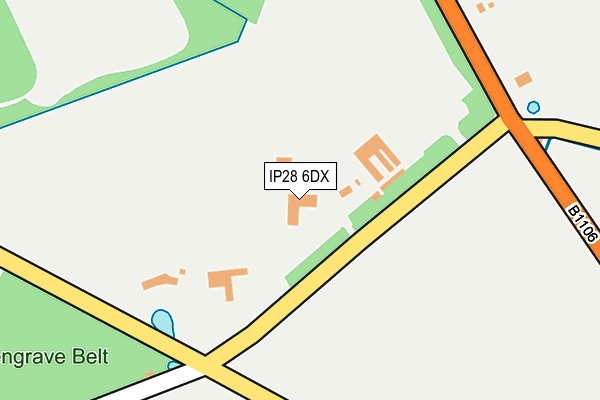
IP28 6DX is in Culford, Bury St. Edmunds. IP28 6DX is located in the The Fornhams & Great Barton electoral ward, within the local authority district of West Suffolk and the English Parliamentary constituency of Bury St Edmunds. The Sub Integrated Care Board (ICB) Location is NHS Suffolk and North East Essex ICB - 07K and the police force is Suffolk. This postcode has been in use since January 1980.


GetTheData
Source: OS OpenMap – Local (Ordnance Survey)
Source: OS VectorMap District (Ordnance Survey)
Licence: Open Government Licence (requires attribution)
| Easting | 583721 |
| Northing | 269393 |
| Latitude | 52.291945 |
| Longitude | 0.692483 |
GetTheData
Source: Open Postcode Geo
Licence: Open Government Licence
| Locality | Culford |
| Town/City | Bury St. Edmunds |
| Country | England |
| Postcode District | IP28 |
| ➜ IP28 open data dashboard ➜ See where IP28 is on a map ➜ Where is Culford? | |
GetTheData
Source: Land Registry Price Paid Data
Licence: Open Government Licence
Elevation or altitude of IP28 6DX as distance above sea level:
| Metres | Feet | |
|---|---|---|
| Elevation | 30m | 98ft |
Elevation is measured from the approximate centre of the postcode, to the nearest point on an OS contour line from OS Terrain 50, which has contour spacing of ten vertical metres.
➜ How high above sea level am I? Find the elevation of your current position using your device's GPS.
GetTheData
Source: Open Postcode Elevation
Licence: Open Government Licence
| Ward | The Fornhams & Great Barton |
| Constituency | Bury St Edmunds |
GetTheData
Source: ONS Postcode Database
Licence: Open Government Licence
| School (The Street) | Culford | 982m |
| School (The Street) | Culford | 984m |
| Shelter (A1101) | Hengrave | 1,306m |
| Shelter (A1101) | Hengrave | 1,311m |
| Bury St Edmunds Station | 4.5km |
GetTheData
Source: NaPTAN
Licence: Open Government Licence
| Percentage of properties with Next Generation Access | 100.0% |
| Percentage of properties with Superfast Broadband | 100.0% |
| Percentage of properties with Ultrafast Broadband | 0.0% |
| Percentage of properties with Full Fibre Broadband | 0.0% |
Superfast Broadband is between 30Mbps and 300Mbps
Ultrafast Broadband is > 300Mbps
| Percentage of properties unable to receive 2Mbps | 0.0% |
| Percentage of properties unable to receive 5Mbps | 0.0% |
| Percentage of properties unable to receive 10Mbps | 0.0% |
| Percentage of properties unable to receive 30Mbps | 0.0% |
GetTheData
Source: Ofcom
Licence: Ofcom Terms of Use (requires attribution)
GetTheData
Source: ONS Postcode Database
Licence: Open Government Licence


➜ Get more ratings from the Food Standards Agency
GetTheData
Source: Food Standards Agency
Licence: FSA terms & conditions
| Last Collection | |||
|---|---|---|---|
| Location | Mon-Fri | Sat | Distance |
| The Street | 17:00 | 11:15 | 957m |
| Culford Road | 16:00 | 07:30 | 2,165m |
| The Street | 16:45 | 11:00 | 2,201m |
GetTheData
Source: Dracos
Licence: Creative Commons Attribution-ShareAlike
| Facility | Distance |
|---|---|
| The Drift (Closed) The Drift, Culford, Bury St Edmunds Grass Pitches | 849m |
| Culford Sports And Tennis Centre Culford, Bury St. Edmunds Sports Hall, Swimming Pool, Health and Fitness Gym, Artificial Grass Pitch, Indoor Tennis Centre, Grass Pitches, Studio, Squash Courts, Outdoor Tennis Courts | 1.1km |
| The Suffolk Golf Club (All Saints Hotel) Fornham St. Martin, Bury St. Edmunds Swimming Pool, Health and Fitness Gym, Golf | 1.9km |
GetTheData
Source: Active Places
Licence: Open Government Licence
| School | Phase of Education | Distance |
|---|---|---|
| Culford School Culford, Bury St Edmunds, IP4 4SN | Not applicable | 1.1km |
| Howard Community Academy Beard Road, Bury St Edmunds, IP32 6SA | Primary | 3.4km |
| The Albany Brooklands Close, Bury St. Edmunds, IP33 3JX | Not applicable | 3.5km |
GetTheData
Source: Edubase
Licence: Open Government Licence
The below table lists the International Territorial Level (ITL) codes (formerly Nomenclature of Territorial Units for Statistics (NUTS) codes) and Local Administrative Units (LAU) codes for IP28 6DX:
| ITL 1 Code | Name |
|---|---|
| TLH | East |
| ITL 2 Code | Name |
| TLH1 | East Anglia |
| ITL 3 Code | Name |
| TLH14 | Suffolk CC |
| LAU 1 Code | Name |
| E07000245 | West Suffolk |
GetTheData
Source: ONS Postcode Directory
Licence: Open Government Licence
The below table lists the Census Output Area (OA), Lower Layer Super Output Area (LSOA), and Middle Layer Super Output Area (MSOA) for IP28 6DX:
| Code | Name | |
|---|---|---|
| OA | E00153462 | |
| LSOA | E01030103 | St Edmundsbury 004A |
| MSOA | E02006276 | St Edmundsbury 004 |
GetTheData
Source: ONS Postcode Directory
Licence: Open Government Licence
| IP28 6DT | 320m | |
| IP28 6DY | West Stow Road | 444m |
| IP28 6LP | 597m | |
| IP28 6DS | 607m | |
| IP28 6EA | Benyon Gardens | 625m |
| IP28 6TT | Fornham Park | 634m |
| IP28 6DR | The Drift | 662m |
| IP28 6DP | The Street | 837m |
| IP28 6LR | Mill Road | 1108m |
| IP28 6DN | The Street | 1121m |
GetTheData
Source: Open Postcode Geo; Land Registry Price Paid Data
Licence: Open Government Licence