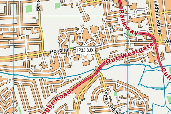
The Albany is located in Bury St. Edmunds and falls under the local authority of Suffolk. This mixed-sex school has a capacity of 5 pupils, aged from eleven up to sixteen, and the type of establishment is academy alternative provision converter.
| Address | The Albany Brooklands Close Bury St. Edmunds IP33 3JX |
| Headteacher | Mr Daryl James |
GetTheData
Source: Get Information About Schools
Licence: Open Government Licence
| Phase of Education | Not applicable |
| Type of Establishment | Academy alternative provision converter |
| Statutory Low Age | 11 |
| Statutory High Age | 16 |
| Boarders | No boarders |
| Official Sixth Form | Does not have a sixth form |
| Gender | Mixed |
| Religious Character | Does not apply |
| Special Classes | Not applicable |
GetTheData
Source: Get Information About Schools
Licence: Open Government Licence
| School Capacity | 5 |
GetTheData
Source: Get Information About Schools
Licence: Open Government Licence
| Street Address | Brooklands Close |
| Town | Bury St. Edmunds |
| Postcode | IP33 3JX |
| ➜ More IP33 3JX open data | |
GetTheData
Source: Get Information About Schools
Licence: Open Government Licence

GetTheData
Source: OS VectorMap District (Ordnance Survey)
Licence: Open Government Licence (requires attribution)
| Ofsted Special Measures | Not applicable |
GetTheData
Source: Get Information About Schools
Licence: Open Government Licence
| Establishment Name | The Albany |
| Establishment Number | 1117 |
| Unique Reference Number | 150266 |
| Local Authority | Suffolk |
| Local Authority Code | 935 |
| Previous Local Authority Code | 999 |
| Government Statistical Service Local Authority Code | E10000029 |
| Government Office Region | East of England |
| District | West Suffolk |
| District Code | E07000245 |
| Ward | Westgate |
| Parliamentary Constituency | Bury St Edmunds |
| Urban/Rural Description | (England/Wales) Urban city and town |
| Middle Super Output Area | West Suffolk 013 |
| Lower Super Output Area | West Suffolk 013D |
GetTheData
Source: Get Information About Schools
Licence: Open Government Licence
| Establishment Status | Open |
| Last Changed Date | 8th January 2024 |
| Reason Establishment Opened | Fresh Start |
| Open Date | 1st September 2023 |
GetTheData
Source: Get Information About Schools
Licence: Open Government Licence
| Teenage Mothers | Not applicable |
| Special Educational Needs (SEN) Provision in Primary Care Unit | Not applicable |
| Pupil Referral Unit (PRU) Provides for Educational and Behavioural Difficulties (EBD) | Not applicable |
GetTheData
Source: Get Information About Schools
Licence: Open Government Licence
| Section 41 Approved | Not applicable |
GetTheData
Source: Get Information About Schools
Licence: Open Government Licence
| Trust flag | Supported by a multi-academy trust |
| Trust | RAEDWALD TRUST |
| School Sponsor flag | - |
GetTheData
Source: Get Information About Schools
Licence: Open Government Licence
| Federation flag | Not applicable |
GetTheData
Source: Get Information About Schools
Licence: Open Government Licence
| UK Provider Reference Number | 10093632 |
GetTheData
Source: Get Information About Schools
Licence: Open Government Licence
| Easting | 583818 |
| Northing | 265878 |
| Latitude | 52.26035 |
| Longitude | 0.69199 |
GetTheData
Source: Get Information About Schools
Licence: Open Government Licence
| School | Phase of Education | Distance |
|---|---|---|
| Howard Community Academy Beard Road, Bury St Edmunds, IP32 6SA | Primary | 85m |
| St Benedict's Catholic School Beetons Way, Bury St Edmunds, IP32 6RH | Secondary | 722m |
| Bury St Edmunds County High School Beetons Way, Bury St Edmunds, IP32 6RF | Secondary | 808m |
| Tollgate Primary School Tollgate Lane, Bury St Edmunds, IP32 6DG | Primary | 879m |
| Sexton's Manor Community Primary School Greene Road, Bury St Edmunds, IP33 3HG | Primary | 1.2km |
| King Edward VI CEVC School Grove Road, Bury St Edmunds, IP33 3BH | Secondary | 1.3km |
| West Suffolk College Out Risbygate, Bury St Edmunds, IP33 3RL | 16 plus | 1.4km |
| St Edmundsbury Church of England Voluntary Aided Primary School Grove Road, Bury St Edmunds, IP33 3BJ | Primary | 1.4km |
| Abbeygate Sixth Form College Beetons Way, Bury St Edmunds, IP33 3YU | 16 plus | 1.4km |
| Westgate Community Primary School and Nursery Brooklands Close, Bury St Edmunds, IP33 3JX | Primary | 2.4km |
GetTheData
Source: Get Information About Schools
Licence: Open Government Licence