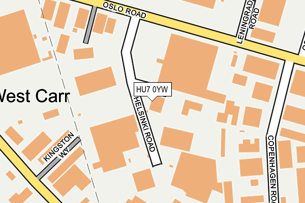
HU7 0YW is located in the Holderness electoral ward, within the unitary authority of Kingston upon Hull, City of and the English Parliamentary constituency of Kingston upon Hull East. The Sub Integrated Care Board (ICB) Location is NHS Humber and North Yorkshire ICB - 03F and the police force is Humberside. This postcode has been in use since August 1992.


GetTheData
Source: OS OpenMap – Local (Ordnance Survey)
Source: OS VectorMap District (Ordnance Survey)
Licence: Open Government Licence (requires attribution)
| Easting | 509727 |
| Northing | 432379 |
| Latitude | 53.776213 |
| Longitude | -0.336429 |
GetTheData
Source: Open Postcode Geo
Licence: Open Government Licence
| Country | England |
| Postcode District | HU7 |
| ➜ HU7 open data dashboard ➜ See where HU7 is on a map ➜ Where is Kingston upon Hull? | |
GetTheData
Source: Land Registry Price Paid Data
Licence: Open Government Licence
Elevation or altitude of HU7 0YW as distance above sea level:
| Metres | Feet | |
|---|---|---|
| Elevation | 0m | 0ft |
Elevation is measured from the approximate centre of the postcode, to the nearest point on an OS contour line from OS Terrain 50, which has contour spacing of ten vertical metres.
➜ How high above sea level am I? Find the elevation of your current position using your device's GPS.
GetTheData
Source: Open Postcode Elevation
Licence: Open Government Licence
| Ward | Holderness |
| Constituency | Kingston Upon Hull East |
GetTheData
Source: ONS Postcode Database
Licence: Open Government Licence
CRANSWICK FOODS, 74, HELSINKI ROAD, HULL, HU7 0YW 2023 15 MAY £284,538 |
➜ Kingston upon Hull house prices
GetTheData
Source: HM Land Registry Price Paid Data
Licence: Contains HM Land Registry data © Crown copyright and database right 2024. This data is licensed under the Open Government Licence v3.0.
| June 2022 | Vehicle crime | On or near Parking Area | 306m |
| June 2022 | Other theft | On or near Parking Area | 306m |
| June 2022 | Violence and sexual offences | On or near Parking Area | 306m |
| ➜ Get more crime data in our Crime section | |||
GetTheData
Source: data.police.uk
Licence: Open Government Licence
| Helsinki Road (Oslo Road) | Sutton Fields | 181m |
| Kingston Way (Stockholm Road) | Sutton Fields | 294m |
| Stockholm Road Council Depot (Stockholm Road) | Sutton Fields | 370m |
| Oslo Road (Holwell Road) | Sutton Park | 404m |
| Oslo Road (Holwell Road) | Sutton Fields | 424m |
| Hull Station | 3.6km |
| Cottingham Station | 4.7km |
GetTheData
Source: NaPTAN
Licence: Open Government Licence
GetTheData
Source: ONS Postcode Database
Licence: Open Government Licence


➜ Get more ratings from the Food Standards Agency
GetTheData
Source: Food Standards Agency
Licence: FSA terms & conditions
| Last Collection | |||
|---|---|---|---|
| Location | Mon-Fri | Sat | Distance |
| Oslo Road Hull | 17:45 | 12:30 | 298m |
| Oslo Road Business Box | 17:45 | 314m | |
| Malmo Road | 19:30 | 397m | |
GetTheData
Source: Dracos
Licence: Creative Commons Attribution-ShareAlike
| Facility | Distance |
|---|---|
| Soccer Kings Oslo Road, Hull Artificial Grass Pitch | 357m |
| Ennerdale Leisure Centre Ennerdale, Hull Sports Hall, Swimming Pool, Health and Fitness Gym, Studio, Cycling | 768m |
| Sutton Fields Dorchester Road, Kingston Upon Hull Grass Pitches | 901m |
GetTheData
Source: Active Places
Licence: Open Government Licence
| School | Phase of Education | Distance |
|---|---|---|
| Sutton Park Primary School Marsdale, Sutton Park, Kingston-upon-Hull, HU7 4AH | Primary | 695m |
| St Mary Queen of Martyrs VC Academy Nidderdale, Sutton Park, Hull, HU7 4BS | Primary | 861m |
| St Andrew's Church of England Voluntary Aided Primary School Grandale, Sutton Park, Hull, HU7 4BL | Primary | 1.1km |
GetTheData
Source: Edubase
Licence: Open Government Licence
| Risk of HU7 0YW flooding from rivers and sea | Medium |
| ➜ HU7 0YW flood map | |
GetTheData
Source: Open Flood Risk by Postcode
Licence: Open Government Licence
The below table lists the International Territorial Level (ITL) codes (formerly Nomenclature of Territorial Units for Statistics (NUTS) codes) and Local Administrative Units (LAU) codes for HU7 0YW:
| ITL 1 Code | Name |
|---|---|
| TLE | Yorkshire and The Humber |
| ITL 2 Code | Name |
| TLE1 | East Yorkshire and Northern Lincolnshire |
| ITL 3 Code | Name |
| TLE11 | Kingston upon Hull, City of |
| LAU 1 Code | Name |
| E06000010 | Kingston upon Hull, City of |
GetTheData
Source: ONS Postcode Directory
Licence: Open Government Licence
The below table lists the Census Output Area (OA), Lower Layer Super Output Area (LSOA), and Middle Layer Super Output Area (MSOA) for HU7 0YW:
| Code | Name | |
|---|---|---|
| OA | E00064660 | |
| LSOA | E01012817 | Kingston upon Hull 016D |
| MSOA | E02002667 | Kingston upon Hull 016 |
GetTheData
Source: ONS Postcode Directory
Licence: Open Government Licence
| HU7 0YN | Oslo Road | 103m |
| HU7 0YR | Oslo Road | 241m |
| HU7 0YG | Gothenburg Way | 429m |
| HU7 6DS | Bretherdale | 488m |
| HU7 6DP | Baysdale | 495m |
| HU7 6DX | Stonesdale | 500m |
| HU7 6DR | Borrowdale | 513m |
| HU7 6EL | Tynedale | 561m |
| HU7 6DT | Airedale | 578m |
| HU7 4BX | Edendale | 608m |
GetTheData
Source: Open Postcode Geo; Land Registry Price Paid Data
Licence: Open Government Licence