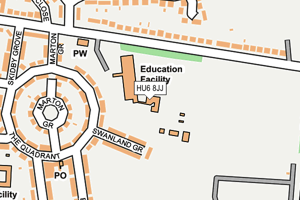
HU6 8JJ is located in the University electoral ward, within the unitary authority of Kingston upon Hull, City of and the English Parliamentary constituency of Kingston upon Hull North. The Sub Integrated Care Board (ICB) Location is NHS Humber and North Yorkshire ICB - 03F and the police force is Humberside. This postcode has been in use since January 1980.


GetTheData
Source: OS OpenMap – Local (Ordnance Survey)
Source: OS VectorMap District (Ordnance Survey)
Licence: Open Government Licence (requires attribution)
| Easting | 507046 |
| Northing | 432126 |
| Latitude | 53.774498 |
| Longitude | -0.377181 |
GetTheData
Source: Open Postcode Geo
Licence: Open Government Licence
| Country | England |
| Postcode District | HU6 |
| ➜ HU6 open data dashboard ➜ See where HU6 is on a map ➜ Where is Kingston upon Hull? | |
GetTheData
Source: Land Registry Price Paid Data
Licence: Open Government Licence
Elevation or altitude of HU6 8JJ as distance above sea level:
| Metres | Feet | |
|---|---|---|
| Elevation | 0m | 0ft |
Elevation is measured from the approximate centre of the postcode, to the nearest point on an OS contour line from OS Terrain 50, which has contour spacing of ten vertical metres.
➜ How high above sea level am I? Find the elevation of your current position using your device's GPS.
GetTheData
Source: Open Postcode Elevation
Licence: Open Government Licence
| Ward | University |
| Constituency | Kingston Upon Hull North |
GetTheData
Source: ONS Postcode Database
Licence: Open Government Licence
| January 2024 | Anti-social behaviour | On or near Elloughton Grove | 341m |
| October 2023 | Violence and sexual offences | On or near Elloughton Grove | 341m |
| August 2023 | Criminal damage and arson | On or near Elloughton Grove | 341m |
| ➜ Get more crime data in our Crime section | |||
GetTheData
Source: data.police.uk
Licence: Open Government Licence
| Newlands School For Girls (Inglemire Lane) | University | 291m |
| Beautiman Court (Endike Lane) | Orchard Park | 430m |
| Ellerburn Avenue (Endike Lane) | Orchard Park | 460m |
| 31st Avenue (Endike Lane) | Orchard Park | 464m |
| Endike Lane Shops (Endike Lane) | Orchard Park | 488m |
| Cottingham Station | 2.1km |
| Hull Station | 4km |
GetTheData
Source: NaPTAN
Licence: Open Government Licence
GetTheData
Source: ONS Postcode Database
Licence: Open Government Licence


➜ Get more ratings from the Food Standards Agency
GetTheData
Source: Food Standards Agency
Licence: FSA terms & conditions
| Last Collection | |||
|---|---|---|---|
| Location | Mon-Fri | Sat | Distance |
| Ellerburn Avenue Hull | 16:30 | 11:15 | 468m |
| Cottingham Grove | 17:30 | 11:00 | 518m |
| Inglemire Lane E | 17:30 | 10:45 | 589m |
GetTheData
Source: Dracos
Licence: Creative Commons Attribution-ShareAlike
| Facility | Distance |
|---|---|
| Frederick Holmes School Inglemire Lane, Hull Swimming Pool | 0m |
| King George V Playing Fields (Inglemire) Inglemire Lane, Kingston Upon Hull Grass Pitches | 337m |
| Hall Road Academy Hall Road, Hull Grass Pitches | 366m |
GetTheData
Source: Active Places
Licence: Open Government Licence
| School | Phase of Education | Distance |
|---|---|---|
| Frederick Holmes School Inglemire Lane, Hull, HU6 8JJ | Not applicable | 99m |
| Hall Road Academy Hall Road, Hull, HU6 8PP | Primary | 363m |
| Newland School for Girls Cottingham Road, Hull, HU6 7RU | Secondary | 485m |
GetTheData
Source: Edubase
Licence: Open Government Licence
| Risk of HU6 8JJ flooding from rivers and sea | Low |
| ➜ HU6 8JJ flood map | |
GetTheData
Source: Open Flood Risk by Postcode
Licence: Open Government Licence
The below table lists the International Territorial Level (ITL) codes (formerly Nomenclature of Territorial Units for Statistics (NUTS) codes) and Local Administrative Units (LAU) codes for HU6 8JJ:
| ITL 1 Code | Name |
|---|---|
| TLE | Yorkshire and The Humber |
| ITL 2 Code | Name |
| TLE1 | East Yorkshire and Northern Lincolnshire |
| ITL 3 Code | Name |
| TLE11 | Kingston upon Hull, City of |
| LAU 1 Code | Name |
| E06000010 | Kingston upon Hull, City of |
GetTheData
Source: ONS Postcode Directory
Licence: Open Government Licence
The below table lists the Census Output Area (OA), Lower Layer Super Output Area (LSOA), and Middle Layer Super Output Area (MSOA) for HU6 8JJ:
| Code | Name | |
|---|---|---|
| OA | E00170749 | |
| LSOA | E01012914 | Kingston upon Hull 012C |
| MSOA | E02002663 | Kingston upon Hull 012 |
GetTheData
Source: ONS Postcode Directory
Licence: Open Government Licence
| HU6 8NX | The Quadrant | 71m |
| HU6 8JQ | Inglemire Lane | 98m |
| HU6 8NU | The Quadrant | 109m |
| HU6 8NY | Swanland Grove | 116m |
| HU6 8NZ | Marton Grove | 147m |
| HU6 8LH | Woodcroft Avenue | 154m |
| HU6 8LG | Oldstead Avenue | 167m |
| HU6 8NT | Marton Grove | 171m |
| HU6 8PA | The Quadrant | 194m |
| HU6 8LF | Inglemire Lane | 195m |
GetTheData
Source: Open Postcode Geo; Land Registry Price Paid Data
Licence: Open Government Licence