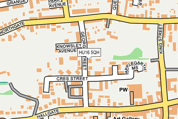
HU16 5QH is located in the Cottingham North electoral ward, within the unitary authority of East Riding of Yorkshire and the English Parliamentary constituency of Haltemprice and Howden. The Sub Integrated Care Board (ICB) Location is NHS Humber and North Yorkshire ICB - 02Y and the police force is Humberside. This postcode has been in use since January 1980.


GetTheData
Source: OS OpenMap – Local (Ordnance Survey)
Source: OS VectorMap District (Ordnance Survey)
Licence: Open Government Licence (requires attribution)
| Easting | 504364 |
| Northing | 433069 |
| Latitude | 53.783514 |
| Longitude | -0.417541 |
GetTheData
Source: Open Postcode Geo
Licence: Open Government Licence
| Country | England |
| Postcode District | HU16 |
| ➜ HU16 open data dashboard ➜ See where HU16 is on a map ➜ Where is Cottingham? | |
GetTheData
Source: Land Registry Price Paid Data
Licence: Open Government Licence
Elevation or altitude of HU16 5QH as distance above sea level:
| Metres | Feet | |
|---|---|---|
| Elevation | 10m | 33ft |
Elevation is measured from the approximate centre of the postcode, to the nearest point on an OS contour line from OS Terrain 50, which has contour spacing of ten vertical metres.
➜ How high above sea level am I? Find the elevation of your current position using your device's GPS.
GetTheData
Source: Open Postcode Elevation
Licence: Open Government Licence
| Ward | Cottingham North |
| Constituency | Haltemprice And Howden |
GetTheData
Source: ONS Postcode Database
Licence: Open Government Licence
| January 2024 | Shoplifting | On or near Petrol Station | 288m |
| January 2024 | Other theft | On or near Petrol Station | 288m |
| January 2024 | Other theft | On or near Petrol Station | 288m |
| ➜ Get more crime data in our Crime section | |||
GetTheData
Source: data.police.uk
Licence: Open Government Licence
| Cottingham Northgate (Northgate) | Cottingham | 149m |
| Cottingham Northgate (Northgate) | Cottingham | 152m |
| Cottingham Northgate (Northgate) | Cottingham | 216m |
| Cottingham King Street (King Street) | Cottingham | 255m |
| Cottingham Northgate (Northgate) | Cottingham | 311m |
| Cottingham Station | 0.8km |
| Hull Station | 6.5km |
GetTheData
Source: NaPTAN
Licence: Open Government Licence
| Percentage of properties with Next Generation Access | 100.0% |
| Percentage of properties with Superfast Broadband | 100.0% |
| Percentage of properties with Ultrafast Broadband | 100.0% |
| Percentage of properties with Full Fibre Broadband | 100.0% |
Superfast Broadband is between 30Mbps and 300Mbps
Ultrafast Broadband is > 300Mbps
| Percentage of properties unable to receive 2Mbps | 0.0% |
| Percentage of properties unable to receive 5Mbps | 0.0% |
| Percentage of properties unable to receive 10Mbps | 0.0% |
| Percentage of properties unable to receive 30Mbps | 0.0% |
GetTheData
Source: Ofcom
Licence: Ofcom Terms of Use (requires attribution)
GetTheData
Source: ONS Postcode Database
Licence: Open Government Licence


➜ Get more ratings from the Food Standards Agency
GetTheData
Source: Food Standards Agency
Licence: FSA terms & conditions
| Last Collection | |||
|---|---|---|---|
| Location | Mon-Fri | Sat | Distance |
| George Street | 17:00 | 12:15 | 59m |
| Northgate | 17:00 | 12:15 | 262m |
| Cottingham Post Office | 17:15 | 12:00 | 354m |
GetTheData
Source: Dracos
Licence: Creative Commons Attribution-ShareAlike
| Facility | Distance |
|---|---|
| Cottingham Sports Centre Northgate, Cottingham Sports Hall, Artificial Grass Pitch | 310m |
| Hallgate Primary School Hallgate, Cottingham Sports Hall, Grass Pitches | 339m |
| King George V Playing Fields (Cottingham) Northgate, Cottingham Grass Pitches | 370m |
GetTheData
Source: Active Places
Licence: Open Government Licence
| School | Phase of Education | Distance |
|---|---|---|
| Hallgate Primary School Cottingham Hallgate Primary School, Hallgate, Cottingham, HU16 4DD | Primary | 339m |
| Westfield Primary School Westfield Primary School, Westfield Road, Cottingham, HU16 5PE | Primary | 640m |
| Bacon Garth Primary School The Garth, Cottingham, HU16 5BP | Primary | 660m |
GetTheData
Source: Edubase
Licence: Open Government Licence
| Risk of HU16 5QH flooding from rivers and sea | Medium |
| ➜ HU16 5QH flood map | |
GetTheData
Source: Open Flood Risk by Postcode
Licence: Open Government Licence
The below table lists the International Territorial Level (ITL) codes (formerly Nomenclature of Territorial Units for Statistics (NUTS) codes) and Local Administrative Units (LAU) codes for HU16 5QH:
| ITL 1 Code | Name |
|---|---|
| TLE | Yorkshire and The Humber |
| ITL 2 Code | Name |
| TLE1 | East Yorkshire and Northern Lincolnshire |
| ITL 3 Code | Name |
| TLE12 | East Riding of Yorkshire |
| LAU 1 Code | Name |
| E06000011 | East Riding of Yorkshire |
GetTheData
Source: ONS Postcode Directory
Licence: Open Government Licence
The below table lists the Census Output Area (OA), Lower Layer Super Output Area (LSOA), and Middle Layer Super Output Area (MSOA) for HU16 5QH:
| Code | Name | |
|---|---|---|
| OA | E00175349 | |
| LSOA | E01012957 | East Riding of Yorkshire 025A |
| MSOA | E02002708 | East Riding of Yorkshire 025 |
GetTheData
Source: ONS Postcode Directory
Licence: Open Government Licence
| HU16 5QP | George Street | 24m |
| HU16 5RR | Crescent Street | 57m |
| HU16 5QD | Knowsley Avenue | 88m |
| HU16 5QT | The Avenue | 89m |
| HU16 5QY | Crescent Street | 97m |
| HU16 5QU | George Street | 102m |
| HU16 5RU | Tennison Court | 102m |
| HU16 5QS | Crescent Street | 110m |
| HU16 5PY | Stones Mount | 122m |
| HU16 5QX | Thorncliffe Gardens | 124m |
GetTheData
Source: Open Postcode Geo; Land Registry Price Paid Data
Licence: Open Government Licence