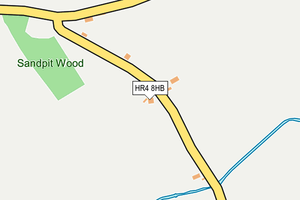
HR4 8HB is in Dilwyn, Hereford. HR4 8HB is located in the Weobley electoral ward, within the unitary authority of Herefordshire, County of and the English Parliamentary constituency of North Herefordshire. The Sub Integrated Care Board (ICB) Location is NHS Herefordshire and Worcestershire ICB - 18C and the police force is West Mercia. This postcode has been in use since January 1980.


GetTheData
Source: OS OpenMap – Local (Ordnance Survey)
Source: OS VectorMap District (Ordnance Survey)
Licence: Open Government Licence (requires attribution)
| Easting | 342268 |
| Northing | 254258 |
| Latitude | 52.183534 |
| Longitude | -2.845812 |
GetTheData
Source: Open Postcode Geo
Licence: Open Government Licence
| Locality | Dilwyn |
| Town/City | Hereford |
| Country | England |
| Postcode District | HR4 |
➜ See where HR4 is on a map ➜ Where is Dilwyn? | |
GetTheData
Source: Land Registry Price Paid Data
Licence: Open Government Licence
Elevation or altitude of HR4 8HB as distance above sea level:
| Metres | Feet | |
|---|---|---|
| Elevation | 90m | 295ft |
Elevation is measured from the approximate centre of the postcode, to the nearest point on an OS contour line from OS Terrain 50, which has contour spacing of ten vertical metres.
➜ How high above sea level am I? Find the elevation of your current position using your device's GPS.
GetTheData
Source: Open Postcode Elevation
Licence: Open Government Licence
| Ward | Weobley |
| Constituency | North Herefordshire |
GetTheData
Source: ONS Postcode Database
Licence: Open Government Licence
2022 14 DEC £285,000 |
2018 15 JUN £340,000 |
2016 25 MAY £675,000 |
2013 23 AUG £176,000 |
RUSSETTS, DILWYN, HEREFORD, HR4 8HB 2009 20 AUG £176,000 |
2001 3 JUL £115,000 |
GetTheData
Source: HM Land Registry Price Paid Data
Licence: Contains HM Land Registry data © Crown copyright and database right 2025. This data is licensed under the Open Government Licence v3.0.
| Crown Inn (Unclassified Road) | Dilwyn | 749m |
| Crown Inn (Unclassiifed Road) | Dilwyn | 754m |
| Crown Inn (Unclassified Road) | Dilwyn | 754m |
| Dilwyn Common (Unclassified Road) | Dilwyn Common | 777m |
| Dilwyn Common (Unclassified Road) | Dilwyn Common | 781m |
GetTheData
Source: NaPTAN
Licence: Open Government Licence
| Percentage of properties with Next Generation Access | 100.0% |
| Percentage of properties with Superfast Broadband | 100.0% |
| Percentage of properties with Ultrafast Broadband | 100.0% |
| Percentage of properties with Full Fibre Broadband | 100.0% |
Superfast Broadband is between 30Mbps and 300Mbps
Ultrafast Broadband is > 300Mbps
| Percentage of properties unable to receive 2Mbps | 0.0% |
| Percentage of properties unable to receive 5Mbps | 0.0% |
| Percentage of properties unable to receive 10Mbps | 0.0% |
| Percentage of properties unable to receive 30Mbps | 0.0% |
GetTheData
Source: Ofcom
Licence: Ofcom Terms of Use (requires attribution)
GetTheData
Source: ONS Postcode Database
Licence: Open Government Licence


➜ Get more ratings from the Food Standards Agency
GetTheData
Source: Food Standards Agency
Licence: FSA terms & conditions
The below table lists the International Territorial Level (ITL) codes (formerly Nomenclature of Territorial Units for Statistics (NUTS) codes) and Local Administrative Units (LAU) codes for HR4 8HB:
| ITL 1 Code | Name |
|---|---|
| TLG | West Midlands (England) |
| ITL 2 Code | Name |
| TLG1 | Herefordshire, Worcestershire and Warwickshire |
| ITL 3 Code | Name |
| TLG11 | Herefordshire, County of |
| LAU 1 Code | Name |
| E06000019 | Herefordshire, County of |
GetTheData
Source: ONS Postcode Directory
Licence: Open Government Licence
The below table lists the Census Output Area (OA), Lower Layer Super Output Area (LSOA), and Middle Layer Super Output Area (MSOA) for HR4 8HB:
| Code | Name | |
|---|---|---|
| OA | E00070758 | |
| LSOA | E01014016 | Herefordshire 007D |
| MSOA | E02002911 | Herefordshire 007 |
GetTheData
Source: ONS Postcode Directory
Licence: Open Government Licence
| HR4 8HA | 363m | |
| HR4 8HJ | 614m | |
| HR4 8HL | 669m | |
| HR4 8HS | 694m | |
| HR4 8JW | 707m | |
| HR4 8HY | Probert Crescent | 722m |
| HR4 8JS | Walnut Tree Close | 741m |
| HR4 8HT | The Glebelands | 743m |
| HR4 8HU | Karen Court | 784m |
| HR4 8HR | 787m |
GetTheData
Source: Open Postcode Geo; Land Registry Price Paid Data
Licence: Open Government Licence