HP11 1WQ maps, stats, and open data
- Home
- Postcode
- HP
- HP11
- HP11 1
HP11 1WQ is located in the Ryemead and Micklefield electoral ward, within the unitary authority of Buckinghamshire and the English Parliamentary constituency of Wycombe. The Sub Integrated Care Board (ICB) Location is NHS Buckinghamshire, Oxfordshire and Berkshire West ICB - 14Y and the police force is Thames Valley. This postcode has been in use since May 2019.
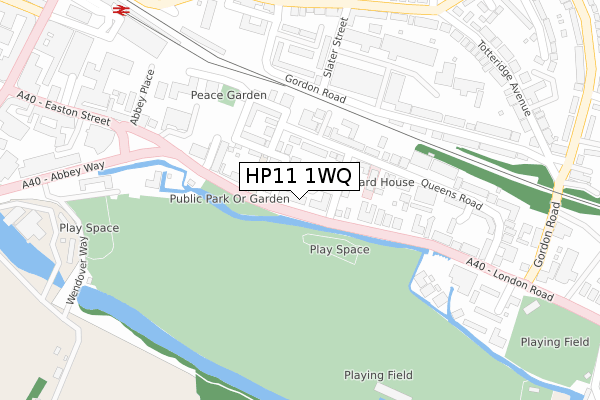
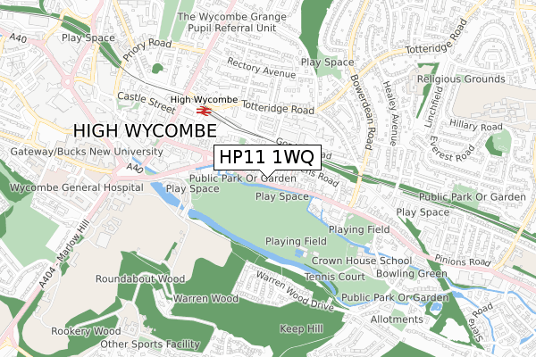
HP11 1WQ maps


Source: OS Open Zoomstack (Ordnance Survey)
Licence: Open Government Licence (requires attribution)
Attribution: Contains OS data © Crown copyright and database right 2026
Source: Open Postcode GeoLicence: Open Government Licence (requires attribution)
Attribution: Contains OS data © Crown copyright and database right 2026; Contains Royal Mail data © Royal Mail copyright and database right 2026; Source: Office for National Statistics licensed under the Open Government Licence v.3.0
HP11 1WQ geodata
| Easting | 487230 |
| Northing | 192732 |
| Latitude | 51.626656 |
| Longitude | -0.741209 |
Where is HP11 1WQ?
| Country | England |
| Postcode District | HP11 |
Politics
| Ward | Ryemead And Micklefield |
|---|
| Constituency | Wycombe |
|---|
Transport
Nearest bus stops to HP11 1WQ
| Trinity Church (London Road) | High Wycombe | 121m |
| Trinity Church (London Road) | High Wycombe | 124m |
| Cricket Ground (London Road) | High Wycombe | 343m |
| Duke Street (Totteridge Road) | High Wycombe | 345m |
| Duke Street (Totteridge Road) | High Wycombe | 353m |
Nearest railway stations to HP11 1WQ
| High Wycombe Station | 0.4km |
Broadband
Broadband access in HP11 1WQ (2020 data)
| Percentage of properties with Next Generation Access | 100.0% |
| Percentage of properties with Superfast Broadband | 100.0% |
| Percentage of properties with Ultrafast Broadband | 0.0% |
| Percentage of properties with Full Fibre Broadband | 0.0% |
Superfast Broadband is between 30Mbps and 300Mbps
Ultrafast Broadband is > 300Mbps
Broadband limitations in HP11 1WQ (2020 data)
| Percentage of properties unable to receive 2Mbps | 0.0% |
| Percentage of properties unable to receive 5Mbps | 0.0% |
| Percentage of properties unable to receive 10Mbps | 0.0% |
| Percentage of properties unable to receive 30Mbps | 0.0% |
Deprivation
26.8% of English postcodes are less deprived than
HP11 1WQ:
Food Standards Agency
Three nearest food hygiene ratings to HP11 1WQ (metres)
Harlow House Day Hospital
Belle Vue PH
Hyundai Training Academy
➜ Get more ratings from the Food Standards Agency
Nearest post box to HP11 1WQ
| | Last Collection | |
|---|
| Location | Mon-Fri | Sat | Distance |
|---|
| Easton Street | 16:15 | 12:00 | 137m |
| Subway | 16:15 | 12:00 | 209m |
| North Town P.o. | 17:00 | 12:00 | 344m |
HP11 1WQ ITL and HP11 1WQ LAU
The below table lists the International Territorial Level (ITL) codes (formerly Nomenclature of Territorial Units for Statistics (NUTS) codes) and Local Administrative Units (LAU) codes for HP11 1WQ:
| ITL 1 Code | Name |
|---|
| TLJ | South East (England) |
| ITL 2 Code | Name |
|---|
| TLJ1 | Berkshire, Buckinghamshire and Oxfordshire |
| ITL 3 Code | Name |
|---|
| TLJ13 | Buckinghamshire |
| LAU 1 Code | Name |
|---|
| E06000060 | Buckinghamshire |
HP11 1WQ census areas
The below table lists the Census Output Area (OA), Lower Layer Super Output Area (LSOA), and Middle Layer Super Output Area (MSOA) for HP11 1WQ:
| Code | Name |
|---|
| OA | E00090342 | |
|---|
| LSOA | E01017910 | Wycombe 016C |
|---|
| MSOA | E02003711 | Wycombe 016 |
|---|
Nearest postcodes to HP11 1WQ


