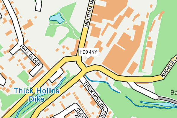
HD9 4NY is located in the Holme Valley North electoral ward, within the metropolitan district of Kirklees and the English Parliamentary constituency of Colne Valley. The Sub Integrated Care Board (ICB) Location is NHS West Yorkshire ICB - X2C4Y and the police force is West Yorkshire. This postcode has been in use since June 2001.


GetTheData
Source: OS OpenMap – Local (Ordnance Survey)
Source: OS VectorMap District (Ordnance Survey)
Licence: Open Government Licence (requires attribution)
| Easting | 410819 |
| Northing | 410624 |
| Latitude | 53.592085 |
| Longitude | -1.838021 |
GetTheData
Source: Open Postcode Geo
Licence: Open Government Licence
| Country | England |
| Postcode District | HD9 |
| ➜ HD9 open data dashboard ➜ See where HD9 is on a map ➜ Where is Meltham? | |
GetTheData
Source: Land Registry Price Paid Data
Licence: Open Government Licence
Elevation or altitude of HD9 4NY as distance above sea level:
| Metres | Feet | |
|---|---|---|
| Elevation | 160m | 525ft |
Elevation is measured from the approximate centre of the postcode, to the nearest point on an OS contour line from OS Terrain 50, which has contour spacing of ten vertical metres.
➜ How high above sea level am I? Find the elevation of your current position using your device's GPS.
GetTheData
Source: Open Postcode Elevation
Licence: Open Government Licence
| Ward | Holme Valley North |
| Constituency | Colne Valley |
GetTheData
Source: ONS Postcode Database
Licence: Open Government Licence
| January 2024 | Other theft | On or near Darnley Close | 409m |
| December 2023 | Other theft | On or near Hall Close | 199m |
| November 2023 | Violence and sexual offences | On or near Hall Close | 199m |
| ➜ Get more crime data in our Crime section | |||
GetTheData
Source: data.police.uk
Licence: Open Government Licence
| Hall Park (Meltham Mills Road) | Meltham | 68m |
| Meltham Mills Rd Mill Bank Road (Meltham Mills Road) | Meltham | 113m |
| Thick Hollins Drive Hambledon Ave (Thick Hollins Drive) | Meltham | 265m |
| Thick Hollins Drive | Meltham | 284m |
| Meltham Mills Road Harewood Mount (Meltham Mills Road) | Meltham | 320m |
| Honley Station | 4.2km |
| Berry Brow Station | 4.4km |
| Brockholes Station | 4.6km |
GetTheData
Source: NaPTAN
Licence: Open Government Licence
GetTheData
Source: ONS Postcode Database
Licence: Open Government Licence


➜ Get more ratings from the Food Standards Agency
GetTheData
Source: Food Standards Agency
Licence: FSA terms & conditions
| Last Collection | |||
|---|---|---|---|
| Location | Mon-Fri | Sat | Distance |
| Meltham Mills Road Meltham | 17:15 | 10:15 | 47m |
| Bishops Way Meltham | 17:00 | 10:15 | 464m |
| Thick Hollins | 16:15 | 10:15 | 523m |
GetTheData
Source: Dracos
Licence: Creative Commons Attribution-ShareAlike
| Facility | Distance |
|---|---|
| Meltham Golf Club Thick Hollins, Meltham, Holmfirth Golf | 437m |
| Meltham Ce Primary School Holmfirth Road, Meltham, Holmfirth Grass Pitches | 584m |
| Meltham Cricket Club Mean Lane, Meltham, Holmfirth Grass Pitches | 816m |
GetTheData
Source: Active Places
Licence: Open Government Licence
| School | Phase of Education | Distance |
|---|---|---|
| Meltham CofE (VC) Primary School Holmfirth Road, Meltham, Holmfirth, HD9 4DA | Primary | 583m |
| Helme Church of England Academy Helme, Meltham, Holmfirth, HD9 5RW | Primary | 1.6km |
| Meltham Moor Primary School Birmingham Lane, Meltham, Holmfirth, HD9 5LH | Primary | 1.7km |
GetTheData
Source: Edubase
Licence: Open Government Licence
| Risk of HD9 4NY flooding from rivers and sea | Medium |
| ➜ HD9 4NY flood map | |
GetTheData
Source: Open Flood Risk by Postcode
Licence: Open Government Licence
The below table lists the International Territorial Level (ITL) codes (formerly Nomenclature of Territorial Units for Statistics (NUTS) codes) and Local Administrative Units (LAU) codes for HD9 4NY:
| ITL 1 Code | Name |
|---|---|
| TLE | Yorkshire and The Humber |
| ITL 2 Code | Name |
| TLE4 | West Yorkshire |
| ITL 3 Code | Name |
| TLE44 | Calderdale and Kirklees |
| LAU 1 Code | Name |
| E08000034 | Kirklees |
GetTheData
Source: ONS Postcode Directory
Licence: Open Government Licence
The below table lists the Census Output Area (OA), Lower Layer Super Output Area (LSOA), and Middle Layer Super Output Area (MSOA) for HD9 4NY:
| Code | Name | |
|---|---|---|
| OA | E00056312 | |
| LSOA | E01011174 | Kirklees 055B |
| MSOA | E02002325 | Kirklees 055 |
GetTheData
Source: ONS Postcode Directory
Licence: Open Government Licence
| HD9 4EJ | Meltham Mills Road | 56m |
| HD9 4AU | Manor Houses | 85m |
| HD9 4AX | Mill Bank Road | 111m |
| HD9 4DJ | Acre Lane | 111m |
| HD9 4EQ | Weavers Court | 133m |
| HD9 4ED | Harrington Court | 141m |
| HD9 4DL | Thick Hollins Drive | 166m |
| HD9 4HL | Knowle Lane | 172m |
| HD9 4DN | Cleveland Avenue | 181m |
| HD9 4EL | Hall Close | 216m |
GetTheData
Source: Open Postcode Geo; Land Registry Price Paid Data
Licence: Open Government Licence