Search properties, postcodes, flood maps:
HD5 8FA maps, stats, and open data
HD5 8FA is located in the Almondbury electoral ward, within the metropolitan district of Kirklees and the English Parliamentary constituency of Huddersfield. The Sub Integrated Care Board (ICB) Location is NHS West Yorkshire ICB - X2C4Y and the police force is West Yorkshire. This postcode has been in use since April 2020.
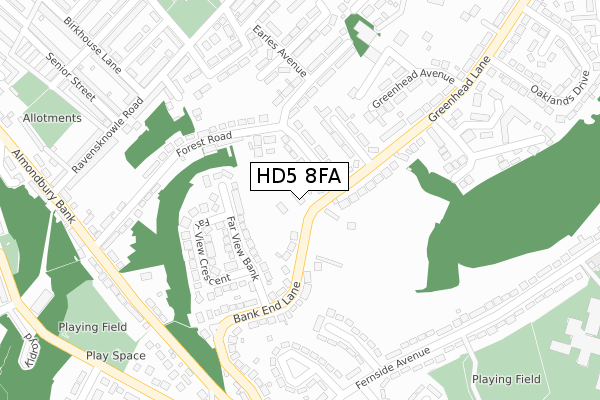
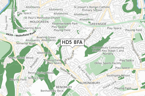
HD5 8FA maps


Source: OS Open Zoomstack (Ordnance Survey)
Licence: Open Government Licence (requires attribution)
Attribution: Contains OS data © Crown copyright and database right 2026
Source: Open Postcode Geo
Licence: Open Government Licence (requires attribution)
Attribution: Contains OS data © Crown copyright and database right 2026; Contains Royal Mail data © Royal Mail copyright and database right 2026; Source: Office for National Statistics licensed under the Open Government Licence v.3.0
Licence: Open Government Licence (requires attribution)
Attribution: Contains OS data © Crown copyright and database right 2026
Source: Open Postcode Geo
Licence: Open Government Licence (requires attribution)
Attribution: Contains OS data © Crown copyright and database right 2026; Contains Royal Mail data © Royal Mail copyright and database right 2026; Source: Office for National Statistics licensed under the Open Government Licence v.3.0
HD5 8FA geodata
| Easting | 416390 |
| Northing | 416081 |
| Latitude | 53.641005 |
| Longitude | -1.753572 |
Where is HD5 8FA?
| Country | England |
| Postcode District | HD5 |
Politics
| Ward | Almondbury |
|---|---|
| Constituency | Huddersfield |
House Prices
Sales of detached houses in HD5 8FA
41, ROSEMEADE COURT, HUDDERSFIELD, HD5 8FA 2022 16 SEP £380,000 |
39, ROSEMEADE COURT, HUDDERSFIELD, HD5 8FA 2022 26 AUG £385,000 |
43, ROSEMEADE COURT, HUDDERSFIELD, HD5 8FA 2022 19 AUG £395,000 |
45, ROSEMEADE COURT, HUDDERSFIELD, HD5 8FA 2022 8 JUL £395,000 |
47, ROSEMEADE COURT, HUDDERSFIELD, HD5 8FA 2022 17 JUN £380,000 |
1, ROSEMEADE COURT, HUDDERSFIELD, HD5 8FA 2022 4 FEB £385,000 |
30, ROSEMEADE COURT, HUDDERSFIELD, HD5 8FA 2021 17 DEC £320,000 |
2, ROSEMEADE COURT, HUDDERSFIELD, HD5 8FA 2021 26 NOV £370,000 |
32, ROSEMEADE COURT, HUDDERSFIELD, HD5 8FA 2021 20 SEP £320,000 |
2021 7 MAY £300,000 |
Source: HM Land Registry Price Paid Data
Licence: Contains HM Land Registry data © Crown copyright and database right 2026. This data is licensed under the Open Government Licence v3.0.
Licence: Contains HM Land Registry data © Crown copyright and database right 2026. This data is licensed under the Open Government Licence v3.0.
Transport
Nearest bus stops to HD5 8FA
| Forest Road (Almondbury Bank) | Almondbury | 294m |
| Forest Road (Almondbury Bank) | Almondbury | 304m |
| Almondbury Bank Ravensknowle Road (Almondbury Bank) | Moldgreen | 341m |
| Fernside Avenue | Almondbury | 369m |
| Almondbury Bank Ravensknowle Road (Almondbury Bank) | Moldgreen | 370m |
Nearest railway stations to HD5 8FA
| Huddersfield Station | 2.2km |
| Deighton Station | 3.1km |
| Lockwood Station | 3.2km |
Deprivation
56.9% of English postcodes are less deprived than HD5 8FA:Food Standards Agency
Three nearest food hygiene ratings to HD5 8FA (metres)
Almond House Day Nursery

Almond House Nursery
201m
Bridgewood Trust

128 Ravensknowle Road
287m
The Shop

16 Ravensknowle Road
330m
➜ Get more ratings from the Food Standards Agency
Nearest post box to HD5 8FA
| Last Collection | |||
|---|---|---|---|
| Location | Mon-Fri | Sat | Distance |
| Upperhead Row | 18:30 | 12:00 | 385m |
| Waterloo Road | 17:00 | 11:45 | 515m |
| Aspley | 17:45 | 12:15 | 848m |
HD5 8FA ITL and HD5 8FA LAU
The below table lists the International Territorial Level (ITL) codes (formerly Nomenclature of Territorial Units for Statistics (NUTS) codes) and Local Administrative Units (LAU) codes for HD5 8FA:
| ITL 1 Code | Name |
|---|---|
| TLE | Yorkshire and The Humber |
| ITL 2 Code | Name |
| TLE4 | West Yorkshire |
| ITL 3 Code | Name |
| TLE44 | Calderdale and Kirklees |
| LAU 1 Code | Name |
| E08000034 | Kirklees |
HD5 8FA census areas
The below table lists the Census Output Area (OA), Lower Layer Super Output Area (LSOA), and Middle Layer Super Output Area (MSOA) for HD5 8FA:
| Code | Name | |
|---|---|---|
| OA | E00055480 | |
| LSOA | E01011006 | Kirklees 040B |
| MSOA | E02002310 | Kirklees 040 |
Nearest postcodes to HD5 8FA
| HD5 8ET | Forest Road | 70m |
| HD5 8EP | Far View Bank | 74m |
| HD5 8ES | Bank End Lane | 133m |
| HD5 8ED | Hallas Grove | 140m |
| HD5 8ER | Far View Crescent | 148m |
| HD5 8EE | Greenhead Lane | 175m |
| HD5 8EU | Forest Road | 193m |
| HD5 8EW | Bank End Lane | 206m |
| HD5 8DP | Holme Avenue | 207m |
| HD5 8DR | Felcote Avenue | 215m |