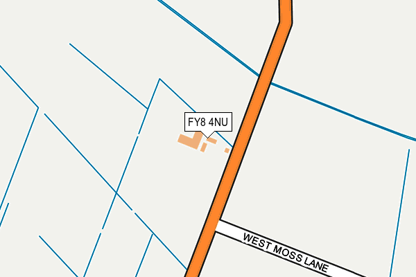
FY8 4NU is located in the Kilnhouse electoral ward, within the local authority district of Fylde and the English Parliamentary constituency of Fylde. The Sub Integrated Care Board (ICB) Location is NHS Lancashire and South Cumbria ICB - 02M and the police force is Lancashire. This postcode has been in use since January 1980.


GetTheData
Source: OS OpenMap – Local (Ordnance Survey)
Source: OS VectorMap District (Ordnance Survey)
Licence: Open Government Licence (requires attribution)
| Easting | 334790 |
| Northing | 430699 |
| Latitude | 53.768534 |
| Longitude | -2.990805 |
GetTheData
Source: Open Postcode Geo
Licence: Open Government Licence
| Country | England |
| Postcode District | FY8 |
| ➜ FY8 open data dashboard ➜ See where FY8 is on a map | |
GetTheData
Source: Land Registry Price Paid Data
Licence: Open Government Licence
Elevation or altitude of FY8 4NU as distance above sea level:
| Metres | Feet | |
|---|---|---|
| Elevation | 10m | 33ft |
Elevation is measured from the approximate centre of the postcode, to the nearest point on an OS contour line from OS Terrain 50, which has contour spacing of ten vertical metres.
➜ How high above sea level am I? Find the elevation of your current position using your device's GPS.
GetTheData
Source: Open Postcode Elevation
Licence: Open Government Licence
| Ward | Kilnhouse |
| Constituency | Fylde |
GetTheData
Source: ONS Postcode Database
Licence: Open Government Licence
| June 2022 | Violence and sexual offences | On or near North Houses Lane | 479m |
| ➜ Get more crime data in our Crime section | |||
GetTheData
Source: data.police.uk
Licence: Open Government Licence
| Telephone Box (Ballam Road) | Higher Ballam | 1,301m |
| Queensway Court (Kilnhouse Lane) | St Annes | 1,364m |
| Queensway Court (Kilnhouse Lane) | St Annes | 1,389m |
| Heyhouses Lane | Hey Houses | 1,439m |
| Elmhurst Road (Singleton Avenue) | Hey Houses | 1,452m |
| Ansdell & Fairhaven Station | 3km |
| St Annes-on-the-Sea Station | 3.1km |
| Moss Side Station | 3.2km |
GetTheData
Source: NaPTAN
Licence: Open Government Licence
GetTheData
Source: ONS Postcode Database
Licence: Open Government Licence


➜ Get more ratings from the Food Standards Agency
GetTheData
Source: Food Standards Agency
Licence: FSA terms & conditions
| Last Collection | |||
|---|---|---|---|
| Location | Mon-Fri | Sat | Distance |
| 197 St Annes Road East, St Annes | 17:15 | 12:00 | 1,483m |
| Grand Manor Drive | 16:00 | 11:45 | 1,601m |
| Heyhouses Lane | 17:30 | 12:00 | 1,696m |
GetTheData
Source: Dracos
Licence: Creative Commons Attribution-ShareAlike
| Facility | Distance |
|---|---|
| Clifton Primary School Clitheroe Road, Lytham St. Annes Grass Pitches | 1.8km |
| St Nicholas Church Of England Primary School School Road, Blackpool Grass Pitches | 1.9km |
| South Shore Cricket Club Common Edge Road, Blackpool Health and Fitness Gym, Grass Pitches, Squash Courts | 1.9km |
GetTheData
Source: Active Places
Licence: Open Government Licence
| School | Phase of Education | Distance |
|---|---|---|
| Clifton Primary School Clitheroe Road, Ansdell, Lytham St Annes, FY8 3PY | Primary | 1.8km |
| Blackpool St Nicholas CofE Primary School School Road, Marton Moss, Blackpool, FY4 5DS | Primary | 1.9km |
| Heyhouses Endowed Church of England Primary School Clarendon Road North, St Anne's, Lytham St Annes, FY8 3EE | Primary | 2.2km |
GetTheData
Source: Edubase
Licence: Open Government Licence
| Risk of FY8 4NU flooding from rivers and sea | Low |
| ➜ FY8 4NU flood map | |
GetTheData
Source: Open Flood Risk by Postcode
Licence: Open Government Licence
The below table lists the International Territorial Level (ITL) codes (formerly Nomenclature of Territorial Units for Statistics (NUTS) codes) and Local Administrative Units (LAU) codes for FY8 4NU:
| ITL 1 Code | Name |
|---|---|
| TLD | North West (England) |
| ITL 2 Code | Name |
| TLD4 | Lancashire |
| ITL 3 Code | Name |
| TLD45 | Mid Lancashire |
| LAU 1 Code | Name |
| E07000119 | Fylde |
GetTheData
Source: ONS Postcode Directory
Licence: Open Government Licence
The below table lists the Census Output Area (OA), Lower Layer Super Output Area (LSOA), and Middle Layer Super Output Area (MSOA) for FY8 4NU:
| Code | Name | |
|---|---|---|
| OA | E00126902 | |
| LSOA | E01025001 | Fylde 005A |
| MSOA | E02005207 | Fylde 005 |
GetTheData
Source: ONS Postcode Directory
Licence: Open Government Licence
| FY4 5EB | Division Lane | 671m |
| FY8 4NH | West Moss Lane | 1107m |
| FY4 5EA | Division Lane | 1171m |
| FY4 5EE | Midgeland Road | 1193m |
| FY4 5ED | Midgeland Road | 1195m |
| FY4 5LL | Peel Road | 1249m |
| FY8 4NQ | Ballam Road | 1293m |
| FY8 3TU | Commonwealth Close | 1296m |
| FY8 4UH | Sadlers Row | 1303m |
| FY8 4NR | South Moss Road | 1306m |
GetTheData
Source: Open Postcode Geo; Land Registry Price Paid Data
Licence: Open Government Licence