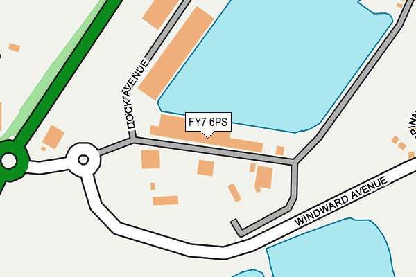
FY7 6PS is located in the Mount electoral ward, within the local authority district of Wyre and the English Parliamentary constituency of Lancaster and Fleetwood. The Sub Integrated Care Board (ICB) Location is NHS Lancashire and South Cumbria ICB - 02M and the police force is Lancashire. This postcode has been in use since January 1980.


GetTheData
Source: OS OpenMap – Local (Ordnance Survey)
Source: OS VectorMap District (Ordnance Survey)
Licence: Open Government Licence (requires attribution)
| Easting | 333308 |
| Northing | 446811 |
| Latitude | 53.913136 |
| Longitude | -3.016789 |
GetTheData
Source: Open Postcode Geo
Licence: Open Government Licence
| Country | England |
| Postcode District | FY7 |
| ➜ FY7 open data dashboard ➜ See where FY7 is on a map ➜ Where is Fleetwood? | |
GetTheData
Source: Land Registry Price Paid Data
Licence: Open Government Licence
Elevation or altitude of FY7 6PS as distance above sea level:
| Metres | Feet | |
|---|---|---|
| Elevation | 10m | 33ft |
Elevation is measured from the approximate centre of the postcode, to the nearest point on an OS contour line from OS Terrain 50, which has contour spacing of ten vertical metres.
➜ How high above sea level am I? Find the elevation of your current position using your device's GPS.
GetTheData
Source: Open Postcode Elevation
Licence: Open Government Licence
| Ward | Mount |
| Constituency | Lancaster And Fleetwood |
GetTheData
Source: ONS Postcode Database
Licence: Open Government Licence
| June 2022 | Burglary | On or near Shopping Area | 368m |
| June 2022 | Anti-social behaviour | On or near Shopping Area | 368m |
| June 2022 | Criminal damage and arson | On or near Shopping Area | 368m |
| ➜ Get more crime data in our Crime section | |||
GetTheData
Source: data.police.uk
Licence: Open Government Licence
| Freeport Village | Freeport | 414m |
| Fire Station (Radcliffe Road) | Fleetwood | 433m |
| Fire Station (Keating Court) | Fleetwood | 446m |
| Nelson Court (Hatfield Avenue) | Fleetwood | 505m |
| Nelson Court (Hatfield Avenue) | Fleetwood | 538m |
| Lindel Road (Blackpool Tramway) (Lindel Road) | Freeport | 453m |
| Stanley Road (Blackpool Tramway) (Stanley Road) | Freeport | 455m |
| Fisherman's Walk (Blackpool Tramway) (Ash Street) | Freeport | 730m |
| Heathfield Road (Blackpool Tramway) (Heathfield Road) | Broadwater | 774m |
| London Street (Blackpool Tramway) (London Street) | Freeport | 1,116m |
GetTheData
Source: NaPTAN
Licence: Open Government Licence
GetTheData
Source: ONS Postcode Database
Licence: Open Government Licence


➜ Get more ratings from the Food Standards Agency
GetTheData
Source: Food Standards Agency
Licence: FSA terms & conditions
| Last Collection | |||
|---|---|---|---|
| Location | Mon-Fri | Sat | Distance |
| Calagran Holiday Park | 16:30 | 12:00 | 412m |
| Fleetwood Freeport | 17:00 | 11:30 | 424m |
| Radcliffe Road | 17:00 | 12:45 | 566m |
GetTheData
Source: Dracos
Licence: Creative Commons Attribution-ShareAlike
| Facility | Distance |
|---|---|
| Elite Muscle And Fitness Fleetwood (Closed) Copse Road, Fleetwood Health and Fitness Gym | 513m |
| Fleetwood Town (Highbury Stadium) Park Avenue, Fleetwood Grass Pitches | 639m |
| Fleetwood Memorial Park Warrenhurst Road, Fleetwood Grass Pitches, Outdoor Tennis Courts | 780m |
GetTheData
Source: Active Places
Licence: Open Government Licence
| School | Phase of Education | Distance |
|---|---|---|
| Fleetwood Flakefleet Primary School Northfleet Avenue, Fleetwood, FY7 7ND | Primary | 1km |
| Fleetwood Chaucer Community Primary School Chaucer Road, Fleetwood, FY7 6QN | Primary | 1.1km |
| St Wulstan's and St Edmund's Catholic Academy Poulton Road, Fleetwood, FY7 7JY | Primary | 1.2km |
GetTheData
Source: Edubase
Licence: Open Government Licence
| Risk of FY7 6PS flooding from rivers and sea | Low |
| ➜ FY7 6PS flood map | |
GetTheData
Source: Open Flood Risk by Postcode
Licence: Open Government Licence
The below table lists the International Territorial Level (ITL) codes (formerly Nomenclature of Territorial Units for Statistics (NUTS) codes) and Local Administrative Units (LAU) codes for FY7 6PS:
| ITL 1 Code | Name |
|---|---|
| TLD | North West (England) |
| ITL 2 Code | Name |
| TLD4 | Lancashire |
| ITL 3 Code | Name |
| TLD44 | Lancaster and Wyre |
| LAU 1 Code | Name |
| E07000128 | Wyre |
GetTheData
Source: ONS Postcode Directory
Licence: Open Government Licence
The below table lists the Census Output Area (OA), Lower Layer Super Output Area (LSOA), and Middle Layer Super Output Area (MSOA) for FY7 6PS:
| Code | Name | |
|---|---|---|
| OA | E00129779 | |
| LSOA | E01025575 | Wyre 005B |
| MSOA | E02005323 | Wyre 005 |
GetTheData
Source: ONS Postcode Directory
Licence: Open Government Licence
| FY7 6FJ | Spinnaker Close | 302m |
| FY7 6FG | Seacrest Avenue | 352m |
| FY7 7PA | Harbour Trading Estate | 382m |
| FY7 6FH | Hawknest Avenue | 383m |
| FY7 6FN | Capstan Close | 404m |
| FY7 6FE | Windward Avenue | 411m |
| FY7 6SD | Wyre Street | 457m |
| FY7 6FQ | Windward Avenue | 468m |
| FY7 6SE | Peel Road | 471m |
| FY7 6FL | Breakers Wharf | 472m |
GetTheData
Source: Open Postcode Geo; Land Registry Price Paid Data
Licence: Open Government Licence