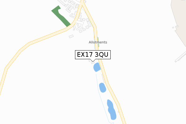
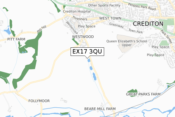
EX17 3QU is located in the Yeo electoral ward, within the local authority district of Mid Devon and the English Parliamentary constituency of Central Devon. The Sub Integrated Care Board (ICB) Location is NHS Devon ICB - 15N and the police force is Devon & Cornwall. This postcode has been in use since December 1999.


GetTheData
Source: OS Open Zoomstack (Ordnance Survey)
Licence: Open Government Licence (requires attribution)
Attribution: Contains OS data © Crown copyright and database right 2024
Source: Open Postcode Geo
Licence: Open Government Licence (requires attribution)
Attribution: Contains OS data © Crown copyright and database right 2024; Contains Royal Mail data © Royal Mail copyright and database right 2024; Source: Office for National Statistics licensed under the Open Government Licence v.3.0
| Easting | 282344 |
| Northing | 99814 |
| Latitude | 50.785923 |
| Longitude | -3.670434 |
GetTheData
Source: Open Postcode Geo
Licence: Open Government Licence
| Country | England |
| Postcode District | EX17 |
| ➜ EX17 open data dashboard ➜ See where EX17 is on a map | |
GetTheData
Source: Land Registry Price Paid Data
Licence: Open Government Licence
Elevation or altitude of EX17 3QU as distance above sea level:
| Metres | Feet | |
|---|---|---|
| Elevation | 60m | 197ft |
Elevation is measured from the approximate centre of the postcode, to the nearest point on an OS contour line from OS Terrain 50, which has contour spacing of ten vertical metres.
➜ How high above sea level am I? Find the elevation of your current position using your device's GPS.
GetTheData
Source: Open Postcode Elevation
Licence: Open Government Licence
| Ward | Yeo |
| Constituency | Central Devon |
GetTheData
Source: ONS Postcode Database
Licence: Open Government Licence
| April 2022 | Violence and sexual offences | On or near Elston Meadow | 223m |
| March 2022 | Violence and sexual offences | On or near Westernlea | 334m |
| March 2022 | Violence and sexual offences | On or near Westernlea | 334m |
| ➜ Get more crime data in our Crime section | |||
GetTheData
Source: data.police.uk
Licence: Open Government Licence
| Westernlea | Crediton | 345m |
| Westernlea | Crediton | 457m |
| Tuckers Meadow | Crediton | 464m |
| Threshers | Crediton | 576m |
| Threshers | Crediton | 584m |
| Crediton Station | 1.7km |
| Yeoford Station | 4.1km |
GetTheData
Source: NaPTAN
Licence: Open Government Licence
| Percentage of properties with Next Generation Access | 100.0% |
| Percentage of properties with Superfast Broadband | 100.0% |
| Percentage of properties with Ultrafast Broadband | 0.0% |
| Percentage of properties with Full Fibre Broadband | 0.0% |
Superfast Broadband is between 30Mbps and 300Mbps
Ultrafast Broadband is > 300Mbps
| Percentage of properties unable to receive 2Mbps | 0.0% |
| Percentage of properties unable to receive 5Mbps | 0.0% |
| Percentage of properties unable to receive 10Mbps | 0.0% |
| Percentage of properties unable to receive 30Mbps | 0.0% |
GetTheData
Source: Ofcom
Licence: Ofcom Terms of Use (requires attribution)
GetTheData
Source: ONS Postcode Database
Licence: Open Government Licence


➜ Get more ratings from the Food Standards Agency
GetTheData
Source: Food Standards Agency
Licence: FSA terms & conditions
| Last Collection | |||
|---|---|---|---|
| Location | Mon-Fri | Sat | Distance |
| Alexandra Road | 17:30 | 12:00 | 750m |
| George Hill | 17:30 | 12:00 | 985m |
| Crediton Post Office | 17:45 | 12:30 | 1,042m |
GetTheData
Source: Dracos
Licence: Creative Commons Attribution-ShareAlike
| Facility | Distance |
|---|---|
| Landscore Primary School Threshers, Crediton Grass Pitches | 571m |
| Queen Elizabeths School (Barnfield Campus) Barnfield, Crediton Grass Pitches, Swimming Pool, Sports Hall | 648m |
| Queen Elizabeths School (Western Road Campus) Western Road, Crediton Sports Hall, Swimming Pool, Health and Fitness Gym, Outdoor Tennis Courts | 735m |
GetTheData
Source: Active Places
Licence: Open Government Licence
| School | Phase of Education | Distance |
|---|---|---|
| Landscore Primary School Threshers, Crediton, EX17 3JH | Primary | 576m |
| Queen Elizabeth's Western Road, Crediton, EX17 3LU | Secondary | 735m |
| Hayward's Primary School East Street, Crediton, EX17 3AX | Primary | 1.4km |
GetTheData
Source: Edubase
Licence: Open Government Licence
| Risk of EX17 3QU flooding from rivers and sea | Low |
| ➜ EX17 3QU flood map | |
GetTheData
Source: Open Flood Risk by Postcode
Licence: Open Government Licence
The below table lists the International Territorial Level (ITL) codes (formerly Nomenclature of Territorial Units for Statistics (NUTS) codes) and Local Administrative Units (LAU) codes for EX17 3QU:
| ITL 1 Code | Name |
|---|---|
| TLK | South West (England) |
| ITL 2 Code | Name |
| TLK4 | Devon |
| ITL 3 Code | Name |
| TLK43 | Devon CC |
| LAU 1 Code | Name |
| E07000042 | Mid Devon |
GetTheData
Source: ONS Postcode Directory
Licence: Open Government Licence
The below table lists the Census Output Area (OA), Lower Layer Super Output Area (LSOA), and Middle Layer Super Output Area (MSOA) for EX17 3QU:
| Code | Name | |
|---|---|---|
| OA | E00101689 | |
| LSOA | E01020083 | Mid Devon 010D |
| MSOA | E02004173 | Mid Devon 010 |
GetTheData
Source: ONS Postcode Directory
Licence: Open Government Licence
| EX17 3SZ | Elston Meadow | 193m |
| EX17 3PF | 249m | |
| EX17 3FS | 270m | |
| EX17 3PE | 317m | |
| EX17 3NU | Tuckers Meadow | 402m |
| EX17 3JE | Westernlea | 419m |
| EX17 3NX | Tuckers Meadow | 449m |
| EX17 3PQ | Park Lane | 466m |
| EX17 3LS | Westwood Road | 496m |
| EX17 3NT | Tuckers Meadow | 522m |
GetTheData
Source: Open Postcode Geo; Land Registry Price Paid Data
Licence: Open Government Licence