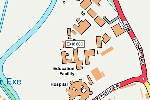
EX16 6SQ is located in the Tiverton Castle electoral ward, within the local authority district of Mid Devon and the English Parliamentary constituency of Tiverton and Honiton. The Sub Integrated Care Board (ICB) Location is NHS Devon ICB - 15N and the police force is Devon & Cornwall. This postcode has been in use since January 1980.


GetTheData
Source: OS OpenMap – Local (Ordnance Survey)
Source: OS VectorMap District (Ordnance Survey)
Licence: Open Government Licence (requires attribution)
| Easting | 295115 |
| Northing | 113443 |
| Latitude | 50.910894 |
| Longitude | -3.493242 |
GetTheData
Source: Open Postcode Geo
Licence: Open Government Licence
| Country | England |
| Postcode District | EX16 |
| ➜ EX16 open data dashboard ➜ See where EX16 is on a map ➜ Where is Tiverton? | |
GetTheData
Source: Land Registry Price Paid Data
Licence: Open Government Licence
Elevation or altitude of EX16 6SQ as distance above sea level:
| Metres | Feet | |
|---|---|---|
| Elevation | 60m | 197ft |
Elevation is measured from the approximate centre of the postcode, to the nearest point on an OS contour line from OS Terrain 50, which has contour spacing of ten vertical metres.
➜ How high above sea level am I? Find the elevation of your current position using your device's GPS.
GetTheData
Source: Open Postcode Elevation
Licence: Open Government Licence
| Ward | Tiverton Castle |
| Constituency | Tiverton And Honiton |
GetTheData
Source: ONS Postcode Database
Licence: Open Government Licence
| June 2022 | Violence and sexual offences | On or near Sports/Recreation Area | 148m |
| June 2022 | Public order | On or near Sports/Recreation Area | 148m |
| June 2022 | Other theft | On or near Petrol Station | 310m |
| ➜ Get more crime data in our Crime section | |||
GetTheData
Source: data.police.uk
Licence: Open Government Licence
| Tiverton Petroc College | Tiverton | 96m |
| Tiverton Petroc College (Bolham Road) | Tiverton | 222m |
| Tiverton Petroc College (Bolham Road) | Tiverton | 235m |
| Morrisons (Kennedy Way) | Cotteylands | 259m |
| Tiverton & District Hospital (Kennedy Way) | Cotteylands | 295m |
GetTheData
Source: NaPTAN
Licence: Open Government Licence
GetTheData
Source: ONS Postcode Database
Licence: Open Government Licence


➜ Get more ratings from the Food Standards Agency
GetTheData
Source: Food Standards Agency
Licence: FSA terms & conditions
| Last Collection | |||
|---|---|---|---|
| Location | Mon-Fri | Sat | Distance |
| Wilcombe Post Office | 17:00 | 12:00 | 622m |
| St Peter Street | 17:30 | 12:00 | 729m |
| Town Hall | 17:30 | 12:00 | 999m |
GetTheData
Source: Dracos
Licence: Creative Commons Attribution-ShareAlike
| Facility | Distance |
|---|---|
| Tiverton High School Bolham Road, Tiverton Sports Hall, Grass Pitches, Studio | 0m |
| Snap Fitness (Tiverton) Kennedy Way, Tiverton Health and Fitness Gym, Studio | 127m |
| Tiverton Rugby Football Club Bolham Road, Tiverton Grass Pitches | 130m |
GetTheData
Source: Active Places
Licence: Open Government Licence
| School | Phase of Education | Distance |
|---|---|---|
| Tiverton High School Bolham Road, Tiverton, EX16 6SQ | Secondary | 12m |
| St John's Catholic Primary School Melbourne Street, Tiverton, EX16 5LB | Primary | 660m |
| Castle Primary School Barrington Street, Tiverton, EX16 6QR | Primary | 866m |
GetTheData
Source: Edubase
Licence: Open Government Licence
| Risk of EX16 6SQ flooding from rivers and sea | Low |
| ➜ EX16 6SQ flood map | |
GetTheData
Source: Open Flood Risk by Postcode
Licence: Open Government Licence
The below table lists the International Territorial Level (ITL) codes (formerly Nomenclature of Territorial Units for Statistics (NUTS) codes) and Local Administrative Units (LAU) codes for EX16 6SQ:
| ITL 1 Code | Name |
|---|---|
| TLK | South West (England) |
| ITL 2 Code | Name |
| TLK4 | Devon |
| ITL 3 Code | Name |
| TLK43 | Devon CC |
| LAU 1 Code | Name |
| E07000042 | Mid Devon |
GetTheData
Source: ONS Postcode Directory
Licence: Open Government Licence
The below table lists the Census Output Area (OA), Lower Layer Super Output Area (LSOA), and Middle Layer Super Output Area (MSOA) for EX16 6SQ:
| Code | Name | |
|---|---|---|
| OA | E00101491 | |
| LSOA | E01020048 | Mid Devon 005A |
| MSOA | E02004168 | Mid Devon 005 |
GetTheData
Source: ONS Postcode Directory
Licence: Open Government Licence
| EX16 6SG | Bolham Road | 344m |
| EX16 5AE | Higher Loughborough | 365m |
| EX16 5AD | Lower Loughborough | 371m |
| EX16 6RY | Alsa Brook Meadow | 397m |
| EX16 5AG | Rackenford Road | 419m |
| EX16 5AQ | Longdrag Hill | 482m |
| EX16 6RX | Whitestone Drive | 492m |
| EX16 5BU | Johnstone Drive | 522m |
| EX16 5AB | Derick Road | 524m |
| EX16 6BA | Park Road | 542m |
GetTheData
Source: Open Postcode Geo; Land Registry Price Paid Data
Licence: Open Government Licence