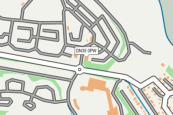
DN35 0PW is located in the Haverstoe electoral ward, within the unitary authority of North East Lincolnshire and the English Parliamentary constituency of Cleethorpes. The Sub Integrated Care Board (ICB) Location is NHS Humber and North Yorkshire ICB - 03H and the police force is Humberside. This postcode has been in use since January 1980.


GetTheData
Source: OS OpenMap – Local (Ordnance Survey)
Source: OS VectorMap District (Ordnance Survey)
Licence: Open Government Licence (requires attribution)
| Easting | 532934 |
| Northing | 406076 |
| Latitude | 53.534522 |
| Longitude | 0.004275 |
GetTheData
Source: Open Postcode Geo
Licence: Open Government Licence
| Country | England |
| Postcode District | DN35 |
| ➜ DN35 open data dashboard ➜ See where DN35 is on a map ➜ Where is Humberston? | |
GetTheData
Source: Land Registry Price Paid Data
Licence: Open Government Licence
Elevation or altitude of DN35 0PW as distance above sea level:
| Metres | Feet | |
|---|---|---|
| Elevation | 10m | 33ft |
Elevation is measured from the approximate centre of the postcode, to the nearest point on an OS contour line from OS Terrain 50, which has contour spacing of ten vertical metres.
➜ How high above sea level am I? Find the elevation of your current position using your device's GPS.
GetTheData
Source: Open Postcode Elevation
Licence: Open Government Licence
| Ward | Haverstoe |
| Constituency | Cleethorpes |
GetTheData
Source: ONS Postcode Database
Licence: Open Government Licence
| June 2022 | Public order | On or near Anthony'S Bank Road | 318m |
| June 2022 | Vehicle crime | On or near Anthony'S Bank Road | 318m |
| June 2022 | Vehicle crime | On or near Anthony'S Bank Road | 318m |
| ➜ Get more crime data in our Crime section | |||
GetTheData
Source: data.police.uk
Licence: Open Government Licence
| Leisure Centre (Main Road) | Thorpe Park | 100m |
| Leisure Centre (Main Road) | Thorpe Park | 105m |
| Main Gate (Main Road) | Thorpe Park | 158m |
| Main Reception (Main Road) | Thorpe Park | 171m |
| Anthonys Bank (Main Road) | Thorpe Park | 374m |
| Cleethorpes Station | 3.8km |
| New Clee Station | 6.2km |
GetTheData
Source: NaPTAN
Licence: Open Government Licence
GetTheData
Source: ONS Postcode Database
Licence: Open Government Licence


➜ Get more ratings from the Food Standards Agency
GetTheData
Source: Food Standards Agency
Licence: FSA terms & conditions
| Last Collection | |||
|---|---|---|---|
| Location | Mon-Fri | Sat | Distance |
| Humberston | 16:00 | 11:00 | 1,712m |
| Humberstone Post Office | 17:45 | 11:45 | 1,987m |
| Daggett Road | 16:00 | 11:15 | 2,342m |
GetTheData
Source: Dracos
Licence: Creative Commons Attribution-ShareAlike
| Facility | Distance |
|---|---|
| Thorpe Park Holiday Centre Cleethorpes Swimming Pool, Golf | 0m |
| Tertia Trust (Closed) South Sea Lane, Humberston, Grimsby Health and Fitness Gym, Sports Hall | 737m |
| Cleethorpes Golf Club Kings Road, Cleethorpes Golf | 986m |
GetTheData
Source: Active Places
Licence: Open Government Licence
| School | Phase of Education | Distance |
|---|---|---|
| The Humberston CofE Primary School Church Lane, Humberston, Grimsby, DN36 4HZ | Primary | 1.6km |
| Humberston Cloverfields Academy St Thomas Close, Humberston, Grimsby, DN36 4HS | Primary | 2.2km |
| Humberston Park School St Thomas Close, Humberston, Grimsby, DN36 4HS | Not applicable | 2.2km |
GetTheData
Source: Edubase
Licence: Open Government Licence
| Risk of DN35 0PW flooding from rivers and sea | Medium |
| ➜ DN35 0PW flood map | |
GetTheData
Source: Open Flood Risk by Postcode
Licence: Open Government Licence
The below table lists the International Territorial Level (ITL) codes (formerly Nomenclature of Territorial Units for Statistics (NUTS) codes) and Local Administrative Units (LAU) codes for DN35 0PW:
| ITL 1 Code | Name |
|---|---|
| TLE | Yorkshire and The Humber |
| ITL 2 Code | Name |
| TLE1 | East Yorkshire and Northern Lincolnshire |
| ITL 3 Code | Name |
| TLE13 | North and North East Lincolnshire |
| LAU 1 Code | Name |
| E06000012 | North East Lincolnshire |
GetTheData
Source: ONS Postcode Directory
Licence: Open Government Licence
The below table lists the Census Output Area (OA), Lower Layer Super Output Area (LSOA), and Middle Layer Super Output Area (MSOA) for DN35 0PW:
| Code | Name | |
|---|---|---|
| OA | E00066378 | |
| LSOA | E01013153 | North East Lincolnshire 020A |
| MSOA | E02002745 | North East Lincolnshire 020 |
GetTheData
Source: ONS Postcode Directory
Licence: Open Government Licence
| DN36 4EX | Humberston Fitties | 341m |
| DN36 4EY | Humberston Fitties | 352m |
| DN36 4EU | Humberston Fitties | 428m |
| DN36 4HB | Humberston Fitties | 664m |
| DN36 4HA | Humberston Fitties | 712m |
| DN35 0PG | Kings Mews | 772m |
| DN36 4EZ | Humberston Fitties | 783m |
| DN35 0PP | North Sea Lane | 827m |
| DN36 4BX | Forest Way | 866m |
| DN35 0NN | Fairway Court | 878m |
GetTheData
Source: Open Postcode Geo; Land Registry Price Paid Data
Licence: Open Government Licence