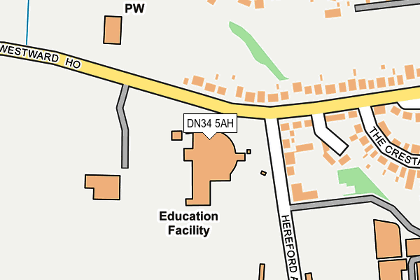
DN34 5AH is located in the South electoral ward, within the unitary authority of North East Lincolnshire and the English Parliamentary constituency of Great Grimsby. The Sub Integrated Care Board (ICB) Location is NHS Humber and North Yorkshire ICB - 03H and the police force is Humberside. This postcode has been in use since January 1980.


GetTheData
Source: OS OpenMap – Local (Ordnance Survey)
Source: OS VectorMap District (Ordnance Survey)
Licence: Open Government Licence (requires attribution)
| Easting | 526000 |
| Northing | 408248 |
| Latitude | 53.555741 |
| Longitude | -0.099409 |
GetTheData
Source: Open Postcode Geo
Licence: Open Government Licence
| Country | England |
| Postcode District | DN34 |
| ➜ DN34 open data dashboard ➜ See where DN34 is on a map ➜ Where is Grimsby? | |
GetTheData
Source: Land Registry Price Paid Data
Licence: Open Government Licence
Elevation or altitude of DN34 5AH as distance above sea level:
| Metres | Feet | |
|---|---|---|
| Elevation | 10m | 33ft |
Elevation is measured from the approximate centre of the postcode, to the nearest point on an OS contour line from OS Terrain 50, which has contour spacing of ten vertical metres.
➜ How high above sea level am I? Find the elevation of your current position using your device's GPS.
GetTheData
Source: Open Postcode Elevation
Licence: Open Government Licence
| Ward | South |
| Constituency | Great Grimsby |
GetTheData
Source: ONS Postcode Database
Licence: Open Government Licence
| January 2024 | Public order | On or near Eaton Court | 499m |
| January 2024 | Theft from the person | On or near Eaton Court | 499m |
| December 2023 | Criminal damage and arson | On or near Westward Close | 168m |
| ➜ Get more crime data in our Crime section | |||
GetTheData
Source: data.police.uk
Licence: Open Government Licence
| Hereford School (Westward Ho) | Grange | 84m |
| The Cresta (Westward Ho) | Grange | 317m |
| The Cresta (Westward Ho) | Grange | 354m |
| First Avenue (Laceby Road) | Grange | 382m |
| Carnarvon Avenue (Laceby Road) | Grange | 389m |
| Grimsby Town Station | 1.2km |
| Grimsby Docks Station | 2.6km |
| Great Coates Station | 3km |
GetTheData
Source: NaPTAN
Licence: Open Government Licence
GetTheData
Source: ONS Postcode Database
Licence: Open Government Licence


➜ Get more ratings from the Food Standards Agency
GetTheData
Source: Food Standards Agency
Licence: FSA terms & conditions
| Last Collection | |||
|---|---|---|---|
| Location | Mon-Fri | Sat | Distance |
| Laceby Road | 17:30 | 11:45 | 513m |
| Laceby Road | 17:30 | 11:45 | 666m |
| Nunsthorpe P.o. | 17:30 | 12:00 | 679m |
GetTheData
Source: Dracos
Licence: Creative Commons Attribution-ShareAlike
| Facility | Distance |
|---|---|
| Ormiston Maritime Academy Westward Ho, Grimsby Sports Hall, Artificial Grass Pitch, Grass Pitches, Studio | 0m |
| The Academy Grimsby Westward Ho, Grimsby Grass Pitches | 0m |
| St James School Playing Field Bargate, Bargate, Grimsby Grass Pitches | 238m |
GetTheData
Source: Active Places
Licence: Open Government Licence
| School | Phase of Education | Distance |
|---|---|---|
| Ormiston Maritime Academy Westward Ho, Grimsby, DN34 5AH | Secondary | 68m |
| Franklin College Chelmsford Avenue, Grimsby, DN34 5BY | 16 plus | 382m |
| TEC Partnership Nuns Corner, Grimsby, DN34 5BQ | 16 plus | 425m |
GetTheData
Source: Edubase
Licence: Open Government Licence
| Risk of DN34 5AH flooding from rivers and sea | Very Low |
| ➜ DN34 5AH flood map | |
GetTheData
Source: Open Flood Risk by Postcode
Licence: Open Government Licence
The below table lists the International Territorial Level (ITL) codes (formerly Nomenclature of Territorial Units for Statistics (NUTS) codes) and Local Administrative Units (LAU) codes for DN34 5AH:
| ITL 1 Code | Name |
|---|---|
| TLE | Yorkshire and The Humber |
| ITL 2 Code | Name |
| TLE1 | East Yorkshire and Northern Lincolnshire |
| ITL 3 Code | Name |
| TLE13 | North and North East Lincolnshire |
| LAU 1 Code | Name |
| E06000012 | North East Lincolnshire |
GetTheData
Source: ONS Postcode Directory
Licence: Open Government Licence
The below table lists the Census Output Area (OA), Lower Layer Super Output Area (LSOA), and Middle Layer Super Output Area (MSOA) for DN34 5AH:
| Code | Name | |
|---|---|---|
| OA | E00066641 | |
| LSOA | E01013211 | North East Lincolnshire 015C |
| MSOA | E02002740 | North East Lincolnshire 015 |
GetTheData
Source: ONS Postcode Directory
Licence: Open Government Licence
| DN34 5AG | Westward Ho | 75m |
| DN34 5AJ | Hereford Avenue | 122m |
| DN34 5AL | Westward Ho | 145m |
| DN34 5AN | Westward Close | 166m |
| DN34 4TG | Augusta Close | 229m |
| DN34 5BW | Gloucester Avenue | 238m |
| DN34 5BP | Gloucester Avenue | 272m |
| DN34 4TE | Northumberland Close | 295m |
| DN34 5BS | Carnarvon Avenue | 296m |
| DN34 5BL | Hereford Avenue | 298m |
GetTheData
Source: Open Postcode Geo; Land Registry Price Paid Data
Licence: Open Government Licence