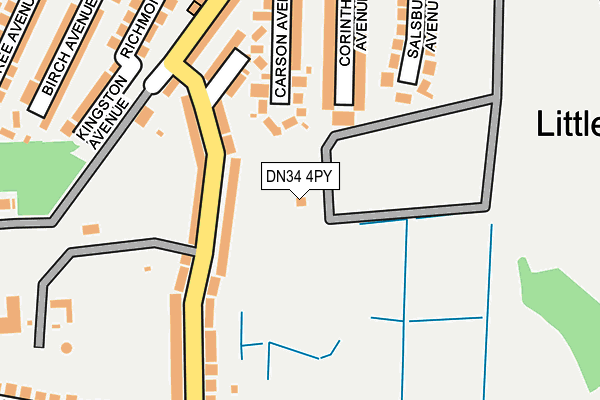
DN34 4PY is located in the South electoral ward, within the unitary authority of North East Lincolnshire and the English Parliamentary constituency of Great Grimsby. The Sub Integrated Care Board (ICB) Location is NHS Humber and North Yorkshire ICB - 03H and the police force is Humberside. This postcode has been in use since January 1980.


GetTheData
Source: OS OpenMap – Local (Ordnance Survey)
Source: OS VectorMap District (Ordnance Survey)
Licence: Open Government Licence (requires attribution)
| Easting | 525558 |
| Northing | 408666 |
| Latitude | 53.559602 |
| Longitude | -0.105909 |
GetTheData
Source: Open Postcode Geo
Licence: Open Government Licence
| Country | England |
| Postcode District | DN34 |
| ➜ DN34 open data dashboard ➜ See where DN34 is on a map ➜ Where is Grimsby? | |
GetTheData
Source: Land Registry Price Paid Data
Licence: Open Government Licence
Elevation or altitude of DN34 4PY as distance above sea level:
| Metres | Feet | |
|---|---|---|
| Elevation | 10m | 33ft |
Elevation is measured from the approximate centre of the postcode, to the nearest point on an OS contour line from OS Terrain 50, which has contour spacing of ten vertical metres.
➜ How high above sea level am I? Find the elevation of your current position using your device's GPS.
GetTheData
Source: Open Postcode Elevation
Licence: Open Government Licence
| Ward | South |
| Constituency | Great Grimsby |
GetTheData
Source: ONS Postcode Database
Licence: Open Government Licence
THE WILLOWS, LITTLEFIELD LANE, GRIMSBY, DN34 4PY 2020 9 NOV £105,000 |
GetTheData
Source: HM Land Registry Price Paid Data
Licence: Contains HM Land Registry data © Crown copyright and database right 2024. This data is licensed under the Open Government Licence v3.0.
| September 2023 | Violence and sexual offences | On or near Westhill Road | 342m |
| January 2023 | Criminal damage and arson | On or near Westhill Road | 342m |
| December 2022 | Burglary | On or near Westhill Road | 342m |
| ➜ Get more crime data in our Crime section | |||
GetTheData
Source: data.police.uk
Licence: Open Government Licence
| Chelmsford Avenue | Grange | 119m |
| Chelmsford Avenue | Grange | 158m |
| Carson Avenue (Littlefield Lane) | West Marsh | 229m |
| Carson Avenue (Littlefield Lane) | West Marsh | 240m |
| Grimsby College (Westward Ho) | Grange | 280m |
| Grimsby Town Station | 1.3km |
| Great Coates Station | 2.4km |
| Grimsby Docks Station | 2.6km |
GetTheData
Source: NaPTAN
Licence: Open Government Licence
GetTheData
Source: ONS Postcode Database
Licence: Open Government Licence


➜ Get more ratings from the Food Standards Agency
GetTheData
Source: Food Standards Agency
Licence: FSA terms & conditions
| Last Collection | |||
|---|---|---|---|
| Location | Mon-Fri | Sat | Distance |
| Market Hotel | 16:00 | 10:30 | 458m |
| Littlefield P.o. | 16:45 | 10:30 | 523m |
| Yarborough Road P.o. | 16:00 | 12:00 | 676m |
GetTheData
Source: Dracos
Licence: Creative Commons Attribution-ShareAlike
| Facility | Distance |
|---|---|
| Grimsby Town Cricket Club Augusta Street, Grimsby Grass Pitches | 368m |
| Franklin College Chelmsford Avenue, Grimsby Health and Fitness Gym, Grass Pitches, Sports Hall, Studio | 588m |
| Ormiston Maritime Academy Westward Ho, Grimsby Sports Hall, Artificial Grass Pitch, Grass Pitches, Studio | 608m |
GetTheData
Source: Active Places
Licence: Open Government Licence
| School | Phase of Education | Distance |
|---|---|---|
| Franklin College Chelmsford Avenue, Grimsby, DN34 5BY | 16 plus | 523m |
| Ormiston Maritime Academy Westward Ho, Grimsby, DN34 5AH | Secondary | 562m |
| Cambridge Park Academy Cambridge Road, Grimsby, DN34 5EB | Not applicable | 658m |
GetTheData
Source: Edubase
Licence: Open Government Licence
| Risk of DN34 4PY flooding from rivers and sea | Very Low |
| ➜ DN34 4PY flood map | |
GetTheData
Source: Open Flood Risk by Postcode
Licence: Open Government Licence
The below table lists the International Territorial Level (ITL) codes (formerly Nomenclature of Territorial Units for Statistics (NUTS) codes) and Local Administrative Units (LAU) codes for DN34 4PY:
| ITL 1 Code | Name |
|---|---|
| TLE | Yorkshire and The Humber |
| ITL 2 Code | Name |
| TLE1 | East Yorkshire and Northern Lincolnshire |
| ITL 3 Code | Name |
| TLE13 | North and North East Lincolnshire |
| LAU 1 Code | Name |
| E06000012 | North East Lincolnshire |
GetTheData
Source: ONS Postcode Directory
Licence: Open Government Licence
The below table lists the Census Output Area (OA), Lower Layer Super Output Area (LSOA), and Middle Layer Super Output Area (MSOA) for DN34 4PY:
| Code | Name | |
|---|---|---|
| OA | E00066632 | |
| LSOA | E01013211 | North East Lincolnshire 015C |
| MSOA | E02002740 | North East Lincolnshire 015 |
GetTheData
Source: ONS Postcode Directory
Licence: Open Government Licence
| DN34 4SA | Chelmsford Avenue | 77m |
| DN34 4RZ | Chelmsford Avenue | 109m |
| DN34 4QX | Carson Avenue | 137m |
| DN34 4QT | Corinthian Avenue | 156m |
| DN34 4RY | Chelmsford Place | 159m |
| DN34 4SE | Chelmsford Avenue | 161m |
| DN34 4RT | Littlefield Lane | 172m |
| DN34 4RU | Littlefield Lane | 177m |
| DN34 4PX | Salsbury Avenue | 181m |
| DN34 4SD | Chelmsford Avenue | 183m |
GetTheData
Source: Open Postcode Geo; Land Registry Price Paid Data
Licence: Open Government Licence