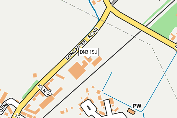
DN3 1SU is located in the Stainforth & Barnby Dun electoral ward, within the metropolitan district of Doncaster and the English Parliamentary constituency of Doncaster Central. The Sub Integrated Care Board (ICB) Location is NHS South Yorkshire ICB - 02X and the police force is South Yorkshire. This postcode has been in use since March 2012.


GetTheData
Source: OS OpenMap – Local (Ordnance Survey)
Source: OS VectorMap District (Ordnance Survey)
Licence: Open Government Licence (requires attribution)
| Easting | 461957 |
| Northing | 408370 |
| Latitude | 53.568310 |
| Longitude | -1.065951 |
GetTheData
Source: Open Postcode Geo
Licence: Open Government Licence
| Country | England |
| Postcode District | DN3 |
| ➜ DN3 open data dashboard ➜ See where DN3 is on a map ➜ Where is Kirk Sandall? | |
GetTheData
Source: Land Registry Price Paid Data
Licence: Open Government Licence
Elevation or altitude of DN3 1SU as distance above sea level:
| Metres | Feet | |
|---|---|---|
| Elevation | 10m | 33ft |
Elevation is measured from the approximate centre of the postcode, to the nearest point on an OS contour line from OS Terrain 50, which has contour spacing of ten vertical metres.
➜ How high above sea level am I? Find the elevation of your current position using your device's GPS.
GetTheData
Source: Open Postcode Elevation
Licence: Open Government Licence
| Ward | Stainforth & Barnby Dun |
| Constituency | Doncaster Central |
GetTheData
Source: ONS Postcode Database
Licence: Open Government Licence
| January 2024 | Anti-social behaviour | On or near Trent Gardens | 350m |
| January 2024 | Vehicle crime | On or near Trent Gardens | 350m |
| October 2023 | Violence and sexual offences | On or near Trent Gardens | 350m |
| ➜ Get more crime data in our Crime section | |||
GetTheData
Source: data.police.uk
Licence: Open Government Licence
| Cricket Ground (Doncaster Road) | Kirk Sandall | 136m |
| Pine Hall Road (Station Road) | Barnby Dun | 264m |
| Pine Hall Road (Station Road) | Barnby Dun | 306m |
| Telephone Exchange (Armthorpe Lane) | Kirk Sandall | 388m |
| Doncaster Golf Range (Armthorpe Lane) | Kirk Sandall | 396m |
| Kirk Sandall Station | 0.7km |
| Hatfield & Stainforth Station | 3.6km |
GetTheData
Source: NaPTAN
Licence: Open Government Licence
GetTheData
Source: ONS Postcode Database
Licence: Open Government Licence


➜ Get more ratings from the Food Standards Agency
GetTheData
Source: Food Standards Agency
Licence: FSA terms & conditions
| Last Collection | |||
|---|---|---|---|
| Location | Mon-Fri | Sat | Distance |
| Lancaster Avenue | 16:15 | 11:00 | 204m |
| Station Road | 16:45 | 11:00 | 224m |
| Hesketh Drive | 16:45 | 11:00 | 568m |
GetTheData
Source: Dracos
Licence: Creative Commons Attribution-ShareAlike
| Facility | Distance |
|---|---|
| Barnby Dun And Kirk Sandall Sports Association Doncaster Road, Kirk Sandall, Doncaster Grass Pitches | 221m |
| Doncaster Golf Range Ltd Armthorpe Lane, Barnby Dun, Doncaster Golf | 487m |
| Kirk Sandall Junior School Magnolia Close, Kirk Sandall, Doncaster Grass Pitches | 1km |
GetTheData
Source: Active Places
Licence: Open Government Licence
| School | Phase of Education | Distance |
|---|---|---|
| Kirk Sandall Junior School Magnolia Close, Kirk Sandall, Doncaster, DN3 1JG | Primary | 1km |
| Kirk Sandall Infant School Queen Mary Crescent, Kirk Sandall, Doncaster, DN3 1JT | Primary | 1km |
| Barnby Dun Primary Academy Church Road, Barnby Dun, Doncaster, DN3 1BG | Primary | 1.1km |
GetTheData
Source: Edubase
Licence: Open Government Licence
| Risk of DN3 1SU flooding from rivers and sea | Low |
| ➜ DN3 1SU flood map | |
GetTheData
Source: Open Flood Risk by Postcode
Licence: Open Government Licence
The below table lists the International Territorial Level (ITL) codes (formerly Nomenclature of Territorial Units for Statistics (NUTS) codes) and Local Administrative Units (LAU) codes for DN3 1SU:
| ITL 1 Code | Name |
|---|---|
| TLE | Yorkshire and The Humber |
| ITL 2 Code | Name |
| TLE3 | South Yorkshire |
| ITL 3 Code | Name |
| TLE31 | Barnsley, Doncaster and Rotherham |
| LAU 1 Code | Name |
| E08000017 | Doncaster |
GetTheData
Source: ONS Postcode Directory
Licence: Open Government Licence
The below table lists the Census Output Area (OA), Lower Layer Super Output Area (LSOA), and Middle Layer Super Output Area (MSOA) for DN3 1SU:
| Code | Name | |
|---|---|---|
| OA | E00038636 | |
| LSOA | E01007621 | Doncaster 007A |
| MSOA | E02001545 | Doncaster 007 |
GetTheData
Source: ONS Postcode Directory
Licence: Open Government Licence
| DN3 1HQ | Station Road | 47m |
| DN3 1NT | Thorold Place | 150m |
| DN3 1NS | Rainford Square | 152m |
| DN3 1ST | Kiln Court | 217m |
| DN3 1NU | Thorold Place | 218m |
| DN3 1HG | Station Road | 254m |
| DN3 1HB | Station Road | 276m |
| DN3 1BU | Earlswood Court | 302m |
| DN3 1NB | Armthorpe Lane | 311m |
| DN3 1HF | Fairview Terrace | 313m |
GetTheData
Source: Open Postcode Geo; Land Registry Price Paid Data
Licence: Open Government Licence