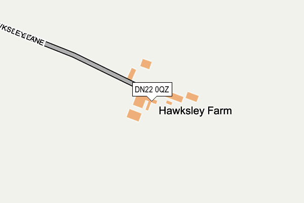
DN22 0QZ is located in the East Markham electoral ward, within the local authority district of Bassetlaw and the English Parliamentary constituency of Newark. The Sub Integrated Care Board (ICB) Location is NHS Nottingham and Nottinghamshire ICB - 02Q and the police force is Nottinghamshire. This postcode has been in use since January 1980.


GetTheData
Source: OS OpenMap – Local (Ordnance Survey)
Source: OS VectorMap District (Ordnance Survey)
Licence: Open Government Licence (requires attribution)
| Easting | 475000 |
| Northing | 375358 |
| Latitude | 53.269940 |
| Longitude | -0.876883 |
GetTheData
Source: Open Postcode Geo
Licence: Open Government Licence
| Country | England |
| Postcode District | DN22 |
| ➜ DN22 open data dashboard ➜ See where DN22 is on a map | |
GetTheData
Source: Land Registry Price Paid Data
Licence: Open Government Licence
Elevation or altitude of DN22 0QZ as distance above sea level:
| Metres | Feet | |
|---|---|---|
| Elevation | 40m | 131ft |
Elevation is measured from the approximate centre of the postcode, to the nearest point on an OS contour line from OS Terrain 50, which has contour spacing of ten vertical metres.
➜ How high above sea level am I? Find the elevation of your current position using your device's GPS.
GetTheData
Source: Open Postcode Elevation
Licence: Open Government Licence
| Ward | East Markham |
| Constituency | Newark |
GetTheData
Source: ONS Postcode Database
Licence: Open Government Licence
| Town Street | Askham | 1,032m |
| Town Street | Askham | 1,044m |
| Askham Lane (Main Street) | Upton | 1,059m |
| Askham Lane (Main Street) | Upton | 1,069m |
| Thorpe Street | Headon | 1,503m |
| Retford Low Level Station | 6.7km |
| Retford Station | 6.9km |
GetTheData
Source: NaPTAN
Licence: Open Government Licence
| Percentage of properties with Next Generation Access | 100.0% |
| Percentage of properties with Superfast Broadband | 0.0% |
| Percentage of properties with Ultrafast Broadband | 0.0% |
| Percentage of properties with Full Fibre Broadband | 0.0% |
Superfast Broadband is between 30Mbps and 300Mbps
Ultrafast Broadband is > 300Mbps
| Percentage of properties unable to receive 2Mbps | 0.0% |
| Percentage of properties unable to receive 5Mbps | 0.0% |
| Percentage of properties unable to receive 10Mbps | 0.0% |
| Percentage of properties unable to receive 30Mbps | 100.0% |
GetTheData
Source: Ofcom
Licence: Ofcom Terms of Use (requires attribution)
GetTheData
Source: ONS Postcode Database
Licence: Open Government Licence


➜ Get more ratings from the Food Standards Agency
GetTheData
Source: Food Standards Agency
Licence: FSA terms & conditions
| Last Collection | |||
|---|---|---|---|
| Location | Mon-Fri | Sat | Distance |
| Upton | 16:00 | 08:45 | 924m |
| Headon | 16:00 | 08:00 | 1,690m |
| East Drayton P.o. | 16:15 | 11:15 | 2,621m |
GetTheData
Source: Dracos
Licence: Creative Commons Attribution-ShareAlike
| Facility | Distance |
|---|---|
| Rayners Field Back Lane, East Markham, Newark Grass Pitches | 2.5km |
| Rampton Secure Hospital St Lukes Way, Retford Grass Pitches, Health and Fitness Gym, Sports Hall, Swimming Pool | 3.4km |
| East Drayton Sports Club East Drayton, Retford Grass Pitches | 3.6km |
GetTheData
Source: Active Places
Licence: Open Government Licence
| School | Phase of Education | Distance |
|---|---|---|
| East Markham Primary School Askham Road, East Markham, Newark, NG22 0RG | Primary | 2.2km |
| Gamston St Peter's CofE Primary School Gamston, Retford, DN22 0PE | Primary | 3.9km |
| Tuxford Academy Marnham Road, Tuxford, Newark, NG22 0JH | Secondary | 4.2km |
GetTheData
Source: Edubase
Licence: Open Government Licence
The below table lists the International Territorial Level (ITL) codes (formerly Nomenclature of Territorial Units for Statistics (NUTS) codes) and Local Administrative Units (LAU) codes for DN22 0QZ:
| ITL 1 Code | Name |
|---|---|
| TLF | East Midlands (England) |
| ITL 2 Code | Name |
| TLF1 | Derbyshire and Nottinghamshire |
| ITL 3 Code | Name |
| TLF15 | North Nottinghamshire |
| LAU 1 Code | Name |
| E07000171 | Bassetlaw |
GetTheData
Source: ONS Postcode Directory
Licence: Open Government Licence
The below table lists the Census Output Area (OA), Lower Layer Super Output Area (LSOA), and Middle Layer Super Output Area (MSOA) for DN22 0QZ:
| Code | Name | |
|---|---|---|
| OA | E00142694 | |
| LSOA | E01028006 | Bassetlaw 015A |
| MSOA | E02005849 | Bassetlaw 015 |
GetTheData
Source: ONS Postcode Directory
Licence: Open Government Licence
| DN22 0RA | 931m | |
| NG22 0RS | Town Street | 1017m |
| NG22 0RU | Church Lane | 1152m |
| NG22 0RW | South Croft | 1170m |
| NG22 0RP | Top Street | 1271m |
| NG22 0RR | Top Street | 1544m |
| NG22 0RH | The Sidings | 1647m |
| NG22 0SN | Lincoln Road | 1662m |
| DN22 0RD | 1786m | |
| NG22 0RG | Askham Road | 2163m |
GetTheData
Source: Open Postcode Geo; Land Registry Price Paid Data
Licence: Open Government Licence