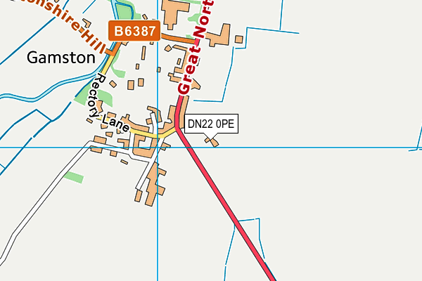
Gamston St Peter's CofE Primary School is located in Retford and falls under the local authority of Nottinghamshire. The school's religious denomination is Church of England. This mixed-sex primary school has a capacity of 105 pupils, aged from three up to eleven, and the type of establishment is academy converter.
| Address | Gamston St Peter's CofE Primary School Gamston Retford Nottinghamshire DN22 0PE |
| Website | http://www.gamstonschool.co.uk |
| Headteacher | Mr Chris Edwards |
GetTheData
Source: Get Information About Schools
Licence: Open Government Licence
| Phase of Education | Primary |
| Type of Establishment | Academy converter |
| Admissions Policy | Not applicable |
| Statutory Low Age | 3 |
| Statutory High Age | 11 |
| Boarders | No boarders |
| Official Sixth Form | Does not have a sixth form |
| Gender | Mixed |
| Religious Character | Church of England |
| Diocese | Diocese of Southwell |
| Special Classes | No Special Classes |
GetTheData
Source: Get Information About Schools
Licence: Open Government Licence
| School Capacity | 105 |
GetTheData
Source: Get Information About Schools
Licence: Open Government Licence
| Street Address | Gamston |
| Town | Retford |
| County | Nottinghamshire |
| Postcode | DN22 0PE |
| ➜ More DN22 0PE open data | |
GetTheData
Source: Get Information About Schools
Licence: Open Government Licence

GetTheData
Source: OS VectorMap District (Ordnance Survey)
Licence: Open Government Licence (requires attribution)
| Ofsted Special Measures | Not applicable |
GetTheData
Source: Get Information About Schools
Licence: Open Government Licence
| Establishment Name | Gamston St Peter's CofE Primary School |
| Establishment Number | 3546 |
| Previous Establishment Number | 3546 |
| Unique Reference Number | 149603 |
| Local Authority | Nottinghamshire |
| Local Authority Code | 891 |
| Previous Local Authority | Pre LGR (1998) Nottinghamshire |
| Previous Local Authority Code | 930 |
| Government Statistical Service Local Authority Code | E10000024 |
| Government Office Region | East Midlands |
| District | Bassetlaw |
| District Code | E07000171 |
| Ward | East Markham |
| Parliamentary Constituency | Newark |
| Urban/Rural Description | (England/Wales) Rural village |
| Middle Super Output Area | Bassetlaw 015 |
| Lower Super Output Area | Bassetlaw 015A |
GetTheData
Source: Get Information About Schools
Licence: Open Government Licence
| Establishment Status | Open |
| Last Changed Date | 12th December 2023 |
| Reason Establishment Opened | Academy Converter |
| Open Date | 1st March 2023 |
GetTheData
Source: Get Information About Schools
Licence: Open Government Licence
| Teenage Mothers | Not applicable |
| Child Care Facilities | Not applicable |
| Special Educational Needs (SEN) Provision in Primary Care Unit | Not applicable |
| Pupil Referral Unit (PRU) Provides for Educational and Behavioural Difficulties (EBD) | Not applicable |
| Pupil Referral Unit (PRU) Provides for Full Time Provision | Not applicable |
| Pupil Referral Unit (PRU) Offers Tuition by Another Provider | Not applicable |
GetTheData
Source: Get Information About Schools
Licence: Open Government Licence
| Section 41 Approved | Not applicable |
GetTheData
Source: Get Information About Schools
Licence: Open Government Licence
| Trust flag | Supported by a multi-academy trust |
| Trust | DIOCESE OF SOUTHWELL AND NOTTINGHAM MULTI-ACADEMY TRUST |
| School Sponsor flag | Linked to a sponsor |
| School Sponsor | Diocese Of Southwell and Nottingham Multi-Academy Trust |
GetTheData
Source: Get Information About Schools
Licence: Open Government Licence
| Federation flag | Not applicable |
GetTheData
Source: Get Information About Schools
Licence: Open Government Licence
| UK Provider Reference Number | 10092133 |
GetTheData
Source: Get Information About Schools
Licence: Open Government Licence
| Easting | 471193 |
| Northing | 376022 |
| Latitude | 53.27641 |
| Longitude | -0.93381 |
GetTheData
Source: Get Information About Schools
Licence: Open Government Licence
| School | Phase of Education | Distance |
|---|---|---|
| Elkesley Primary and Nursery School Headland Avenue, Elkesley, Retford, DN22 8AQ | Primary | 2.8km |
| East Markham Primary School Askham Road, East Markham, Newark, NG22 0RG | Primary | 3.8km |
| Thrumpton Primary Academy Thrumpton Close, Retford, DN22 7AQ | Primary | 3.9km |
| Ordsall Primary School Ordsall Road, Retford, DN22 7SL | Primary | 4km |
| Bracken Lane Primary Academy Bracken Lane, Retford, DN22 7EU | Primary | 4.1km |
| St Swithun's Church of England Primary Academy Grove Street, Retford, DN22 6LD | Primary | 5.1km |
| St Giles School Babworth Road, Retford, DN22 7NJ | Not applicable | 5.2km |
| Retford Oaks Academy Babworth Road, Retford, DN22 7NJ | Secondary | 5.2km |
| St. Joseph's Catholic Primary School, a Voluntary Academy Babworth Road, Retford, DN22 7BP | Primary | 5.3km |
| Tuxford Primary Academy Newark Road, Tuxford, Newark, NG22 0NA | Primary | 5.8km |
GetTheData
Source: Get Information About Schools
Licence: Open Government Licence