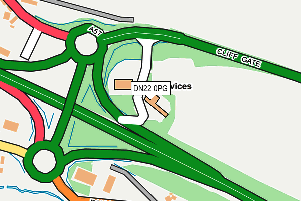
DN22 0PG is located in the East Markham electoral ward, within the local authority district of Bassetlaw and the English Parliamentary constituency of Newark. The Sub Integrated Care Board (ICB) Location is NHS Nottingham and Nottinghamshire ICB - 02Q and the police force is Nottinghamshire. This postcode has been in use since January 1991.


GetTheData
Source: OS OpenMap – Local (Ordnance Survey)
Source: OS VectorMap District (Ordnance Survey)
Licence: Open Government Licence (requires attribution)
| Easting | 472104 |
| Northing | 373683 |
| Latitude | 53.255266 |
| Longitude | -0.920679 |
GetTheData
Source: Open Postcode Geo
Licence: Open Government Licence
| Country | England |
| Postcode District | DN22 |
| ➜ DN22 open data dashboard ➜ See where DN22 is on a map ➜ Where is Markham Moor? | |
GetTheData
Source: Land Registry Price Paid Data
Licence: Open Government Licence
Elevation or altitude of DN22 0PG as distance above sea level:
| Metres | Feet | |
|---|---|---|
| Elevation | 30m | 98ft |
Elevation is measured from the approximate centre of the postcode, to the nearest point on an OS contour line from OS Terrain 50, which has contour spacing of ten vertical metres.
➜ How high above sea level am I? Find the elevation of your current position using your device's GPS.
GetTheData
Source: Open Postcode Elevation
Licence: Open Government Licence
| Ward | East Markham |
| Constituency | Newark |
GetTheData
Source: ONS Postcode Database
Licence: Open Government Licence
| June 2022 | Vehicle crime | On or near A57 | 213m |
| June 2022 | Vehicle crime | On or near Petrol Station | 349m |
| June 2022 | Criminal damage and arson | On or near Petrol Station | 349m |
| ➜ Get more crime data in our Crime section | |||
GetTheData
Source: data.police.uk
Licence: Open Government Licence
| Mussel And Crab (Great North Road) | Sibthorpe | 402m |
| Great North Road | Markham Moor | 429m |
| Mussel And Crab (Great North Road) | Sibthorpe | 429m |
| Great North Road (Old London Road) | Markham Moor | 558m |
| Great North Road | Markham Moor | 567m |
GetTheData
Source: NaPTAN
Licence: Open Government Licence
GetTheData
Source: ONS Postcode Database
Licence: Open Government Licence


➜ Get more ratings from the Food Standards Agency
GetTheData
Source: Food Standards Agency
Licence: FSA terms & conditions
| Last Collection | |||
|---|---|---|---|
| Location | Mon-Fri | Sat | Distance |
| Sibthorpe Hill | 16:00 | 10:30 | 287m |
| Markham Moor | 16:00 | 08:45 | 422m |
| Milton | 16:00 | 11:00 | 943m |
GetTheData
Source: Dracos
Licence: Creative Commons Attribution-ShareAlike
| Facility | Distance |
|---|---|
| Ernie Wass Sports Ground (Closed) Bevercotes, Retford Grass Pitches | 2.4km |
| Gamston C Of E Primary School Stanboard Lane, Gamston, Retford Grass Pitches | 2.5km |
| Rayners Field Back Lane, East Markham, Newark Grass Pitches | 2.7km |
GetTheData
Source: Active Places
Licence: Open Government Licence
| School | Phase of Education | Distance |
|---|---|---|
| East Markham Primary School Askham Road, East Markham, Newark, NG22 0RG | Primary | 1.9km |
| Gamston St Peter's CofE Primary School Gamston, Retford, DN22 0PE | Primary | 2.5km |
| Tuxford Primary Academy Newark Road, Tuxford, Newark, NG22 0NA | Primary | 3.3km |
GetTheData
Source: Edubase
Licence: Open Government Licence
The below table lists the International Territorial Level (ITL) codes (formerly Nomenclature of Territorial Units for Statistics (NUTS) codes) and Local Administrative Units (LAU) codes for DN22 0PG:
| ITL 1 Code | Name |
|---|---|
| TLF | East Midlands (England) |
| ITL 2 Code | Name |
| TLF1 | Derbyshire and Nottinghamshire |
| ITL 3 Code | Name |
| TLF15 | North Nottinghamshire |
| LAU 1 Code | Name |
| E07000171 | Bassetlaw |
GetTheData
Source: ONS Postcode Directory
Licence: Open Government Licence
The below table lists the Census Output Area (OA), Lower Layer Super Output Area (LSOA), and Middle Layer Super Output Area (MSOA) for DN22 0PG:
| Code | Name | |
|---|---|---|
| OA | E00142697 | |
| LSOA | E01028007 | Bassetlaw 015B |
| MSOA | E02005849 | Bassetlaw 015 |
GetTheData
Source: ONS Postcode Directory
Licence: Open Government Licence
| NG22 0PJ | Sibthorpe Hill | 328m |
| DN22 0QU | 333m | |
| DN22 0QT | 767m | |
| NG22 0PH | Cleveland Hill | 799m |
| NG22 0PP | Main Street | 879m |
| DN22 0QS | Great North Road | 890m |
| DN22 0QR | 899m | |
| NG22 0PW | The Avenue | 971m |
| NG22 0PN | 979m | |
| DN22 0QY | Holme Lane | 1015m |
GetTheData
Source: Open Postcode Geo; Land Registry Price Paid Data
Licence: Open Government Licence