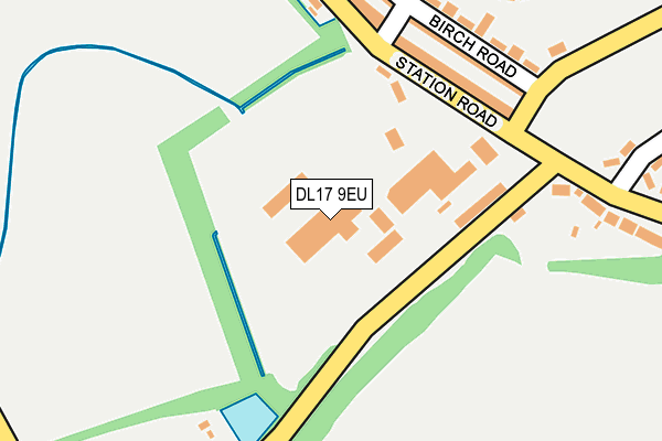
DL17 9EU is located in the Bishop Middleham and Cornforth electoral ward, within the unitary authority of County Durham and the English Parliamentary constituency of Sedgefield. The Sub Integrated Care Board (ICB) Location is NHS North East and North Cumbria ICB - 84H and the police force is Durham. This postcode has been in use since January 1980.


GetTheData
Source: OS OpenMap – Local (Ordnance Survey)
Source: OS VectorMap District (Ordnance Survey)
Licence: Open Government Licence (requires attribution)
| Easting | 430928 |
| Northing | 533820 |
| Latitude | 54.698467 |
| Longitude | -1.521636 |
GetTheData
Source: Open Postcode Geo
Licence: Open Government Licence
| Country | England |
| Postcode District | DL17 |
| ➜ DL17 open data dashboard ➜ See where DL17 is on a map ➜ Where is Cornforth? | |
GetTheData
Source: Land Registry Price Paid Data
Licence: Open Government Licence
Elevation or altitude of DL17 9EU as distance above sea level:
| Metres | Feet | |
|---|---|---|
| Elevation | 130m | 427ft |
Elevation is measured from the approximate centre of the postcode, to the nearest point on an OS contour line from OS Terrain 50, which has contour spacing of ten vertical metres.
➜ How high above sea level am I? Find the elevation of your current position using your device's GPS.
GetTheData
Source: Open Postcode Elevation
Licence: Open Government Licence
| Ward | Bishop Middleham And Cornforth |
| Constituency | Sedgefield |
GetTheData
Source: ONS Postcode Database
Licence: Open Government Licence
| June 2022 | Violence and sexual offences | On or near Birch Road | 203m |
| June 2022 | Violence and sexual offences | On or near Birch Road | 203m |
| June 2022 | Violence and sexual offences | On or near Birch Road | 203m |
| ➜ Get more crime data in our Crime section | |||
GetTheData
Source: data.police.uk
Licence: Open Government Licence
| Villas (Unclassifed Road Cornforth To Bypass) | Stobb Cross | 149m |
| Villas (Unclassified Road Cornforth To Bypass) | Stobb Cross | 162m |
| Villas (Station Road) | Stobb Cross | 171m |
| Villas (Stobb Cross Road) | Stobb Cross | 237m |
| Library (Station Road) | West Cornforth | 357m |
GetTheData
Source: NaPTAN
Licence: Open Government Licence
GetTheData
Source: ONS Postcode Database
Licence: Open Government Licence


➜ Get more ratings from the Food Standards Agency
GetTheData
Source: Food Standards Agency
Licence: FSA terms & conditions
| Last Collection | |||
|---|---|---|---|
| Location | Mon-Fri | Sat | Distance |
| East Howle | 16:15 | 10:30 | 1,302m |
| Thinford Street, Metal Bridge | 16:00 | 09:00 | 1,515m |
| Bogma Avenue, Coxhoe | 16:45 | 09:00 | 1,583m |
GetTheData
Source: Dracos
Licence: Creative Commons Attribution-ShareAlike
| Facility | Distance |
|---|---|
| West Cornforth Community Centre Station Road, West Cornforth, Ferryhill Sports Hall, Grass Pitches | 439m |
| West Cornforth Primary School High Street, West Cornforth, Ferryhill Grass Pitches | 509m |
| Coxhoe Primary School Cornforth Lane, Coxhoe, Durham Grass Pitches | 1.6km |
GetTheData
Source: Active Places
Licence: Open Government Licence
| School | Phase of Education | Distance |
|---|---|---|
| West Cornforth Primary School High Street, West Cornforth, Ferryhill, DL17 9HP | Primary | 545m |
| Cleves Cross Primary and Nursery School Academy Cleves Cross, Ferryhill, DL17 8QY | Primary | 1.5km |
| Coxhoe Primary School Cornforth Lane, Coxhoe, Durham, DH6 4EJ | Primary | 1.6km |
GetTheData
Source: Edubase
Licence: Open Government Licence
The below table lists the International Territorial Level (ITL) codes (formerly Nomenclature of Territorial Units for Statistics (NUTS) codes) and Local Administrative Units (LAU) codes for DL17 9EU:
| ITL 1 Code | Name |
|---|---|
| TLC | North East (England) |
| ITL 2 Code | Name |
| TLC1 | Tees Valley and Durham |
| ITL 3 Code | Name |
| TLC14 | Durham |
| LAU 1 Code | Name |
| E06000047 | County Durham |
GetTheData
Source: ONS Postcode Directory
Licence: Open Government Licence
The below table lists the Census Output Area (OA), Lower Layer Super Output Area (LSOA), and Middle Layer Super Output Area (MSOA) for DL17 9EU:
| Code | Name | |
|---|---|---|
| OA | E00105534 | |
| LSOA | E01020797 | County Durham 050A |
| MSOA | E02004336 | County Durham 050 |
GetTheData
Source: ONS Postcode Directory
Licence: Open Government Licence
| DL17 9EL | Poplar Terrace | 173m |
| DL17 9EP | Hawthorne Terrace | 193m |
| DL17 9ES | Poplar Terrace | 195m |
| DL17 9NG | Cedar Terrace | 217m |
| DL17 9EZ | Stobbcross Villas | 257m |
| DL17 9NQ | Cedar Villas | 259m |
| DL17 9EW | Birch Road | 299m |
| DL17 9NJ | Laburnum Road | 304m |
| DL17 9ER | Sycamore Road | 317m |
| DL17 9EN | Maple Grove | 326m |
GetTheData
Source: Open Postcode Geo; Land Registry Price Paid Data
Licence: Open Government Licence