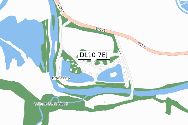
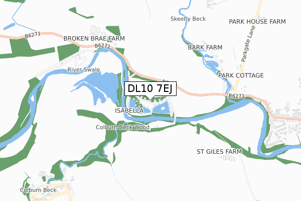
DL10 7EJ is located in the Catterick Village & Brompton-on-Swale electoral ward, within the unitary authority of North Yorkshire and the English Parliamentary constituency of Richmond (Yorks). The Sub Integrated Care Board (ICB) Location is NHS Humber and North Yorkshire ICB - 42D and the police force is North Yorkshire. This postcode has been in use since January 2008.


GetTheData
Source: OS Open Zoomstack (Ordnance Survey)
Licence: Open Government Licence (requires attribution)
Attribution: Contains OS data © Crown copyright and database right 2024
Source: Open Postcode Geo
Licence: Open Government Licence (requires attribution)
Attribution: Contains OS data © Crown copyright and database right 2024; Contains Royal Mail data © Royal Mail copyright and database right 2024; Source: Office for National Statistics licensed under the Open Government Licence v.3.0
| Easting | 420531 |
| Northing | 499847 |
| Latitude | 54.393701 |
| Longitude | -1.685318 |
GetTheData
Source: Open Postcode Geo
Licence: Open Government Licence
| Country | England |
| Postcode District | DL10 |
| ➜ DL10 open data dashboard ➜ See where DL10 is on a map | |
GetTheData
Source: Land Registry Price Paid Data
Licence: Open Government Licence
Elevation or altitude of DL10 7EJ as distance above sea level:
| Metres | Feet | |
|---|---|---|
| Elevation | 70m | 230ft |
Elevation is measured from the approximate centre of the postcode, to the nearest point on an OS contour line from OS Terrain 50, which has contour spacing of ten vertical metres.
➜ How high above sea level am I? Find the elevation of your current position using your device's GPS.
GetTheData
Source: Open Postcode Elevation
Licence: Open Government Licence
| Ward | Catterick Village & Brompton-on-swale |
| Constituency | Richmond (Yorks) |
GetTheData
Source: ONS Postcode Database
Licence: Open Government Licence
| River Lane (B6271) | Brompton-on-swale | 1,128m |
| River Lane (B6271) | Brompton-on-swale | 1,147m |
| Forest Drive | Colburn | 1,150m |
| Bramble Close (Forest Drive) | Colburn | 1,184m |
| Coronation Avenue | Colburn | 1,371m |
GetTheData
Source: NaPTAN
Licence: Open Government Licence
GetTheData
Source: ONS Postcode Database
Licence: Open Government Licence


➜ Get more ratings from the Food Standards Agency
GetTheData
Source: Food Standards Agency
Licence: FSA terms & conditions
| Last Collection | |||
|---|---|---|---|
| Location | Mon-Fri | Sat | Distance |
| Vimy Barracks, Catterick Garris | 17:00 | 11:15 | 1,553m |
| Bridge Road, Brompton On Swale | 17:00 | 11:30 | 1,556m |
| Easby | 17:00 | 11:30 | 1,904m |
GetTheData
Source: Dracos
Licence: Creative Commons Attribution-ShareAlike
| Facility | Distance |
|---|---|
| Brompton On Swale Ce Primary School Brompton Park, Brompton On Swale, Richmond Grass Pitches | 1.3km |
| Colburn Leisure Centre Catterick Road, Colburn, Catterick Garrison Health and Fitness Gym, Sports Hall, Grass Pitches | 1.4km |
| Colburn Community Primary School Colburn Lane, Catterick Garrison Grass Pitches | 1.6km |
GetTheData
Source: Active Places
Licence: Open Government Licence
| School | Phase of Education | Distance |
|---|---|---|
| Brompton-on-Swale Church of England Primary School Brompton Park, Brompton-on-Swale, Richmond, DL10 7JW | Primary | 1.3km |
| Colburn Community Primary School Colburn Lane, Colburn, Catterick Garrison, DL9 4LS | Primary | 1.6km |
| Hipswell Church of England Primary School Hipswell, Catterick Garrison, DL9 4BB | Primary | 2.5km |
GetTheData
Source: Edubase
Licence: Open Government Licence
| Risk of DL10 7EJ flooding from rivers and sea | High |
| ➜ DL10 7EJ flood map | |
GetTheData
Source: Open Flood Risk by Postcode
Licence: Open Government Licence
The below table lists the International Territorial Level (ITL) codes (formerly Nomenclature of Territorial Units for Statistics (NUTS) codes) and Local Administrative Units (LAU) codes for DL10 7EJ:
| ITL 1 Code | Name |
|---|---|
| TLE | Yorkshire and The Humber |
| ITL 2 Code | Name |
| TLE2 | North Yorkshire |
| ITL 3 Code | Name |
| TLE22 | North Yorkshire CC |
| LAU 1 Code | Name |
| E07000166 | Richmondshire |
GetTheData
Source: ONS Postcode Directory
Licence: Open Government Licence
The below table lists the Census Output Area (OA), Lower Layer Super Output Area (LSOA), and Middle Layer Super Output Area (MSOA) for DL10 7EJ:
| Code | Name | |
|---|---|---|
| OA | E00141296 | |
| LSOA | E01027745 | Richmondshire 003A |
| MSOA | E02005784 | Richmondshire 003 |
GetTheData
Source: ONS Postcode Directory
Licence: Open Government Licence
| DL10 7HA | Parkgate Lane | 638m |
| DL10 7PH | 708m | |
| DL9 4PE | 1052m | |
| DL10 7HQ | St Pauls Drive | 1079m |
| DL9 4PG | Bridge Close | 1111m |
| DL10 7HG | St Pauls Close | 1116m |
| DL9 4TT | Daisy Close | 1128m |
| DL9 4XX | Hawkins Drive | 1130m |
| DL9 4PD | 1131m | |
| DL10 7HE | Richmond Road | 1138m |
GetTheData
Source: Open Postcode Geo; Land Registry Price Paid Data
Licence: Open Government Licence