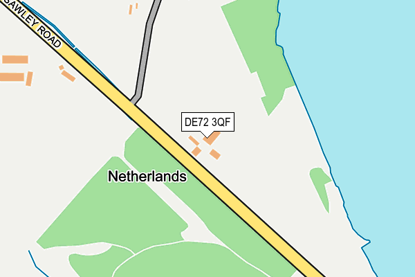
DE72 3QF lies on Sawley Road in Draycott, Derby. DE72 3QF is located in the Breaston electoral ward, within the local authority district of Erewash and the English Parliamentary constituency of Erewash. The Sub Integrated Care Board (ICB) Location is NHS Derby and Derbyshire ICB - 15M and the police force is Derbyshire. This postcode has been in use since August 1992.


GetTheData
Source: OS OpenMap – Local (Ordnance Survey)
Source: OS VectorMap District (Ordnance Survey)
Licence: Open Government Licence (requires attribution)
| Easting | 445426 |
| Northing | 332637 |
| Latitude | 52.889276 |
| Longitude | -1.326301 |
GetTheData
Source: Open Postcode Geo
Licence: Open Government Licence
| Street | Sawley Road |
| Locality | Draycott |
| Town/City | Derby |
| Country | England |
| Postcode District | DE72 |
| ➜ DE72 open data dashboard ➜ See where DE72 is on a map | |
GetTheData
Source: Land Registry Price Paid Data
Licence: Open Government Licence
Elevation or altitude of DE72 3QF as distance above sea level:
| Metres | Feet | |
|---|---|---|
| Elevation | 40m | 131ft |
Elevation is measured from the approximate centre of the postcode, to the nearest point on an OS contour line from OS Terrain 50, which has contour spacing of ten vertical metres.
➜ How high above sea level am I? Find the elevation of your current position using your device's GPS.
GetTheData
Source: Open Postcode Elevation
Licence: Open Government Licence
| Ward | Breaston |
| Constituency | Erewash |
GetTheData
Source: ONS Postcode Database
Licence: Open Government Licence
| The Crescent (Draycott Road) | Breaston | 774m |
| The Crescent (Draycott Road) | Breaston | 785m |
| Hills Road (Draycott Road) | Breaston | 802m |
| Hills Road (Draycott Road) | Breaston | 811m |
| Old Station (Station Road) | Draycott | 875m |
| Long Eaton Station | 2.7km |
| East Midlands Parkway Station | 5.2km |
GetTheData
Source: NaPTAN
Licence: Open Government Licence
➜ Broadband speed and availability dashboard for DE72 3QF
| Percentage of properties with Next Generation Access | 100.0% |
| Percentage of properties with Superfast Broadband | 28.6% |
| Percentage of properties with Ultrafast Broadband | 0.0% |
| Percentage of properties with Full Fibre Broadband | 0.0% |
Superfast Broadband is between 30Mbps and 300Mbps
Ultrafast Broadband is > 300Mbps
| Median download speed | 27.4Mbps |
| Average download speed | 25.1Mbps |
| Maximum download speed | 39.96Mbps |
| Median upload speed | 1.8Mbps |
| Average upload speed | 3.3Mbps |
| Maximum upload speed | 7.19Mbps |
| Percentage of properties unable to receive 2Mbps | 0.0% |
| Percentage of properties unable to receive 5Mbps | 0.0% |
| Percentage of properties unable to receive 10Mbps | 0.0% |
| Percentage of properties unable to receive 30Mbps | 71.4% |
➜ Broadband speed and availability dashboard for DE72 3QF
GetTheData
Source: Ofcom
Licence: Ofcom Terms of Use (requires attribution)
GetTheData
Source: ONS Postcode Database
Licence: Open Government Licence


➜ Get more ratings from the Food Standards Agency
GetTheData
Source: Food Standards Agency
Licence: FSA terms & conditions
| Last Collection | |||
|---|---|---|---|
| Location | Mon-Fri | Sat | Distance |
| Draycott Road | 17:00 | 10:30 | 763m |
| Station Road | 17:00 | 10:30 | 915m |
| Breaston Post Office | 16:00 | 10:15 | 1,066m |
GetTheData
Source: Dracos
Licence: Creative Commons Attribution-ShareAlike
| Facility | Distance |
|---|---|
| Draycott Table Tennis Centre Derby Road, Draycott, Derby Sports Hall | 1.4km |
| Draycott Recreation Ground Hopwell Road, Draycott Grass Pitches | 1.5km |
| Breaston Park Longmoor Lane, Breaston Grass Pitches | 1.5km |
GetTheData
Source: Active Places
Licence: Open Government Licence
| School | Phase of Education | Distance |
|---|---|---|
| Ellern Mede Derby School 96 Draycott Road, Breaston, Derby, DE72 3DB | Not applicable | 825m |
| Firfield Primary School Firfield Avenue, Breaston, Derby, DE72 3EG | Primary | 1.1km |
| Draycott Community Primary School Hopwell Road, Draycott, Derby, DE72 3NH | Primary | 1.4km |
GetTheData
Source: Edubase
Licence: Open Government Licence
| Risk of DE72 3QF flooding from rivers and sea | Low |
| ➜ DE72 3QF flood map | |
GetTheData
Source: Open Flood Risk by Postcode
Licence: Open Government Licence
The below table lists the International Territorial Level (ITL) codes (formerly Nomenclature of Territorial Units for Statistics (NUTS) codes) and Local Administrative Units (LAU) codes for DE72 3QF:
| ITL 1 Code | Name |
|---|---|
| TLF | East Midlands (England) |
| ITL 2 Code | Name |
| TLF1 | Derbyshire and Nottinghamshire |
| ITL 3 Code | Name |
| TLF13 | South and West Derbyshire |
| LAU 1 Code | Name |
| E07000036 | Erewash |
GetTheData
Source: ONS Postcode Directory
Licence: Open Government Licence
The below table lists the Census Output Area (OA), Lower Layer Super Output Area (LSOA), and Middle Layer Super Output Area (MSOA) for DE72 3QF:
| Code | Name | |
|---|---|---|
| OA | E00099379 | |
| LSOA | E01019643 | Erewash 013B |
| MSOA | E02004090 | Erewash 013 |
GetTheData
Source: ONS Postcode Directory
Licence: Open Government Licence
| DE72 3UP | Belvoir Close | 661m |
| DE72 3DE | The Crescent | 716m |
| DE72 3DB | Draycott Road | 744m |
| DE72 3DD | Marlborough Road | 749m |
| DE72 3QH | Wilne Road | 783m |
| DE72 3QP | Attewell Close | 815m |
| DE72 3UT | Western Mere Close | 836m |
| DE72 3DH | Festival Avenue | 863m |
| DE72 3TZ | Millhouse Court | 866m |
| DE72 3DA | Draycott Road | 870m |
GetTheData
Source: Open Postcode Geo; Land Registry Price Paid Data
Licence: Open Government Licence