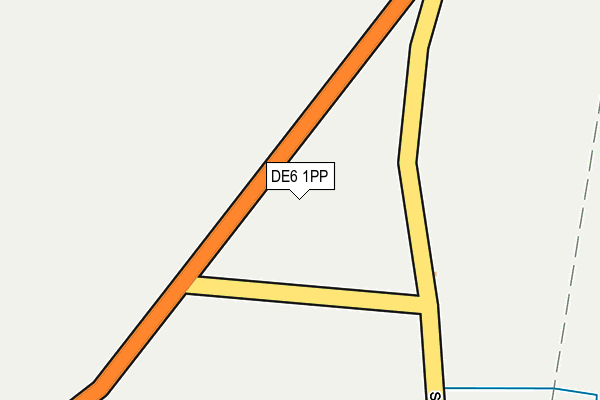
DE6 1PP is located in the Hulland electoral ward, within the local authority district of Derbyshire Dales and the English Parliamentary constituency of Derbyshire Dales. The Sub Integrated Care Board (ICB) Location is NHS Derby and Derbyshire ICB - 15M and the police force is Derbyshire. This postcode has been in use since September 2010.


GetTheData
Source: OS OpenMap – Local (Ordnance Survey)
Source: OS VectorMap District (Ordnance Survey)
Licence: Open Government Licence (requires attribution)
| Easting | 423014 |
| Northing | 351363 |
| Latitude | 53.059026 |
| Longitude | -1.658065 |
GetTheData
Source: Open Postcode Geo
Licence: Open Government Licence
| Country | England |
| Postcode District | DE6 |
| ➜ DE6 open data dashboard ➜ See where DE6 is on a map | |
GetTheData
Source: Land Registry Price Paid Data
Licence: Open Government Licence
Elevation or altitude of DE6 1PP as distance above sea level:
| Metres | Feet | |
|---|---|---|
| Elevation | 260m | 853ft |
Elevation is measured from the approximate centre of the postcode, to the nearest point on an OS contour line from OS Terrain 50, which has contour spacing of ten vertical metres.
➜ How high above sea level am I? Find the elevation of your current position using your device's GPS.
GetTheData
Source: Open Postcode Elevation
Licence: Open Government Licence
| Ward | Hulland |
| Constituency | Derbyshire Dales |
GetTheData
Source: ONS Postcode Database
Licence: Open Government Licence
| February 2022 | Other theft | On or near Big Lane | 460m |
| November 2021 | Possession of weapons | On or near Big Lane | 460m |
| October 2021 | Other theft | On or near Big Lane | 460m |
| ➜ Get more crime data in our Crime section | |||
GetTheData
Source: data.police.uk
Licence: Open Government Licence
| Church (Main Street) | Hognaston | 927m |
| Church (Main Street) | Hognaston | 1,005m |
| Visitor Centre (Car Park) | Carsington Water | 1,071m |
| Mills Croft (Main Street) | Hognaston | 1,095m |
GetTheData
Source: NaPTAN
Licence: Open Government Licence
GetTheData
Source: ONS Postcode Database
Licence: Open Government Licence


➜ Get more ratings from the Food Standards Agency
GetTheData
Source: Food Standards Agency
Licence: FSA terms & conditions
| Last Collection | |||
|---|---|---|---|
| Location | Mon-Fri | Sat | Distance |
| Red Lion | 16:00 | 10:00 | 869m |
| White House | 16:45 | 07:00 | 1,098m |
| Carsington Water | 16:00 | 07:45 | 1,151m |
GetTheData
Source: Dracos
Licence: Creative Commons Attribution-ShareAlike
| Facility | Distance |
|---|---|
| Kniveton Ce Primary School Kniveton, Ashbourne Grass Pitches | 2.2km |
| Brassington Primary School School Hill, Brassington, Matlock Grass Pitches | 2.9km |
| Hulland Ward Playing Field Ashes Avenue, Hulland Ward Grass Pitches | 4.7km |
GetTheData
Source: Active Places
Licence: Open Government Licence
| School | Phase of Education | Distance |
|---|---|---|
| Kniveton CofE Primary School Kniveton, Ashbourne, DE6 1JJ | Primary | 2.2km |
| Brassington Primary School School Hill, Brassington, Matlock, DE4 4HB | Primary | 2.9km |
| Carsington and Hopton Primary School Carsington, Matlock, DE4 4DE | Primary | 3km |
GetTheData
Source: Edubase
Licence: Open Government Licence
The below table lists the International Territorial Level (ITL) codes (formerly Nomenclature of Territorial Units for Statistics (NUTS) codes) and Local Administrative Units (LAU) codes for DE6 1PP:
| ITL 1 Code | Name |
|---|---|
| TLF | East Midlands (England) |
| ITL 2 Code | Name |
| TLF1 | Derbyshire and Nottinghamshire |
| ITL 3 Code | Name |
| TLF13 | South and West Derbyshire |
| LAU 1 Code | Name |
| E07000035 | Derbyshire Dales |
GetTheData
Source: ONS Postcode Directory
Licence: Open Government Licence
The below table lists the Census Output Area (OA), Lower Layer Super Output Area (LSOA), and Middle Layer Super Output Area (MSOA) for DE6 1PP:
| Code | Name | |
|---|---|---|
| OA | E00099167 | |
| LSOA | E01019605 | Derbyshire Dales 008B |
| MSOA | E02004075 | Derbyshire Dales 008 |
GetTheData
Source: ONS Postcode Directory
Licence: Open Government Licence
| DE6 1NQ | 609m | |
| DE6 1NR | Overtown | 648m |
| DE6 1PS | 788m | |
| DE6 1PR | 846m | |
| DE6 1PT | Mills Croft | 1111m |
| DE6 1PU | Main Street | 1183m |
| DE6 1PE | Old Bakery Close | 1223m |
| DE4 4DB | 1463m | |
| DE6 1PX | 1933m | |
| DE6 1QZ | Standlow Lane | 1985m |
GetTheData
Source: Open Postcode Geo; Land Registry Price Paid Data
Licence: Open Government Licence