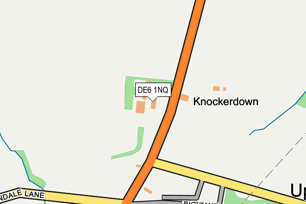
DE6 1NQ is in Knockerdown, Ashbourne. DE6 1NQ is located in the Dovedale, Parwich & Brassington electoral ward, within the local authority district of Derbyshire Dales and the English Parliamentary constituency of Derbyshire Dales. The Sub Integrated Care Board (ICB) Location is NHS Derby and Derbyshire ICB - 15M and the police force is Derbyshire. This postcode has been in use since January 1980.


GetTheData
Source: OS OpenMap – Local (Ordnance Survey)
Source: OS VectorMap District (Ordnance Survey)
Licence: Open Government Licence (requires attribution)
| Easting | 423264 |
| Northing | 351918 |
| Latitude | 53.064004 |
| Longitude | -1.654295 |
GetTheData
Source: Open Postcode Geo
Licence: Open Government Licence
| Locality | Knockerdown |
| Town/City | Ashbourne |
| Country | England |
| Postcode District | DE6 |
➜ See where DE6 is on a map ➜ Where is Knockerdown? | |
GetTheData
Source: Land Registry Price Paid Data
Licence: Open Government Licence
Elevation or altitude of DE6 1NQ as distance above sea level:
| Metres | Feet | |
|---|---|---|
| Elevation | 240m | 787ft |
Elevation is measured from the approximate centre of the postcode, to the nearest point on an OS contour line from OS Terrain 50, which has contour spacing of ten vertical metres.
➜ How high above sea level am I? Find the elevation of your current position using your device's GPS.
GetTheData
Source: Open Postcode Elevation
Licence: Open Government Licence
| Ward | Dovedale, Parwich & Brassington |
| Constituency | Derbyshire Dales |
GetTheData
Source: ONS Postcode Database
Licence: Open Government Licence
| Visitor Centre (Car Park) | Carsington Water | 849m |
| Church (Main Street) | Hognaston | 1,366m |
| Church (Main Street) | Hognaston | 1,439m |
| Mills Croft (Main Street) | Hognaston | 1,505m |
GetTheData
Source: NaPTAN
Licence: Open Government Licence
GetTheData
Source: ONS Postcode Database
Licence: Open Government Licence


➜ Get more ratings from the Food Standards Agency
GetTheData
Source: Food Standards Agency
Licence: FSA terms & conditions
| Last Collection | |||
|---|---|---|---|
| Location | Mon-Fri | Sat | Distance |
| White House | 16:45 | 07:00 | 492m |
| Carsington Water | 16:00 | 07:45 | 963m |
| Netherton Hall | 16:30 | 07:30 | 1,216m |
GetTheData
Source: Dracos
Licence: Creative Commons Attribution-ShareAlike
The below table lists the International Territorial Level (ITL) codes (formerly Nomenclature of Territorial Units for Statistics (NUTS) codes) and Local Administrative Units (LAU) codes for DE6 1NQ:
| ITL 1 Code | Name |
|---|---|
| TLF | East Midlands (England) |
| ITL 2 Code | Name |
| TLF1 | Derbyshire and Nottinghamshire |
| ITL 3 Code | Name |
| TLF13 | South and West Derbyshire |
| LAU 1 Code | Name |
| E07000035 | Derbyshire Dales |
GetTheData
Source: ONS Postcode Directory
Licence: Open Government Licence
The below table lists the Census Output Area (OA), Lower Layer Super Output Area (LSOA), and Middle Layer Super Output Area (MSOA) for DE6 1NQ:
| Code | Name | |
|---|---|---|
| OA | E00099164 | |
| LSOA | E01019605 | Derbyshire Dales 008B |
| MSOA | E02004075 | Derbyshire Dales 008 |
GetTheData
Source: ONS Postcode Directory
Licence: Open Government Licence
| DE6 1NR | Overtown | 540m |
| DE4 4DB | 881m | |
| DE6 1PS | 1159m | |
| DE6 1PR | 1303m | |
| DE4 4DA | 1474m | |
| DE6 1PT | Mills Croft | 1537m |
| DE6 1PU | Main Street | 1582m |
| DE6 1PE | Old Bakery Close | 1631m |
| DE4 4HR | Wash Hills Close | 2119m |
| DE6 1PB | 2125m |
GetTheData
Source: Open Postcode Geo; Land Registry Price Paid Data
Licence: Open Government Licence