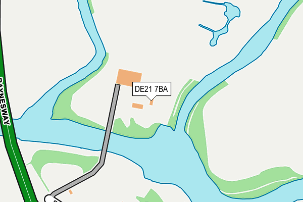
DE21 7BA is located in the Spondon electoral ward, within the unitary authority of Derby and the English Parliamentary constituency of Mid Derbyshire. The Sub Integrated Care Board (ICB) Location is NHS Derby and Derbyshire ICB - 15M and the police force is Derbyshire. This postcode has been in use since August 1992.


GetTheData
Source: OS OpenMap – Local (Ordnance Survey)
Source: OS VectorMap District (Ordnance Survey)
Licence: Open Government Licence (requires attribution)
| Easting | 438641 |
| Northing | 334384 |
| Latitude | 52.905526 |
| Longitude | -1.426926 |
GetTheData
Source: Open Postcode Geo
Licence: Open Government Licence
| Country | England |
| Postcode District | DE21 |
| ➜ DE21 open data dashboard ➜ See where DE21 is on a map ➜ Where is Derby? | |
GetTheData
Source: Land Registry Price Paid Data
Licence: Open Government Licence
Elevation or altitude of DE21 7BA as distance above sea level:
| Metres | Feet | |
|---|---|---|
| Elevation | 40m | 131ft |
Elevation is measured from the approximate centre of the postcode, to the nearest point on an OS contour line from OS Terrain 50, which has contour spacing of ten vertical metres.
➜ How high above sea level am I? Find the elevation of your current position using your device's GPS.
GetTheData
Source: Open Postcode Elevation
Licence: Open Government Licence
| Ward | Spondon |
| Constituency | Mid Derbyshire |
GetTheData
Source: ONS Postcode Database
Licence: Open Government Licence
| May 2022 | Criminal damage and arson | On or near Raynesway Park Drive | 301m |
| April 2022 | Anti-social behaviour | On or near Sports/Recreation Area | 138m |
| December 2021 | Burglary | On or near Sports/Recreation Area | 138m |
| ➜ Get more crime data in our Crime section | |||
GetTheData
Source: data.police.uk
Licence: Open Government Licence
| Rolls Royce Offices (West Service Road) | Raynesway | 475m |
| Mica Works (West Service Road) | Raynesway | 584m |
| Derby Commercial Park (Fernhook Avenue) | Alvaston | 683m |
| Charlton House (East Service Road) | Raynesway | 715m |
| Severn Trent (West Service Road) | Raynesway | 740m |
| Spondon Station | 1.3km |
| Derby Station | 2.7km |
| Peartree Station | 3.3km |
GetTheData
Source: NaPTAN
Licence: Open Government Licence
GetTheData
Source: ONS Postcode Database
Licence: Open Government Licence


➜ Get more ratings from the Food Standards Agency
GetTheData
Source: Food Standards Agency
Licence: FSA terms & conditions
| Last Collection | |||
|---|---|---|---|
| Location | Mon-Fri | Sat | Distance |
| London Road | 17:30 | 11:00 | 881m |
| Shardlow Road | 17:30 | 11:00 | 941m |
| Alvaston Post Office | 17:30 | 12:00 | 975m |
GetTheData
Source: Dracos
Licence: Creative Commons Attribution-ShareAlike
| Facility | Distance |
|---|---|
| Alvaston And Boulton Cricket Club Raynesway, Derby Grass Pitches | 347m |
| Choices Health Clubs (Derby) Raynesway, Spondon, Derby Swimming Pool, Health and Fitness Gym, Studio | 538m |
| St John Fisher Catholic Voluntary Academy (Alvaston) Alvaston Street, Alvaston, Derby Grass Pitches | 856m |
GetTheData
Source: Active Places
Licence: Open Government Licence
| School | Phase of Education | Distance |
|---|---|---|
| St John Fisher Catholic Voluntary Academy Alvaston Street, Alvaston, Derby, DE24 0PA | Primary | 869m |
| Kingsmead School Brighton Road, Derby, DE24 8TE | Not applicable | 1.1km |
| Lakeside Primary Academy 877 London Road, Alvaston, Derby, DE24 8UY | Primary | 1.1km |
GetTheData
Source: Edubase
Licence: Open Government Licence
| Risk of DE21 7BA flooding from rivers and sea | Low |
| ➜ DE21 7BA flood map | |
GetTheData
Source: Open Flood Risk by Postcode
Licence: Open Government Licence
The below table lists the International Territorial Level (ITL) codes (formerly Nomenclature of Territorial Units for Statistics (NUTS) codes) and Local Administrative Units (LAU) codes for DE21 7BA:
| ITL 1 Code | Name |
|---|---|
| TLF | East Midlands (England) |
| ITL 2 Code | Name |
| TLF1 | Derbyshire and Nottinghamshire |
| ITL 3 Code | Name |
| TLF11 | Derby |
| LAU 1 Code | Name |
| E06000015 | Derby |
GetTheData
Source: ONS Postcode Directory
Licence: Open Government Licence
The below table lists the Census Output Area (OA), Lower Layer Super Output Area (LSOA), and Middle Layer Super Output Area (MSOA) for DE21 7BA:
| Code | Name | |
|---|---|---|
| OA | E00171226 | |
| LSOA | E01013595 | Derby 014B |
| MSOA | E02002809 | Derby 014 |
GetTheData
Source: ONS Postcode Directory
Licence: Open Government Licence
| DE21 7BH | Raynesway Park Drive | 351m |
| DE21 7AY | West Side Park | 500m |
| DE24 0NY | Metcalfe Close | 694m |
| DE21 7RW | East Service Road | 704m |
| DE24 8QQ | Meadow Lane | 734m |
| DE24 8QS | Curzon Lane | 735m |
| DE24 8QW | Hollis Street | 741m |
| DE24 8QT | Burnside Street | 745m |
| DE24 8QY | Lincoln Avenue | 753m |
| DE24 8QZ | Wye Street | 753m |
GetTheData
Source: Open Postcode Geo; Land Registry Price Paid Data
Licence: Open Government Licence