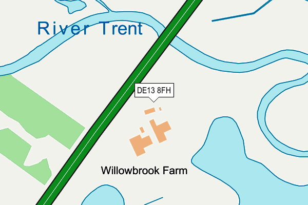
DE13 8FH is located in the Bagots & Needwood electoral ward, within the local authority district of East Staffordshire and the English Parliamentary constituency of Lichfield. The Sub Integrated Care Board (ICB) Location is NHS Staffordshire and Stoke-on-Trent ICB - 05D and the police force is Staffordshire. This postcode has been in use since April 2015.


GetTheData
Source: OS OpenMap – Local (Ordnance Survey)
Source: OS VectorMap District (Ordnance Survey)
Licence: Open Government Licence (requires attribution)
| Easting | 418285 |
| Northing | 315683 |
| Latitude | 52.738472 |
| Longitude | -1.730618 |
GetTheData
Source: Open Postcode Geo
Licence: Open Government Licence
| Country | England |
| Postcode District | DE13 |
| ➜ DE13 open data dashboard ➜ See where DE13 is on a map | |
GetTheData
Source: Land Registry Price Paid Data
Licence: Open Government Licence
Elevation or altitude of DE13 8FH as distance above sea level:
| Metres | Feet | |
|---|---|---|
| Elevation | 60m | 197ft |
Elevation is measured from the approximate centre of the postcode, to the nearest point on an OS contour line from OS Terrain 50, which has contour spacing of ten vertical metres.
➜ How high above sea level am I? Find the elevation of your current position using your device's GPS.
GetTheData
Source: Open Postcode Elevation
Licence: Open Government Licence
| Ward | Bagots & Needwood |
| Constituency | Lichfield |
GetTheData
Source: ONS Postcode Database
Licence: Open Government Licence
| Burton Road (Main St) | Alrewas | 1,027m |
| Main Street (Ryknild Street) | Alrewas | 1,115m |
| Exchange Road (Main St) | Alrewas | 1,150m |
| Exchange Road (Main St) | Alrewas | 1,174m |
| The National Memorial Arboretum (Croxall Road) | Alrewas | 1,187m |
GetTheData
Source: NaPTAN
Licence: Open Government Licence
GetTheData
Source: ONS Postcode Database
Licence: Open Government Licence


➜ Get more ratings from the Food Standards Agency
GetTheData
Source: Food Standards Agency
Licence: FSA terms & conditions
| Last Collection | |||
|---|---|---|---|
| Location | Mon-Fri | Sat | Distance |
| Alrewas | 16:00 | 08:00 | 997m |
| Park Road | 16:00 | 09:00 | 1,146m |
| National Arboretum | 17:00 | 1,183m | |
GetTheData
Source: Dracos
Licence: Creative Commons Attribution-ShareAlike
| Facility | Distance |
|---|---|
| All Saints C Of E (C) Primary School Furlong Close, Alrewas, Burton-on-trent Grass Pitches | 1.4km |
| Walk Field Daisy Lane, Alrewas, Burton Upon Trent Grass Pitches, Outdoor Tennis Courts | 1.9km |
| Barton Aquadome (Thomas Russell Junior School) Gilmour Lane, Barton Under Needwood, Burton-on-trent Swimming Pool | 2.6km |
GetTheData
Source: Active Places
Licence: Open Government Licence
| School | Phase of Education | Distance |
|---|---|---|
| All Saints Church of England Primary and Nursery School Furlong Close, Alrewas, Burton-on-Trent, DE13 7EF | Primary | 1.4km |
| Thomas Russell Junior School Gilmour Lane, Barton-Under-Needwood, Burton-on-Trent, DE13 8EU | Primary | 2.6km |
| Thomas Russell Infants School Station Road, Barton-Under-Needwood, Burton-on-Trent, DE13 8DS | Primary | 2.9km |
GetTheData
Source: Edubase
Licence: Open Government Licence
| Risk of DE13 8FH flooding from rivers and sea | Medium |
| ➜ DE13 8FH flood map | |
GetTheData
Source: Open Flood Risk by Postcode
Licence: Open Government Licence
The below table lists the International Territorial Level (ITL) codes (formerly Nomenclature of Territorial Units for Statistics (NUTS) codes) and Local Administrative Units (LAU) codes for DE13 8FH:
| ITL 1 Code | Name |
|---|---|
| TLG | West Midlands (England) |
| ITL 2 Code | Name |
| TLG2 | Shropshire and Staffordshire |
| ITL 3 Code | Name |
| TLG24 | Staffordshire CC |
| LAU 1 Code | Name |
| E07000193 | East Staffordshire |
GetTheData
Source: ONS Postcode Directory
Licence: Open Government Licence
The below table lists the Census Output Area (OA), Lower Layer Super Output Area (LSOA), and Middle Layer Super Output Area (MSOA) for DE13 8FH:
| Code | Name | |
|---|---|---|
| OA | E00149993 | |
| LSOA | E01029441 | East Staffordshire 015C |
| MSOA | E02006145 | East Staffordshire 015 |
GetTheData
Source: ONS Postcode Directory
Licence: Open Government Licence
| DE13 7BA | Burton Road | 582m |
| DE13 7AW | Salters Green Way | 760m |
| DE13 8BY | 781m | |
| DE13 7AU | Micklehome Drive | 839m |
| DE13 7BB | Burton Road | 910m |
| DE13 7AT | Micklehome Drive | 943m |
| DE13 7DR | Selwyn Close | 976m |
| DE13 7BD | Croxall Road | 1052m |
| DE13 7AA | Main Street | 1077m |
| DE13 7AJ | Park Road | 1089m |
GetTheData
Source: Open Postcode Geo; Land Registry Price Paid Data
Licence: Open Government Licence