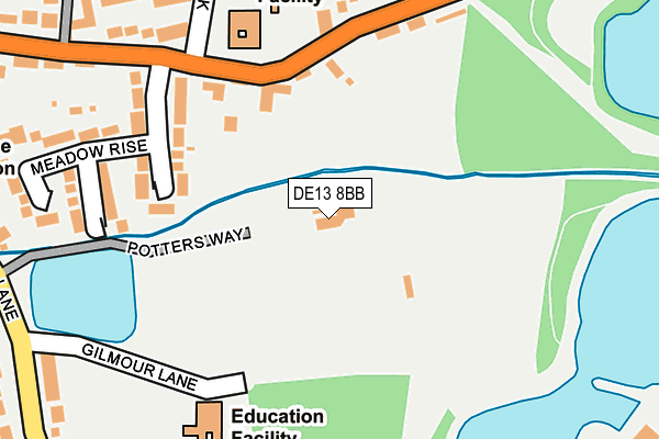
DE13 8BB is located in the Bagots & Needwood electoral ward, within the local authority district of East Staffordshire and the English Parliamentary constituency of Lichfield. The Sub Integrated Care Board (ICB) Location is NHS Staffordshire and Stoke-on-Trent ICB - 05D and the police force is Staffordshire. This postcode has been in use since October 2006.


GetTheData
Source: OS OpenMap – Local (Ordnance Survey)
Source: OS VectorMap District (Ordnance Survey)
Licence: Open Government Licence (requires attribution)
| Easting | 419343 |
| Northing | 318295 |
| Latitude | 52.761933 |
| Longitude | -1.714789 |
GetTheData
Source: Open Postcode Geo
Licence: Open Government Licence
| Country | England |
| Postcode District | DE13 |
| ➜ DE13 open data dashboard ➜ See where DE13 is on a map ➜ Where is Barton-under-Needwood? | |
GetTheData
Source: Land Registry Price Paid Data
Licence: Open Government Licence
Elevation or altitude of DE13 8BB as distance above sea level:
| Metres | Feet | |
|---|---|---|
| Elevation | 50m | 164ft |
Elevation is measured from the approximate centre of the postcode, to the nearest point on an OS contour line from OS Terrain 50, which has contour spacing of ten vertical metres.
➜ How high above sea level am I? Find the elevation of your current position using your device's GPS.
GetTheData
Source: Open Postcode Elevation
Licence: Open Government Licence
| Ward | Bagots & Needwood |
| Constituency | Lichfield |
GetTheData
Source: ONS Postcode Database
Licence: Open Government Licence
| September 2023 | Other theft | On or near Park/Open Space | 295m |
| September 2023 | Anti-social behaviour | On or near Beech Road | 492m |
| August 2023 | Violence and sexual offences | On or near Park/Open Space | 295m |
| ➜ Get more crime data in our Crime section | |||
GetTheData
Source: data.police.uk
Licence: Open Government Licence
| Thomas Russell School (Station Rd) | Barton Under Needwood | 192m |
| Thomas Russell School (Station Rd) | Barton Under Needwood | 232m |
| Recreation Ground (Efflinch Ln) | Barton Under Needwood | 331m |
| Recreation Ground (Efflinch Lane) | Barton Under Needwood | 342m |
| Barton Lodge (Station Rd) | Barton Under Needwood | 369m |
| Burton-on-Trent Station | 6.9km |
GetTheData
Source: NaPTAN
Licence: Open Government Licence
GetTheData
Source: ONS Postcode Database
Licence: Open Government Licence


➜ Get more ratings from the Food Standards Agency
GetTheData
Source: Food Standards Agency
Licence: FSA terms & conditions
| Last Collection | |||
|---|---|---|---|
| Location | Mon-Fri | Sat | Distance |
| Station Road (Barton) | 16:00 | 09:45 | 264m |
| Barton U Needwood | 16:00 | 09:45 | 611m |
| Efflinch Lane | 16:00 | 09:30 | 694m |
GetTheData
Source: Dracos
Licence: Creative Commons Attribution-ShareAlike
| Facility | Distance |
|---|---|
| Holland Sports Club Potters Way, Barton Under Needwood, Burton-on-trent Grass Pitches, Outdoor Tennis Courts | 14m |
| Barton Aquadome (Thomas Russell Junior School) Gilmour Lane, Barton Under Needwood, Burton-on-trent Swimming Pool | 195m |
| John Taylor High School Dunstall Road, Barton Under Needwood, Burton-on-trent Sports Hall, Grass Pitches | 517m |
GetTheData
Source: Active Places
Licence: Open Government Licence
| School | Phase of Education | Distance |
|---|---|---|
| Thomas Russell Infants School Station Road, Barton-Under-Needwood, Burton-on-Trent, DE13 8DS | Primary | 182m |
| Thomas Russell Junior School Gilmour Lane, Barton-Under-Needwood, Burton-on-Trent, DE13 8EU | Primary | 223m |
| John Taylor High School Dunstall Road, Barton-under-Needwood, Burton-on-Trent, DE13 8AZ | Secondary | 517m |
GetTheData
Source: Edubase
Licence: Open Government Licence
| Risk of DE13 8BB flooding from rivers and sea | Medium |
| ➜ DE13 8BB flood map | |
GetTheData
Source: Open Flood Risk by Postcode
Licence: Open Government Licence
The below table lists the International Territorial Level (ITL) codes (formerly Nomenclature of Territorial Units for Statistics (NUTS) codes) and Local Administrative Units (LAU) codes for DE13 8BB:
| ITL 1 Code | Name |
|---|---|
| TLG | West Midlands (England) |
| ITL 2 Code | Name |
| TLG2 | Shropshire and Staffordshire |
| ITL 3 Code | Name |
| TLG24 | Staffordshire CC |
| LAU 1 Code | Name |
| E07000193 | East Staffordshire |
GetTheData
Source: ONS Postcode Directory
Licence: Open Government Licence
The below table lists the Census Output Area (OA), Lower Layer Super Output Area (LSOA), and Middle Layer Super Output Area (MSOA) for DE13 8BB:
| Code | Name | |
|---|---|---|
| OA | E00149993 | |
| LSOA | E01029441 | East Staffordshire 015C |
| MSOA | E02006145 | East Staffordshire 015 |
GetTheData
Source: ONS Postcode Directory
Licence: Open Government Licence
| DE13 8DS | Station Road | 166m |
| DE13 8DT | Meadow Rise | 221m |
| DE13 8AR | Grove Mews | 297m |
| DE13 8DU | Holland Park | 297m |
| DE13 8EU | Efflinch Lane | 349m |
| DE13 8DR | Station Road | 356m |
| DE13 8ET | Efflinch Lane | 378m |
| DE13 8PA | Needwood Park | 431m |
| DE13 8AS | Barton Turn | 444m |
| DE13 8FE | Sutton Crescent | 448m |
GetTheData
Source: Open Postcode Geo; Land Registry Price Paid Data
Licence: Open Government Licence