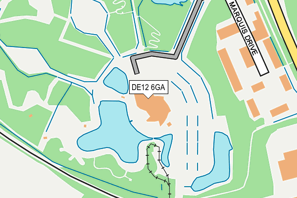
DE12 6GA is located in the Ashby Woulds electoral ward, within the local authority district of North West Leicestershire and the English Parliamentary constituency of North West Leicestershire. The Sub Integrated Care Board (ICB) Location is NHS Leicester, Leicestershire and Rutland ICB - 04V and the police force is Leicestershire. This postcode has been in use since June 2001.


GetTheData
Source: OS OpenMap – Local (Ordnance Survey)
Source: OS VectorMap District (Ordnance Survey)
Licence: Open Government Licence (requires attribution)
| Easting | 430939 |
| Northing | 316135 |
| Latitude | 52.741962 |
| Longitude | -1.543162 |
GetTheData
Source: Open Postcode Geo
Licence: Open Government Licence
| Country | England |
| Postcode District | DE12 |
| ➜ DE12 open data dashboard ➜ See where DE12 is on a map ➜ Where is Moira? | |
GetTheData
Source: Land Registry Price Paid Data
Licence: Open Government Licence
Elevation or altitude of DE12 6GA as distance above sea level:
| Metres | Feet | |
|---|---|---|
| Elevation | 100m | 328ft |
Elevation is measured from the approximate centre of the postcode, to the nearest point on an OS contour line from OS Terrain 50, which has contour spacing of ten vertical metres.
➜ How high above sea level am I? Find the elevation of your current position using your device's GPS.
GetTheData
Source: Open Postcode Elevation
Licence: Open Government Licence
| Ward | Ashby Woulds |
| Constituency | North West Leicestershire |
GetTheData
Source: ONS Postcode Database
Licence: Open Government Licence
| June 2022 | Other theft | On or near Marquis Drive | 243m |
| June 2022 | Anti-social behaviour | On or near Marquis Drive | 243m |
| June 2022 | Criminal damage and arson | On or near Marquis Drive | 243m |
| ➜ Get more crime data in our Crime section | |||
GetTheData
Source: data.police.uk
Licence: Open Government Licence
| Conkers (Rawdon Road) | Moira | 327m |
| Conkers (Rawdon Road) | Moira | 456m |
| Gorse Lane (Reservoir Hill) | Spring Cottage | 498m |
| Gorse Lane (Reservoir Hill) | Spring Cottage | 520m |
| Bath Yard (Bath Lane) | Moira | 561m |
GetTheData
Source: NaPTAN
Licence: Open Government Licence
GetTheData
Source: ONS Postcode Database
Licence: Open Government Licence


➜ Get more ratings from the Food Standards Agency
GetTheData
Source: Food Standards Agency
Licence: FSA terms & conditions
| Last Collection | |||
|---|---|---|---|
| Location | Mon-Fri | Sat | Distance |
| Spring Cottage | 16:00 | 09:30 | 531m |
| The Crescent | 16:00 | 11:15 | 856m |
| Moira So | 16:00 | 11:30 | 880m |
GetTheData
Source: Dracos
Licence: Creative Commons Attribution-ShareAlike
| Facility | Distance |
|---|---|
| Spring Cottage Recreation Ground Spring Cottage Road, Overseal, Swadlincote Grass Pitches | 599m |
| Moira Miners Welfare Bath Lane, Moira, Swadlincote Grass Pitches | 616m |
| Moira United Football Club Ashby Road, Moira Grass Pitches | 943m |
GetTheData
Source: Active Places
Licence: Open Government Licence
| School | Phase of Education | Distance |
|---|---|---|
| Overseal Primary School Woodville Road, Overseal, Swadlincote, DE12 6LU | Primary | 1.1km |
| Moira Primary School Blackfordby Lane, Moira, Swadlincote, DE12 6EX | Primary | 1.9km |
| Albert Village Primary School Occupation Road, Albert Village, Swadlincote, DE11 8HA | Primary | 2km |
GetTheData
Source: Edubase
Licence: Open Government Licence
| Risk of DE12 6GA flooding from rivers and sea | Low |
| ➜ DE12 6GA flood map | |
GetTheData
Source: Open Flood Risk by Postcode
Licence: Open Government Licence
The below table lists the International Territorial Level (ITL) codes (formerly Nomenclature of Territorial Units for Statistics (NUTS) codes) and Local Administrative Units (LAU) codes for DE12 6GA:
| ITL 1 Code | Name |
|---|---|
| TLF | East Midlands (England) |
| ITL 2 Code | Name |
| TLF2 | Leicestershire, Rutland and Northamptonshire |
| ITL 3 Code | Name |
| TLF22 | Leicestershire CC and Rutland |
| LAU 1 Code | Name |
| E07000134 | North West Leicestershire |
GetTheData
Source: ONS Postcode Directory
Licence: Open Government Licence
The below table lists the Census Output Area (OA), Lower Layer Super Output Area (LSOA), and Middle Layer Super Output Area (MSOA) for DE12 6GA:
| Code | Name | |
|---|---|---|
| OA | E00131700 | |
| LSOA | E01025950 | North West Leicestershire 008A |
| MSOA | E02005404 | North West Leicestershire 008 |
GetTheData
Source: ONS Postcode Directory
Licence: Open Government Licence
| DE12 6DA | Rawdon Road | 451m |
| DE12 6NA | Spring Cottage Road | 482m |
| DE12 6BS | Roman Way | 571m |
| DE12 6ND | Spring Cottage Road | 573m |
| DE12 6BP | Bath Lane | 630m |
| DE12 6DH | Gorse Lane | 635m |
| DE12 6DQ | Rawdon Road | 643m |
| DE12 6BG | Whitworth Close | 659m |
| DE12 6LP | Forest Lea | 677m |
| DE12 6BE | Via Devana | 705m |
GetTheData
Source: Open Postcode Geo; Land Registry Price Paid Data
Licence: Open Government Licence