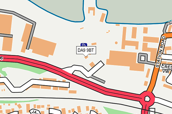
DA9 9BT is located in the Stone Castle electoral ward, within the local authority district of Dartford and the English Parliamentary constituency of Dartford. The Sub Integrated Care Board (ICB) Location is NHS Kent and Medway ICB - 91Q and the police force is Kent. This postcode has been in use since October 1984.


GetTheData
Source: OS OpenMap – Local (Ordnance Survey)
Source: OS VectorMap District (Ordnance Survey)
Licence: Open Government Licence (requires attribution)
| Easting | 558183 |
| Northing | 175071 |
| Latitude | 51.452528 |
| Longitude | 0.275215 |
GetTheData
Source: Open Postcode Geo
Licence: Open Government Licence
| Country | England |
| Postcode District | DA9 |
| ➜ DA9 open data dashboard ➜ See where DA9 is on a map ➜ Where is Swanscombe? | |
GetTheData
Source: Land Registry Price Paid Data
Licence: Open Government Licence
Elevation or altitude of DA9 9BT as distance above sea level:
| Metres | Feet | |
|---|---|---|
| Elevation | 10m | 33ft |
Elevation is measured from the approximate centre of the postcode, to the nearest point on an OS contour line from OS Terrain 50, which has contour spacing of ten vertical metres.
➜ How high above sea level am I? Find the elevation of your current position using your device's GPS.
GetTheData
Source: Open Postcode Elevation
Licence: Open Government Licence
| Ward | Stone Castle |
| Constituency | Dartford |
GetTheData
Source: ONS Postcode Database
Licence: Open Government Licence
| January 2024 | Bicycle theft | On or near Parking Area | 313m |
| November 2023 | Vehicle crime | On or near Parking Area | 313m |
| June 2023 | Vehicle crime | On or near Parking Area | 313m |
| ➜ Get more crime data in our Crime section | |||
GetTheData
Source: data.police.uk
Licence: Open Government Licence
| Asda (Asda Grounds) | Greenhithe | 178m |
| Asda (Crossways Boulevard) | Greenhithe | 194m |
| Asda (Asda Grounds) | Greenhithe | 200m |
| Asda (Crossways Boulevard) | Greenhithe | 209m |
| Station Road | Greenhithe | 254m |
| Greenhithe for Bluewater Station | 0.4km |
| Stone Crossing Station | 0.8km |
| Swanscombe Station | 2.4km |
GetTheData
Source: NaPTAN
Licence: Open Government Licence
GetTheData
Source: ONS Postcode Database
Licence: Open Government Licence


➜ Get more ratings from the Food Standards Agency
GetTheData
Source: Food Standards Agency
Licence: FSA terms & conditions
| Last Collection | |||
|---|---|---|---|
| Location | Mon-Fri | Sat | Distance |
| Eagles Road | 17:30 | 11:00 | 273m |
| Crossways | 18:30 | 11:00 | 286m |
| Cowley Avenue | 17:30 | 11:00 | 301m |
GetTheData
Source: Dracos
Licence: Creative Commons Attribution-ShareAlike
| Facility | Distance |
|---|---|
| Knockhall Primary School Eynsford Road, Greenhithe Grass Pitches | 1km |
| Knockhall Playing Fields Knockhall Road, Greenhithe Grass Pitches | 1.3km |
| Beefs & Babes Gym London Road, Greenhithe Health and Fitness Gym, Studio | 1.4km |
GetTheData
Source: Active Places
Licence: Open Government Licence
| School | Phase of Education | Distance |
|---|---|---|
| Knockhall Primary School Eynsford Road, Greenhithe, DA9 9RF | Primary | 1km |
| Stone St Mary's CofE Primary School Hayes Road, Horns Cross, Greenhithe, DA9 9EF | Primary | 1.5km |
| The Craylands School Craylands Lane, Swanscombe, DA10 0LP | Primary | 2km |
GetTheData
Source: Edubase
Licence: Open Government Licence
| Risk of DA9 9BT flooding from rivers and sea | Very Low |
| ➜ DA9 9BT flood map | |
GetTheData
Source: Open Flood Risk by Postcode
Licence: Open Government Licence
The below table lists the International Territorial Level (ITL) codes (formerly Nomenclature of Territorial Units for Statistics (NUTS) codes) and Local Administrative Units (LAU) codes for DA9 9BT:
| ITL 1 Code | Name |
|---|---|
| TLJ | South East (England) |
| ITL 2 Code | Name |
| TLJ4 | Kent |
| ITL 3 Code | Name |
| TLJ43 | Kent Thames Gateway |
| LAU 1 Code | Name |
| E07000107 | Dartford |
GetTheData
Source: ONS Postcode Directory
Licence: Open Government Licence
The below table lists the Census Output Area (OA), Lower Layer Super Output Area (LSOA), and Middle Layer Super Output Area (MSOA) for DA9 9BT:
| Code | Name | |
|---|---|---|
| OA | E00122713 | |
| LSOA | E01024172 | Dartford 006D |
| MSOA | E02005033 | Dartford 006 |
GetTheData
Source: ONS Postcode Directory
Licence: Open Government Licence
| DA9 9US | Ifield Place | 129m |
| DA9 9UJ | North Star Boulevard | 146m |
| DA9 9AQ | Charles Street | 165m |
| DA9 9UH | North Star Boulevard | 189m |
| DA9 9PZ | Sayer Close | 205m |
| DA9 9UE | Marston Court | 222m |
| DA9 9UF | Evelyn Walk | 226m |
| DA9 9RB | Chambers Close | 231m |
| DA9 9UD | Evelyn Walk | 233m |
| DA9 9UG | North Star Boulevard | 233m |
GetTheData
Source: Open Postcode Geo; Land Registry Price Paid Data
Licence: Open Government Licence