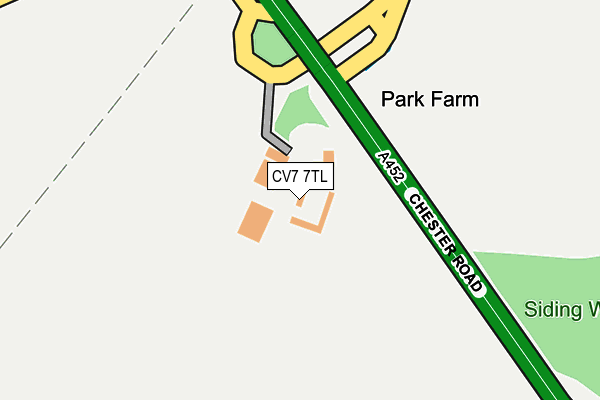
CV7 7TL is located in the Bickenhill electoral ward, within the metropolitan district of Solihull and the English Parliamentary constituency of Meriden. The Sub Integrated Care Board (ICB) Location is NHS Birmingham and Solihull ICB - 15E and the police force is West Midlands. This postcode has been in use since November 2010.


GetTheData
Source: OS OpenMap – Local (Ordnance Survey)
Source: OS VectorMap District (Ordnance Survey)
Licence: Open Government Licence (requires attribution)
| Easting | 420638 |
| Northing | 284002 |
| Latitude | 52.453602 |
| Longitude | -1.697726 |
GetTheData
Source: Open Postcode Geo
Licence: Open Government Licence
| Country | England |
| Postcode District | CV7 |
| ➜ CV7 open data dashboard ➜ See where CV7 is on a map | |
GetTheData
Source: Land Registry Price Paid Data
Licence: Open Government Licence
Elevation or altitude of CV7 7TL as distance above sea level:
| Metres | Feet | |
|---|---|---|
| Elevation | 100m | 328ft |
Elevation is measured from the approximate centre of the postcode, to the nearest point on an OS contour line from OS Terrain 50, which has contour spacing of ten vertical metres.
➜ How high above sea level am I? Find the elevation of your current position using your device's GPS.
GetTheData
Source: Open Postcode Elevation
Licence: Open Government Licence
| Ward | Bickenhill |
| Constituency | Meriden |
GetTheData
Source: ONS Postcode Database
Licence: Open Government Licence
| December 2021 | Anti-social behaviour | On or near Packington Lane | 135m |
| November 2021 | Vehicle crime | On or near Packington Lane | 135m |
| August 2021 | Other theft | On or near Packington Lane | 135m |
| ➜ Get more crime data in our Crime section | |||
GetTheData
Source: data.police.uk
Licence: Open Government Licence
| Middle Bickenhill Lane (Chester Rd) | Stonebridge | 268m |
| Middle Bickenhill Lane (Chester Rd) | Stonebridge | 269m |
| Middle Bickenhill Lane (East Way) | Stonebridge | 827m |
| East Way (Coventry Rd) | Stonebridge | 895m |
| Bickenhill Lane (Coventry Rd) | Stonebridge | 943m |
| Birmingham International Station | 1.9km |
| Hampton-in-Arden Station | 2.7km |
| Marston Green Station | 4.2km |
GetTheData
Source: NaPTAN
Licence: Open Government Licence
| Percentage of properties with Next Generation Access | 0.0% |
| Percentage of properties with Superfast Broadband | 0.0% |
| Percentage of properties with Ultrafast Broadband | 0.0% |
| Percentage of properties with Full Fibre Broadband | 0.0% |
Superfast Broadband is between 30Mbps and 300Mbps
Ultrafast Broadband is > 300Mbps
| Percentage of properties unable to receive 2Mbps | 100.0% |
| Percentage of properties unable to receive 5Mbps | 100.0% |
| Percentage of properties unable to receive 10Mbps | 100.0% |
| Percentage of properties unable to receive 30Mbps | 100.0% |
GetTheData
Source: Ofcom
Licence: Ofcom Terms of Use (requires attribution)
GetTheData
Source: ONS Postcode Database
Licence: Open Government Licence


➜ Get more ratings from the Food Standards Agency
GetTheData
Source: Food Standards Agency
Licence: FSA terms & conditions
| Last Collection | |||
|---|---|---|---|
| Location | Mon-Fri | Sat | Distance |
| Bham Intl Station | 17:00 | 12:00 | 1,886m |
| Waterside Centre | 18:30 | 12:00 | 2,215m |
| Elmdon Trading Estate | 2,215m | ||
GetTheData
Source: Dracos
Licence: Creative Commons Attribution-ShareAlike
| Facility | Distance |
|---|---|
| Livingwell Health Club (Birmingham Metropole) National Exhibition Centre, Birmingham Swimming Pool, Health and Fitness Gym | 1.3km |
| Arden Hotel And Leisure Club Coventry Road, Bickenhill, Solihull Health and Fitness Gym, Swimming Pool | 1.8km |
| The Hampton Health And Fitness Club Old Station Road, Hampton-in-arden, Solihull Health and Fitness Gym, Studio | 2.4km |
GetTheData
Source: Active Places
Licence: Open Government Licence
| School | Phase of Education | Distance |
|---|---|---|
| The Island Project School Diddington Hall, Diddington Lane, Meriden, CV7 7HQ | Not applicable | 1.7km |
| George Fentham Endowed School Fentham Road, Hampton-in-Arden, Solihull, B92 0AY | Primary | 3.1km |
| Windy Arbor Primary School Woodlands Way, Chelmsley Wood, Birmingham, B37 6RN | Primary | 3.5km |
GetTheData
Source: Edubase
Licence: Open Government Licence
The below table lists the International Territorial Level (ITL) codes (formerly Nomenclature of Territorial Units for Statistics (NUTS) codes) and Local Administrative Units (LAU) codes for CV7 7TL:
| ITL 1 Code | Name |
|---|---|
| TLG | West Midlands (England) |
| ITL 2 Code | Name |
| TLG3 | West Midlands |
| ITL 3 Code | Name |
| TLG32 | Solihull |
| LAU 1 Code | Name |
| E08000029 | Solihull |
GetTheData
Source: ONS Postcode Directory
Licence: Open Government Licence
The below table lists the Census Output Area (OA), Lower Layer Super Output Area (LSOA), and Middle Layer Super Output Area (MSOA) for CV7 7TL:
| Code | Name | |
|---|---|---|
| OA | E00051124 | |
| LSOA | E01010109 | Solihull 009A |
| MSOA | E02002089 | Solihull 009 |
GetTheData
Source: ONS Postcode Directory
Licence: Open Government Licence
| B92 0HJ | Middle Bickenhill Lane | 733m |
| B46 3HY | Chester Road | 1031m |
| CV7 7HN | Packington Lane | 1165m |
| B92 0HQ | Old Station Road | 1522m |
| B37 7ES | 1779m | |
| B37 7YU | Solihull Parkway | 1813m |
| B92 0HF | Old Station Road | 1848m |
| B92 0DT | Church Lane | 1851m |
| B92 0HE | Old Station Road | 1907m |
| B37 7WY | Solihull Parkway | 1927m |
GetTheData
Source: Open Postcode Geo; Land Registry Price Paid Data
Licence: Open Government Licence