B46 3HY maps, stats, and open data
B46 3HY lies on Chester Road in Coleshill, Birmingham. B46 3HY is located in the Fillongley electoral ward, within the local authority district of North Warwickshire and the English Parliamentary constituency of North Warwickshire. The Sub Integrated Care Board (ICB) Location is NHS Coventry and Warwickshire ICB - B2M3M and the police force is Warwickshire. This postcode has been in use since January 1980.
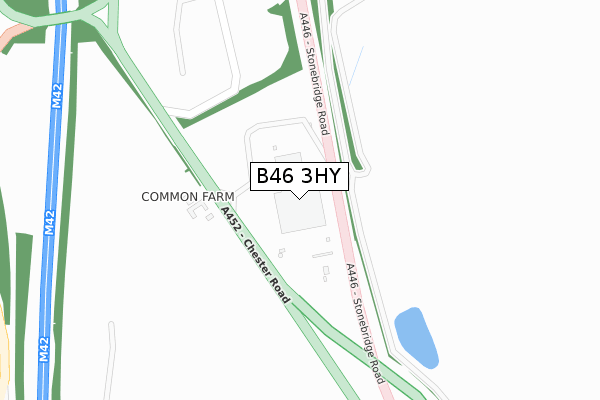
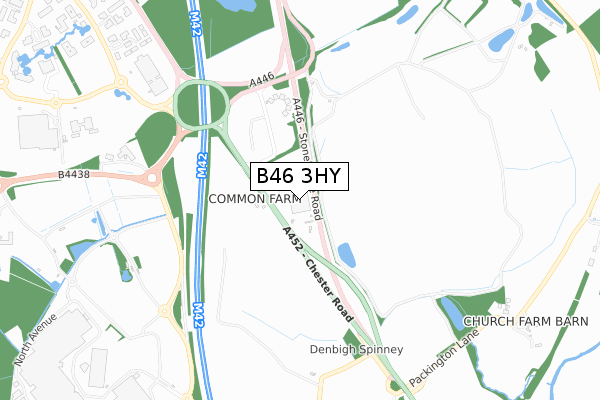
B46 3HY maps


Licence: Open Government Licence (requires attribution)
Attribution: Contains OS data © Crown copyright and database right 2025
Source: Open Postcode Geo
Licence: Open Government Licence (requires attribution)
Attribution: Contains OS data © Crown copyright and database right 2025; Contains Royal Mail data © Royal Mail copyright and database right 2025; Source: Office for National Statistics licensed under the Open Government Licence v.3.0
B46 3HY geodata
| Easting | 420196 |
| Northing | 284934 |
| Latitude | 52.461982 |
| Longitude | -1.704181 |
Where is B46 3HY?
| Street | Chester Road |
| Locality | Coleshill |
| Town/City | Birmingham |
| Country | England |
| Postcode District | B46 |
B46 3HY Elevation
Elevation or altitude of B46 3HY as distance above sea level:
| Metres | Feet | |
|---|---|---|
| Elevation | 100m | 328ft |
Elevation is measured from the approximate centre of the postcode, to the nearest point on an OS contour line from OS Terrain 50, which has contour spacing of ten vertical metres.
➜ How high above sea level am I? Find the elevation of your current position using your device's GPS.
Politics
| Ward | Fillongley |
|---|---|
| Constituency | North Warwickshire |
Transport
Nearest bus stops to B46 3HY
| Middle Bickenhill Lane (Chester Rd) | Stonebridge | 763m |
| Middle Bickenhill Lane (Chester Rd) | Stonebridge | 764m |
| The Little Owl (Bickenhill Parkway) | Birmingham Business Park | 825m |
| The Little Owl (Bickenhill Parkway) | Birmingham Business Park | 880m |
| Fujitsu (Solihull Parkway) | Birmingham Business Park | 966m |
Nearest underground/metro/tram to B46 3HY
| Birmingham Intl Rail Station (Air-rail Link) | Birmingham Airport | 1,968m |
Nearest railway stations to B46 3HY
| Birmingham International Station | 1.9km |
| Marston Green Station | 3.5km |
| Hampton-in-Arden Station | 3.7km |
Deprivation
66.5% of English postcodes are less deprived than B46 3HY:Food Standards Agency
Three nearest food hygiene ratings to B46 3HY (metres)


➜ Get more ratings from the Food Standards Agency
Nearest post box to B46 3HY
| Last Collection | |||
|---|---|---|---|
| Location | Mon-Fri | Sat | Distance |
| Waterside Centre | 18:30 | 12:00 | 1,326m |
| Elmdon Trading Estate | 1,327m | ||
| Bickenhill Road / Blackfirs Lane | 17:15 | 12:00 | 1,755m |
B46 3HY ITL and B46 3HY LAU
The below table lists the International Territorial Level (ITL) codes (formerly Nomenclature of Territorial Units for Statistics (NUTS) codes) and Local Administrative Units (LAU) codes for B46 3HY:
| ITL 1 Code | Name |
|---|---|
| TLG | West Midlands (England) |
| ITL 2 Code | Name |
| TLG1 | Herefordshire, Worcestershire and Warwickshire |
| ITL 3 Code | Name |
| TLG13 | Warwickshire CC |
| LAU 1 Code | Name |
| E07000218 | North Warwickshire |
B46 3HY census areas
The below table lists the Census Output Area (OA), Lower Layer Super Output Area (LSOA), and Middle Layer Super Output Area (MSOA) for B46 3HY:
| Code | Name | |
|---|---|---|
| OA | E00158175 | |
| LSOA | E01031028 | North Warwickshire 007D |
| MSOA | E02006474 | North Warwickshire 007 |
Nearest postcodes to B46 3HY
| B37 7YU | Solihull Parkway | 822m |
| B37 7WY | Solihull Parkway | 933m |
| B37 7YB | Solihull Parkway | 1081m |
| CV7 7HN | Packington Lane | 1212m |
| B37 7YN | Solihull Parkway | 1313m |
| B37 7YE | The Crescent | 1406m |
| B92 0HJ | Middle Bickenhill Lane | 1588m |
| B37 7JE | Black Firs Lane | 1590m |
| B37 7HY | Coleshill Heath Road | 1704m |
| B37 7EY | Bickenhill Lane | 1705m |