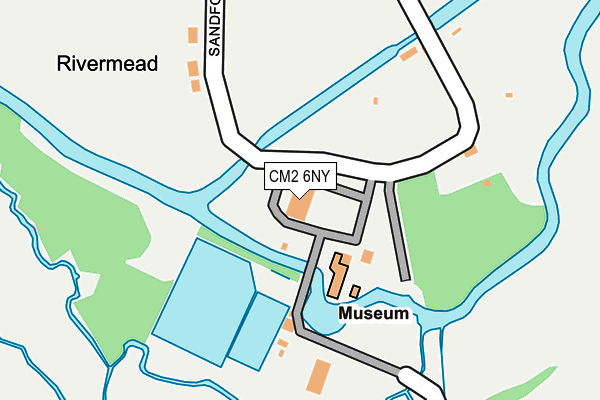
CM2 6NY is located in the Chelmer Village and Beaulieu Park electoral ward, within the local authority district of Chelmsford and the English Parliamentary constituency of Chelmsford. The Sub Integrated Care Board (ICB) Location is NHS Mid and South Essex ICB - 06Q and the police force is Essex. This postcode has been in use since January 1980.


GetTheData
Source: OS OpenMap – Local (Ordnance Survey)
Source: OS VectorMap District (Ordnance Survey)
Licence: Open Government Licence (requires attribution)
| Easting | 573866 |
| Northing | 206151 |
| Latitude | 51.727117 |
| Longitude | 0.516059 |
GetTheData
Source: Open Postcode Geo
Licence: Open Government Licence
| Country | England |
| Postcode District | CM2 |
| ➜ CM2 open data dashboard ➜ See where CM2 is on a map | |
GetTheData
Source: Land Registry Price Paid Data
Licence: Open Government Licence
Elevation or altitude of CM2 6NY as distance above sea level:
| Metres | Feet | |
|---|---|---|
| Elevation | 20m | 66ft |
Elevation is measured from the approximate centre of the postcode, to the nearest point on an OS contour line from OS Terrain 50, which has contour spacing of ten vertical metres.
➜ How high above sea level am I? Find the elevation of your current position using your device's GPS.
GetTheData
Source: Open Postcode Elevation
Licence: Open Government Licence
| Ward | Chelmer Village And Beaulieu Park |
| Constituency | Chelmsford |
GetTheData
Source: ONS Postcode Database
Licence: Open Government Licence
| June 2022 | Anti-social behaviour | On or near Sandford Mill Road | 259m |
| May 2022 | Public order | On or near Sandford Mill Road | 259m |
| November 2021 | Vehicle crime | On or near Sandford Mill Road | 424m |
| ➜ Get more crime data in our Crime section | |||
GetTheData
Source: data.police.uk
Licence: Open Government Licence
| Molrams Lane (Maldon Road) | Great Baddow | 755m |
| Molrams Lane (Maldon Road) | Great Baddow | 764m |
| Brick Kiln Road (Maldon Road) | Sandon | 783m |
| Brick Kiln Road (Maldon Road) | Sandon | 829m |
| Manor Farm Shop (Maldon Road) | Great Baddow | 860m |
| Chelmsford Station | 3.4km |
GetTheData
Source: NaPTAN
Licence: Open Government Licence
GetTheData
Source: ONS Postcode Database
Licence: Open Government Licence


➜ Get more ratings from the Food Standards Agency
GetTheData
Source: Food Standards Agency
Licence: FSA terms & conditions
| Last Collection | |||
|---|---|---|---|
| Location | Mon-Fri | Sat | Distance |
| Baddow Hall Crescent | 17:45 | 11:30 | 930m |
| Molrams Lane | 17:45 | 11:30 | 1,146m |
| Chelmer Village P.o. | 17:30 | 12:00 | 1,176m |
GetTheData
Source: Dracos
Licence: Creative Commons Attribution-ShareAlike
| Facility | Distance |
|---|---|
| Sandford Mill Lane Sandford Mill Road, Chelmsford Grass Pitches | 478m |
| The Sandon School Molrams Lane, Chelmsford Grass Pitches, Sports Hall, Artificial Grass Pitch | 1.3km |
| Sandon Sports Club Rectory Chase, Sandon, Chelmsford Grass Pitches | 1.4km |
GetTheData
Source: Active Places
Licence: Open Government Licence
| School | Phase of Education | Distance |
|---|---|---|
| Chancellor Park Primary School, Chelmsford Brook End Road South, Chelmsford, CM2 6PT | Primary | 1.2km |
| The Sandon School Molrams Lane, Sandon, Chelmsford, CM2 7AQ | Secondary | 1.3km |
| Barnes Farm Junior School Henniker Gate, Chelmer Village, Chelmsford, CM2 6QH | Primary | 1.4km |
GetTheData
Source: Edubase
Licence: Open Government Licence
| Risk of CM2 6NY flooding from rivers and sea | Medium |
| ➜ CM2 6NY flood map | |
GetTheData
Source: Open Flood Risk by Postcode
Licence: Open Government Licence
The below table lists the International Territorial Level (ITL) codes (formerly Nomenclature of Territorial Units for Statistics (NUTS) codes) and Local Administrative Units (LAU) codes for CM2 6NY:
| ITL 1 Code | Name |
|---|---|
| TLH | East |
| ITL 2 Code | Name |
| TLH3 | Essex |
| ITL 3 Code | Name |
| TLH36 | Heart of Essex |
| LAU 1 Code | Name |
| E07000070 | Chelmsford |
GetTheData
Source: ONS Postcode Directory
Licence: Open Government Licence
The below table lists the Census Output Area (OA), Lower Layer Super Output Area (LSOA), and Middle Layer Super Output Area (MSOA) for CM2 6NY:
| Code | Name | |
|---|---|---|
| OA | E00109456 | |
| LSOA | E01021548 | Chelmsford 013A |
| MSOA | E02004497 | Chelmsford 013 |
GetTheData
Source: ONS Postcode Directory
Licence: Open Government Licence
| CM2 6NX | Brook End Road | 176m |
| CM2 7RT | Sandford Mill Lane | 333m |
| CM2 6NT | Sandford Mill Road | 543m |
| CM2 6NU | Storms Way | 562m |
| CM2 6SA | Sandford Mill Road | 683m |
| CM2 6RW | Colyers Reach | 727m |
| CM2 6RJ | Saywell Brook | 791m |
| CM2 7DG | Maldon Road | 795m |
| CM2 6NS | Sandford Mill Road | 828m |
| CM2 7DQ | Maldon Road | 834m |
GetTheData
Source: Open Postcode Geo; Land Registry Price Paid Data
Licence: Open Government Licence