CM17 9TT maps, stats, and open data
CM17 9TT is located in the Old Harlow electoral ward, within the local authority district of Harlow and the English Parliamentary constituency of Harlow. The Sub Integrated Care Board (ICB) Location is NHS Hertfordshire and West Essex ICB - 07H and the police force is Essex. This postcode has been in use since July 2019.
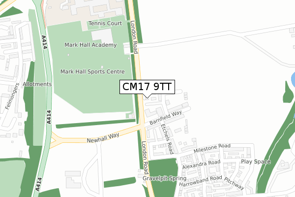
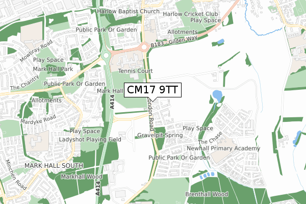
CM17 9TT maps


Licence: Open Government Licence (requires attribution)
Attribution: Contains OS data © Crown copyright and database right 2026
Source: Open Postcode Geo
Licence: Open Government Licence (requires attribution)
Attribution: Contains OS data © Crown copyright and database right 2026; Contains Royal Mail data © Royal Mail copyright and database right 2026; Source: Office for National Statistics licensed under the Open Government Licence v.3.0
CM17 9TT geodata
| Easting | 547294 |
| Northing | 210787 |
| Latitude | 51.776381 |
| Longitude | 0.133618 |
Where is CM17 9TT?
| Country | England |
| Postcode District | CM17 |
Politics
| Ward | Old Harlow |
|---|---|
| Constituency | Harlow |
House Prices
Sales of detached houses in CM17 9TT
6, QUIET LANE, NEWHALL, HARLOW, CM17 9TT 2023 27 APR £475,000 |
8, QUIET LANE, NEWHALL, HARLOW, CM17 9TT 2023 21 APR £480,000 |
7, QUIET LANE, NEWHALL, HARLOW, CM17 9TT 2023 20 APR £469,950 |
1, QUIET LANE, NEWHALL, HARLOW, CM17 9TT 2019 23 AUG £435,000 |
2, QUIET LANE, NEWHALL, HARLOW, CM17 9TT 2019 23 AUG £435,000 |
Licence: Contains HM Land Registry data © Crown copyright and database right 2026. This data is licensed under the Open Government Licence v3.0.
Transport
Nearest bus stops to CM17 9TT
| Playing Fields (London Road) | Old Harlow | 143m |
| Playing Fields (London Road) | Old Harlow | 155m |
| The May Pole (London Road) | Old Harlow | 393m |
| The May Pole (London Road) | Old Harlow | 401m |
| Mark Hall School (First Avenue Mandela Avenue) | Old Harlow | 408m |
Nearest railway stations to CM17 9TT
| Harlow Mill Station | 1.6km |
| Harlow Town Station | 2.7km |
| Sawbridgeworth Station | 4.6km |
Broadband
Broadband access in CM17 9TT (2020 data)
| Percentage of properties with Next Generation Access | 100.0% |
| Percentage of properties with Superfast Broadband | 100.0% |
| Percentage of properties with Ultrafast Broadband | 4.2% |
| Percentage of properties with Full Fibre Broadband | 4.2% |
Superfast Broadband is between 30Mbps and 300Mbps
Ultrafast Broadband is > 300Mbps
Broadband limitations in CM17 9TT (2020 data)
| Percentage of properties unable to receive 2Mbps | 0.0% |
| Percentage of properties unable to receive 5Mbps | 0.0% |
| Percentage of properties unable to receive 10Mbps | 0.0% |
| Percentage of properties unable to receive 30Mbps | 0.0% |
Deprivation
25.5% of English postcodes are less deprived than CM17 9TT:Food Standards Agency
Three nearest food hygiene ratings to CM17 9TT (metres)


➜ Get more ratings from the Food Standards Agency
Nearest post box to CM17 9TT
| Last Collection | |||
|---|---|---|---|
| Location | Mon-Fri | Sat | Distance |
| London Road P.o. | 17:30 | 12:30 | 648m |
| Tesco | 17:30 | 12:30 | 1,242m |
| Old Hall Rise | 17:15 | 11:40 | 1,481m |
CM17 9TT ITL and CM17 9TT LAU
The below table lists the International Territorial Level (ITL) codes (formerly Nomenclature of Territorial Units for Statistics (NUTS) codes) and Local Administrative Units (LAU) codes for CM17 9TT:
| ITL 1 Code | Name |
|---|---|
| TLH | East |
| ITL 2 Code | Name |
| TLH3 | Essex |
| ITL 3 Code | Name |
| TLH35 | West Essex |
| LAU 1 Code | Name |
| E07000073 | Harlow |
CM17 9TT census areas
The below table lists the Census Output Area (OA), Lower Layer Super Output Area (LSOA), and Middle Layer Super Output Area (MSOA) for CM17 9TT:
| Code | Name | |
|---|---|---|
| OA | E00170082 | |
| LSOA | E01021857 | Harlow 001D |
| MSOA | E02004544 | Harlow 001 |
Nearest postcodes to CM17 9TT
| CM17 9LS | London Road | 142m |
| CM17 9NW | Milestone Road | 313m |
| CM17 9LX | London Road | 322m |
| CM17 9NU | Alexandra Road | 323m |
| CM17 9LQ | Canopy Lane | 326m |
| CM17 9NB | Tatton Street | 356m |
| CM17 9FD | Albertine Street | 358m |
| CM17 9NP | Harrowbond Road | 363m |
| CM17 9LZ | Harrowbond Road | 386m |
| CM17 9FG | New Pond Street | 394m |