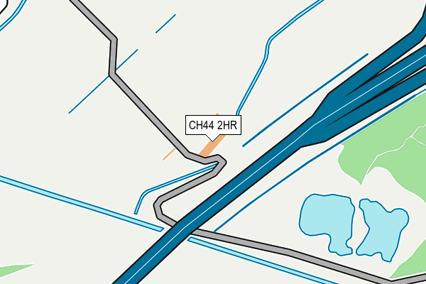
CH44 2HR is located in the Leasowe and Moreton East electoral ward, within the metropolitan district of Wirral and the English Parliamentary constituency of Wallasey. The Sub Integrated Care Board (ICB) Location is NHS Cheshire and Merseyside ICB - 12F and the police force is Merseyside. This postcode has been in use since June 1999.


GetTheData
Source: OS OpenMap – Local (Ordnance Survey)
Source: OS VectorMap District (Ordnance Survey)
Licence: Open Government Licence (requires attribution)
| Easting | 328247 |
| Northing | 391106 |
| Latitude | 53.411864 |
| Longitude | -3.080931 |
GetTheData
Source: Open Postcode Geo
Licence: Open Government Licence
| Country | England |
| Postcode District | CH44 |
| ➜ CH44 open data dashboard ➜ See where CH44 is on a map | |
GetTheData
Source: Land Registry Price Paid Data
Licence: Open Government Licence
Elevation or altitude of CH44 2HR as distance above sea level:
| Metres | Feet | |
|---|---|---|
| Elevation | 10m | 33ft |
Elevation is measured from the approximate centre of the postcode, to the nearest point on an OS contour line from OS Terrain 50, which has contour spacing of ten vertical metres.
➜ How high above sea level am I? Find the elevation of your current position using your device's GPS.
GetTheData
Source: Open Postcode Elevation
Licence: Open Government Licence
| Ward | Leasowe And Moreton East |
| Constituency | Wallasey |
GetTheData
Source: ONS Postcode Database
Licence: Open Government Licence
| June 2022 | Robbery | On or near Scoresby Road | 412m |
| June 2022 | Anti-social behaviour | On or near Scoresby Road | 412m |
| June 2022 | Public order | On or near Scoresby Road | 412m |
| ➜ Get more crime data in our Crime section | |||
GetTheData
Source: data.police.uk
Licence: Open Government Licence
| Ross Avenue (Grant Road) | Leasowe | 470m |
| Scoresby Road (Grant Road) | Leasowe | 480m |
| Grant Road (Ross Avenue) | Leasowe | 492m |
| Grant Road (Cameron Road) | Leasowe | 496m |
| Bidston Link Road (Fender Lane) | Bidston | 515m |
| Bidston Station | 0.3km |
| Leasowe Station | 1.3km |
| Wallasey Village Station | 1.5km |
GetTheData
Source: NaPTAN
Licence: Open Government Licence
GetTheData
Source: ONS Postcode Database
Licence: Open Government Licence


➜ Get more ratings from the Food Standards Agency
GetTheData
Source: Food Standards Agency
Licence: FSA terms & conditions
| Last Collection | |||
|---|---|---|---|
| Location | Mon-Fri | Sat | Distance |
| Leasowe Post Office | 17:11 | 12:00 | 1,445m |
| Saughall Bridge Road | 17:15 | 12:00 | 1,447m |
| Lynhurst Road | 17:15 | 12:00 | 1,644m |
GetTheData
Source: Dracos
Licence: Creative Commons Attribution-ShareAlike
| Facility | Distance |
|---|---|
| Bidston Golf Club Bidston Link Road, Wallasey Golf | 0m |
| Puregym (Wirral Bidston Moss) Bidston Moss, Wallasey Health and Fitness Gym | 464m |
| Leasowe Road Playing Field Heyes Drive, Wallasey Grass Pitches | 721m |
GetTheData
Source: Active Places
Licence: Open Government Licence
| School | Phase of Education | Distance |
|---|---|---|
| Leasowe Primary School Oxley Avenue, Leasowe, Wirral, CH46 1RU | Primary | 606m |
| Castleway Nursery School Castleway North, Moreton, Wirral, CH46 1RN | Nursery | 712m |
| Bidston Village CofE (Controlled) Primary School Ballantyne Drive, Bidston, Prenton, CH43 7XG | Primary | 761m |
GetTheData
Source: Edubase
Licence: Open Government Licence
| Risk of CH44 2HR flooding from rivers and sea | Very Low |
| ➜ CH44 2HR flood map | |
GetTheData
Source: Open Flood Risk by Postcode
Licence: Open Government Licence
The below table lists the International Territorial Level (ITL) codes (formerly Nomenclature of Territorial Units for Statistics (NUTS) codes) and Local Administrative Units (LAU) codes for CH44 2HR:
| ITL 1 Code | Name |
|---|---|
| TLD | North West (England) |
| ITL 2 Code | Name |
| TLD7 | Merseyside |
| ITL 3 Code | Name |
| TLD74 | Wirral |
| LAU 1 Code | Name |
| E08000015 | Wirral |
GetTheData
Source: ONS Postcode Directory
Licence: Open Government Licence
The below table lists the Census Output Area (OA), Lower Layer Super Output Area (LSOA), and Middle Layer Super Output Area (MSOA) for CH44 2HR:
| Code | Name | |
|---|---|---|
| OA | E00036493 | |
| LSOA | E01007210 | Wirral 006C |
| MSOA | E02001472 | Wirral 006 |
GetTheData
Source: ONS Postcode Directory
Licence: Open Government Licence
| CH46 1QF | Scoresby Road | 374m |
| CH46 1RR | Mackenzie Road | 390m |
| CH46 1QB | Scoresby Road | 428m |
| CH46 2RZ | Grant Road | 430m |
| CH46 1RT | Mackenzie Road | 442m |
| CH46 2RY | Grant Road | 470m |
| CH46 2RX | Grant Road | 474m |
| CH46 1RX | Boyd Close | 498m |
| CH46 2SB | Ross Avenue | 512m |
| CH46 2RU | Grant Road | 516m |
GetTheData
Source: Open Postcode Geo; Land Registry Price Paid Data
Licence: Open Government Licence