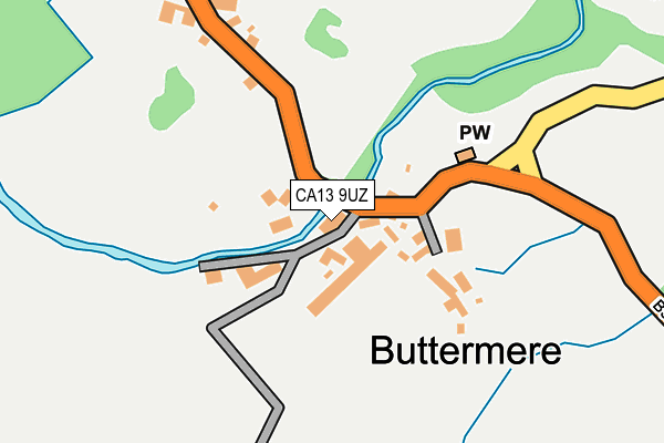
CA13 9UZ is located in the Bothel and Wharrels electoral ward, within the unitary authority of Cumberland and the English Parliamentary constituency of Copeland. The Sub Integrated Care Board (ICB) Location is NHS North East and North Cumbria ICB - 01H and the police force is Cumbria. This postcode has been in use since January 1980.


GetTheData
Source: OS OpenMap – Local (Ordnance Survey)
Source: OS VectorMap District (Ordnance Survey)
Licence: Open Government Licence (requires attribution)
| Easting | 317481 |
| Northing | 516968 |
| Latitude | 54.541230 |
| Longitude | -3.276994 |
GetTheData
Source: Open Postcode Geo
Licence: Open Government Licence
| Country | England |
| Postcode District | CA13 |
| ➜ CA13 open data dashboard ➜ See where CA13 is on a map ➜ Where is Buttermere? | |
GetTheData
Source: Land Registry Price Paid Data
Licence: Open Government Licence
Elevation or altitude of CA13 9UZ as distance above sea level:
| Metres | Feet | |
|---|---|---|
| Elevation | 110m | 361ft |
Elevation is measured from the approximate centre of the postcode, to the nearest point on an OS contour line from OS Terrain 50, which has contour spacing of ten vertical metres.
➜ How high above sea level am I? Find the elevation of your current position using your device's GPS.
GetTheData
Source: Open Postcode Elevation
Licence: Open Government Licence
| Ward | Bothel And Wharrels |
| Constituency | Copeland |
GetTheData
Source: ONS Postcode Database
Licence: Open Government Licence
| April 2023 | Violence and sexual offences | On or near Parking Area | 200m |
| May 2022 | Public order | On or near Buttermere | 174m |
| May 2022 | Other theft | On or near Buttermere | 174m |
| ➜ Get more crime data in our Crime section | |||
GetTheData
Source: data.police.uk
Licence: Open Government Licence
| The Fish Hotel (Unnamed Road) | Buttermere | 46m |
| Youth Hostel (B5289) | Buttermere | 322m |
| Youth Hostel (B5289) | Buttermere | 332m |
| Dalegarth (B5289) | Hassness | 1,616m |
| Dalegarth Guest House (B5289) | Hassness | 1,629m |
GetTheData
Source: NaPTAN
Licence: Open Government Licence
GetTheData
Source: ONS Postcode Database
Licence: Open Government Licence


➜ Get more ratings from the Food Standards Agency
GetTheData
Source: Food Standards Agency
Licence: FSA terms & conditions
| Last Collection | |||
|---|---|---|---|
| Location | Mon-Fri | Sat | Distance |
| Church Brow Buttermere | 12:30 | 10:15 | 34m |
| Gatesgarth | 12:30 | 10:15 | 2,758m |
| Kirkstile | 12:30 | 10:00 | 5,210m |
GetTheData
Source: Dracos
Licence: Creative Commons Attribution-ShareAlike
| Risk of CA13 9UZ flooding from rivers and sea | Medium |
| ➜ CA13 9UZ flood map | |
GetTheData
Source: Open Flood Risk by Postcode
Licence: Open Government Licence
The below table lists the International Territorial Level (ITL) codes (formerly Nomenclature of Territorial Units for Statistics (NUTS) codes) and Local Administrative Units (LAU) codes for CA13 9UZ:
| ITL 1 Code | Name |
|---|---|
| TLD | North West (England) |
| ITL 2 Code | Name |
| TLD1 | Cumbria |
| ITL 3 Code | Name |
| TLD11 | West Cumbria |
| LAU 1 Code | Name |
| E07000026 | Allerdale |
GetTheData
Source: ONS Postcode Directory
Licence: Open Government Licence
The below table lists the Census Output Area (OA), Lower Layer Super Output Area (LSOA), and Middle Layer Super Output Area (MSOA) for CA13 9UZ:
| Code | Name | |
|---|---|---|
| OA | E00096473 | |
| LSOA | E01019090 | Allerdale 007E |
| MSOA | E02003971 | Allerdale 007 |
GetTheData
Source: ONS Postcode Directory
Licence: Open Government Licence
| CA13 9XA | 477m | |
| CA13 9UY | 3992m | |
| CA13 0RU | 5345m | |
| CA13 9UX | 5639m | |
| CA13 0RS | 5651m | |
| CA13 0RR | 6106m | |
| CA12 5TS | 6343m | |
| CA12 5TU | 6454m | |
| CA13 9UD | 6770m | |
| CA13 0RP | 7226m |
GetTheData
Source: Open Postcode Geo; Land Registry Price Paid Data
Licence: Open Government Licence