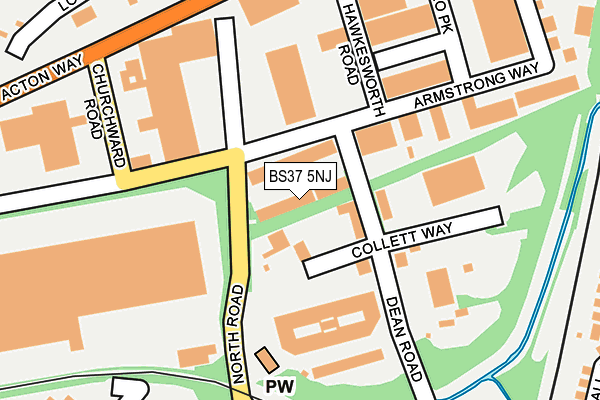
BS37 5NJ lies on Dean Court in Yate, Bristol. BS37 5NJ is located in the Frampton Cotterell electoral ward, within the unitary authority of South Gloucestershire and the English Parliamentary constituency of Thornbury and Yate. The Sub Integrated Care Board (ICB) Location is NHS Bristol, North Somerset and South Gloucestershire ICB - 15C and the police force is Avon and Somerset. This postcode has been in use since December 1997.


GetTheData
Source: OS OpenMap – Local (Ordnance Survey)
Source: OS VectorMap District (Ordnance Survey)
Licence: Open Government Licence (requires attribution)
| Easting | 370005 |
| Northing | 183233 |
| Latitude | 51.547186 |
| Longitude | -2.433954 |
GetTheData
Source: Open Postcode Geo
Licence: Open Government Licence
| Street | Dean Court |
| Locality | Yate |
| Town/City | Bristol |
| Country | England |
| Postcode District | BS37 |
| ➜ BS37 open data dashboard ➜ See where BS37 is on a map ➜ Where is Yate? | |
GetTheData
Source: Land Registry Price Paid Data
Licence: Open Government Licence
Elevation or altitude of BS37 5NJ as distance above sea level:
| Metres | Feet | |
|---|---|---|
| Elevation | 70m | 230ft |
Elevation is measured from the approximate centre of the postcode, to the nearest point on an OS contour line from OS Terrain 50, which has contour spacing of ten vertical metres.
➜ How high above sea level am I? Find the elevation of your current position using your device's GPS.
GetTheData
Source: Open Postcode Elevation
Licence: Open Government Licence
| Ward | Frampton Cotterell |
| Constituency | Thornbury And Yate |
GetTheData
Source: ONS Postcode Database
Licence: Open Government Licence
| December 2023 | Violence and sexual offences | On or near Whitley Close | 355m |
| October 2023 | Violence and sexual offences | On or near Whitley Close | 355m |
| October 2023 | Possession of weapons | On or near Whitley Close | 355m |
| ➜ Get more crime data in our Crime section | |||
GetTheData
Source: data.police.uk
Licence: Open Government Licence
| North Road (Goose Green Way) | Yate | 225m |
| North Road (Goose Green Way) | Yate | 235m |
| Broad Lane (North Road) | Engine Common | 348m |
| Broad Lane (North Road) | Engine Common | 355m |
| Armstrong Way (Iron Acton Way) | Yate | 532m |
| Yate Station | 0.7km |
GetTheData
Source: NaPTAN
Licence: Open Government Licence
Estimated total energy consumption in BS37 5NJ by fuel type, 2015.
| Consumption (kWh) | 123,541 |
|---|---|
| Meter count | 9 |
| Mean (kWh/meter) | 13,727 |
| Median (kWh/meter) | 8,567 |
GetTheData
Source: Postcode level gas estimates: 2015 (experimental)
Source: Postcode level electricity estimates: 2015 (experimental)
Licence: Open Government Licence
GetTheData
Source: ONS Postcode Database
Licence: Open Government Licence

➜ Get more ratings from the Food Standards Agency
GetTheData
Source: Food Standards Agency
Licence: FSA terms & conditions
| Last Collection | |||
|---|---|---|---|
| Location | Mon-Fri | Sat | Distance |
| Dean Road (Yate) | 16:45 | 09:00 | 88m |
| Stover Trading Estate | 18:30 | 396m | |
| North Road Post Office | 17:00 | 11:00 | 507m |
GetTheData
Source: Dracos
Licence: Creative Commons Attribution-ShareAlike
| Facility | Distance |
|---|---|
| Yate Town Football Club Lodge Road, Yate, Bristol Grass Pitches | 361m |
| Brimsham Green School Broad Lane, Yate, Bristol Grass Pitches, Sports Hall, Studio | 836m |
| Yate Outdoor Sports Complex Broad Lane, Yate, Bristol Athletics, Grass Pitches, Artificial Grass Pitch, Sports Hall | 934m |
GetTheData
Source: Active Places
Licence: Open Government Licence
| School | Phase of Education | Distance |
|---|---|---|
| North Road Community Primary School North Road, Yate, Bristol, BS37 7LQ | Primary | 511m |
| Tyndale Primary School Tyndale Avenue, Yate, BS37 5EX | Primary | 770m |
| Vinney Green Secure Unit Care of: South Gloucestershire Council, Badminton Road, Yate, Bristol, BS37 5AF | Not applicable | 807m |
GetTheData
Source: Edubase
Licence: Open Government Licence
The below table lists the International Territorial Level (ITL) codes (formerly Nomenclature of Territorial Units for Statistics (NUTS) codes) and Local Administrative Units (LAU) codes for BS37 5NJ:
| ITL 1 Code | Name |
|---|---|
| TLK | South West (England) |
| ITL 2 Code | Name |
| TLK1 | Gloucestershire, Wiltshire and Bath/Bristol area |
| ITL 3 Code | Name |
| TLK12 | Bath and North East Somerset, North Somerset and South Gloucestershire |
| LAU 1 Code | Name |
| E06000025 | South Gloucestershire |
GetTheData
Source: ONS Postcode Directory
Licence: Open Government Licence
The below table lists the Census Output Area (OA), Lower Layer Super Output Area (LSOA), and Middle Layer Super Output Area (MSOA) for BS37 5NJ:
| Code | Name | |
|---|---|---|
| OA | E00075432 | |
| LSOA | E01014929 | South Gloucestershire 003C |
| MSOA | E02003092 | South Gloucestershire 003 |
GetTheData
Source: ONS Postcode Directory
Licence: Open Government Licence
| BS37 5NG | Armstrong Way | 98m |
| BS37 5NH | Dean Road | 141m |
| BS37 7LE | Lodge Road | 269m |
| BS37 7PR | North Road | 272m |
| BS37 7BE | Broad Lane | 317m |
| BS37 7LD | Broad Lane | 331m |
| BS37 5XX | Whitley Close | 342m |
| BS37 5XS | Parnall Crescent | 353m |
| BS37 5XT | Parnall Crescent | 399m |
| BS37 5ED | Celestine Road | 407m |
GetTheData
Source: Open Postcode Geo; Land Registry Price Paid Data
Licence: Open Government Licence