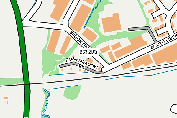
BS3 2UQ is located in the Bedminster electoral ward, within the unitary authority of Bristol, City of and the English Parliamentary constituency of Bristol South. The Sub Integrated Care Board (ICB) Location is NHS Bristol, North Somerset and South Gloucestershire ICB - 15C and the police force is Avon and Somerset. This postcode has been in use since January 1980.


GetTheData
Source: OS OpenMap – Local (Ordnance Survey)
Source: OS VectorMap District (Ordnance Survey)
Licence: Open Government Licence (requires attribution)
| Easting | 356215 |
| Northing | 170076 |
| Latitude | 51.427986 |
| Longitude | -2.631177 |
GetTheData
Source: Open Postcode Geo
Licence: Open Government Licence
| Country | England |
| Postcode District | BS3 |
| ➜ BS3 open data dashboard ➜ See where BS3 is on a map ➜ Where is Bristol? | |
GetTheData
Source: Land Registry Price Paid Data
Licence: Open Government Licence
Elevation or altitude of BS3 2UQ as distance above sea level:
| Metres | Feet | |
|---|---|---|
| Elevation | 20m | 66ft |
Elevation is measured from the approximate centre of the postcode, to the nearest point on an OS contour line from OS Terrain 50, which has contour spacing of ten vertical metres.
➜ How high above sea level am I? Find the elevation of your current position using your device's GPS.
GetTheData
Source: Open Postcode Elevation
Licence: Open Government Licence
| Ward | Bedminster |
| Constituency | Bristol South |
GetTheData
Source: ONS Postcode Database
Licence: Open Government Licence
| January 2024 | Burglary | On or near Brook Gate | 133m |
| October 2023 | Violence and sexual offences | On or near Brook Gate | 133m |
| October 2023 | Violence and sexual offences | On or near Brook Gate | 133m |
| ➜ Get more crime data in our Crime section | |||
GetTheData
Source: data.police.uk
Licence: Open Government Licence
| Langley Crescent | Ashton Vale | 291m |
| Risdale Road | Ashton Vale | 327m |
| Risdale Road | Ashton Vale | 331m |
| Risdale Road | Ashton Vale | 533m |
| Risdale Road (Ashton Drive) | Ashton Vale | 584m |
| Parson Street Station | 1.7km |
| Bedminster Station | 2.9km |
| Bristol Temple Meads Station | 4.2km |
GetTheData
Source: NaPTAN
Licence: Open Government Licence
GetTheData
Source: ONS Postcode Database
Licence: Open Government Licence


➜ Get more ratings from the Food Standards Agency
GetTheData
Source: Food Standards Agency
Licence: FSA terms & conditions
| Last Collection | |||
|---|---|---|---|
| Location | Mon-Fri | Sat | Distance |
| Ashton Drive | 17:15 | 12:00 | 556m |
| South Liberty Lane | 18:30 | 12:00 | 602m |
| Swiss Drive | 17:15 | 11:45 | 793m |
GetTheData
Source: Dracos
Licence: Creative Commons Attribution-ShareAlike
| Facility | Distance |
|---|---|
| Trojan Fitness South Liberty Lane, Bristol Health and Fitness Gym | 134m |
| City & County Of Bristol Indoor Bowls Club South Liberty Lane, Bristol Indoor Bowls | 155m |
| South Liberty Lane Playing Field Langley Crescent, Bristol Grass Pitches | 212m |
GetTheData
Source: Active Places
Licence: Open Government Licence
| School | Phase of Education | Distance |
|---|---|---|
| Ashton Vale Primary School Avebury Road, Ashton Vale, Bristol, BS3 2QG | Primary | 738m |
| Bedminster Down School Donald Road, Bedminster Down, Bristol, BS13 7DQ | Secondary | 1km |
| Cheddar Grove Primary School Cheddar Grove, Bedminster Down, Bristol, BS13 7EN | Primary | 1.1km |
GetTheData
Source: Edubase
Licence: Open Government Licence
| Risk of BS3 2UQ flooding from rivers and sea | Low |
| ➜ BS3 2UQ flood map | |
GetTheData
Source: Open Flood Risk by Postcode
Licence: Open Government Licence
The below table lists the International Territorial Level (ITL) codes (formerly Nomenclature of Territorial Units for Statistics (NUTS) codes) and Local Administrative Units (LAU) codes for BS3 2UQ:
| ITL 1 Code | Name |
|---|---|
| TLK | South West (England) |
| ITL 2 Code | Name |
| TLK1 | Gloucestershire, Wiltshire and Bath/Bristol area |
| ITL 3 Code | Name |
| TLK11 | Bristol, City of |
| LAU 1 Code | Name |
| E06000023 | Bristol, City of |
GetTheData
Source: ONS Postcode Directory
Licence: Open Government Licence
The below table lists the Census Output Area (OA), Lower Layer Super Output Area (LSOA), and Middle Layer Super Output Area (MSOA) for BS3 2UQ:
| Code | Name | |
|---|---|---|
| OA | E00073249 | |
| LSOA | E01014501 | Bristol 041A |
| MSOA | E02003052 | Bristol 041 |
GetTheData
Source: ONS Postcode Directory
Licence: Open Government Licence
| BS3 2TY | South Liberty Lane | 105m |
| BS3 2TN | South Liberty Lane | 210m |
| BS3 2RD | Risdale Road | 247m |
| BS3 2UN | Brookgate | 248m |
| BS3 2RE | Langley Crescent | 333m |
| BS3 2RF | Langley Crescent | 346m |
| BS3 2RH | Atyeo Close | 360m |
| BS3 2PZ | Ashton Drive | 361m |
| BS3 2RA | Risdale Road | 404m |
| BS3 2TJ | South Liberty Lane | 405m |
GetTheData
Source: Open Postcode Geo; Land Registry Price Paid Data
Licence: Open Government Licence