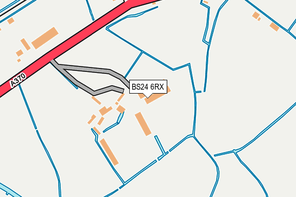
BS24 6RX is located in the Congresbury & Puxton electoral ward, within the unitary authority of North Somerset and the English Parliamentary constituency of Weston-Super-Mare. The Sub Integrated Care Board (ICB) Location is NHS Bristol, North Somerset and South Gloucestershire ICB - 15C and the police force is Avon and Somerset. This postcode has been in use since February 2006.


GetTheData
Source: OS OpenMap – Local (Ordnance Survey)
Source: OS VectorMap District (Ordnance Survey)
Licence: Open Government Licence (requires attribution)
| Easting | 340101 |
| Northing | 164233 |
| Latitude | 51.373976 |
| Longitude | -2.861942 |
GetTheData
Source: Open Postcode Geo
Licence: Open Government Licence
| Country | England |
| Postcode District | BS24 |
| ➜ BS24 open data dashboard ➜ See where BS24 is on a map ➜ Where is Hewish? | |
GetTheData
Source: Land Registry Price Paid Data
Licence: Open Government Licence
Elevation or altitude of BS24 6RX as distance above sea level:
| Metres | Feet | |
|---|---|---|
| Elevation | 10m | 33ft |
Elevation is measured from the approximate centre of the postcode, to the nearest point on an OS contour line from OS Terrain 50, which has contour spacing of ten vertical metres.
➜ How high above sea level am I? Find the elevation of your current position using your device's GPS.
GetTheData
Source: Open Postcode Elevation
Licence: Open Government Licence
| Ward | Congresbury & Puxton |
| Constituency | Weston-super-mare |
GetTheData
Source: ONS Postcode Database
Licence: Open Government Licence
| June 2022 | Public order | On or near Parking Area | 361m |
| June 2022 | Anti-social behaviour | On or near Parking Area | 361m |
| May 2022 | Criminal damage and arson | On or near A370 | 259m |
| ➜ Get more crime data in our Crime section | |||
GetTheData
Source: data.police.uk
Licence: Open Government Licence
| Full Quart | Hewish | 188m |
| Full Quart | Hewish | 227m |
| Palmers Elm (A370) | Hewish | 517m |
| Palmers Elm | Hewish | 548m |
| Puxton Lane (A370) | Hewish | 679m |
| Yatton Station | 3km |
| Worle Station | 3.8km |
GetTheData
Source: NaPTAN
Licence: Open Government Licence
GetTheData
Source: ONS Postcode Database
Licence: Open Government Licence


➜ Get more ratings from the Food Standards Agency
GetTheData
Source: Food Standards Agency
Licence: FSA terms & conditions
| Last Collection | |||
|---|---|---|---|
| Location | Mon-Fri | Sat | Distance |
| Puxton | 16:15 | 09:30 | 1,066m |
| Doubleton House | 16:30 | 08:00 | 2,245m |
| Kingston Seymour | 17:30 | 11:45 | 2,717m |
GetTheData
Source: Dracos
Licence: Creative Commons Attribution-ShareAlike
| Facility | Distance |
|---|---|
| St. Anne's Church Academy Bristol Road, Hewish, Weston-super-mare Grass Pitches | 380m |
| Chestnut Park Primary School Wheatear Road, Wheatear Road, Yatton, Bristol Grass Pitches | 3.2km |
| Yatton Rugby Football Club North End Road, Yatton, Bristol Grass Pitches | 3.2km |
GetTheData
Source: Active Places
Licence: Open Government Licence
| School | Phase of Education | Distance |
|---|---|---|
| St Anne's Church Academy Bristol Road, Hewish, 1 Scot Elm Drive, Weston Super Mare, BS24 6RT | Primary | 314m |
| St Georges Church School Pastures Avenue, St Georges, Weston-Super-Mare, BS22 7SA | Primary | 2.9km |
| Chestnut Park Primary 64 Wheatear Road, North End, Yatton, BS49 4FW | Primary | 3.2km |
GetTheData
Source: Edubase
Licence: Open Government Licence
| Risk of BS24 6RX flooding from rivers and sea | Low |
| ➜ BS24 6RX flood map | |
GetTheData
Source: Open Flood Risk by Postcode
Licence: Open Government Licence
The below table lists the International Territorial Level (ITL) codes (formerly Nomenclature of Territorial Units for Statistics (NUTS) codes) and Local Administrative Units (LAU) codes for BS24 6RX:
| ITL 1 Code | Name |
|---|---|
| TLK | South West (England) |
| ITL 2 Code | Name |
| TLK1 | Gloucestershire, Wiltshire and Bath/Bristol area |
| ITL 3 Code | Name |
| TLK12 | Bath and North East Somerset, North Somerset and South Gloucestershire |
| LAU 1 Code | Name |
| E06000024 | North Somerset |
GetTheData
Source: ONS Postcode Directory
Licence: Open Government Licence
The below table lists the Census Output Area (OA), Lower Layer Super Output Area (LSOA), and Middle Layer Super Output Area (MSOA) for BS24 6RX:
| Code | Name | |
|---|---|---|
| OA | E00074633 | |
| LSOA | E01014773 | North Somerset 014C |
| MSOA | E02003078 | North Somerset 014 |
GetTheData
Source: ONS Postcode Directory
Licence: Open Government Licence
| BS24 6RU | 83m | |
| BS24 6SF | 296m | |
| BS24 6RT | 318m | |
| BS24 6SE | 378m | |
| BS24 6RS | 532m | |
| BS24 6TA | Puxton Lane | 551m |
| BS24 6RZ | 569m | |
| BS24 6RN | Palmers Elm | 667m |
| BS24 6RW | Southview Cottages | 684m |
| BS24 6TR | 774m |
GetTheData
Source: Open Postcode Geo; Land Registry Price Paid Data
Licence: Open Government Licence