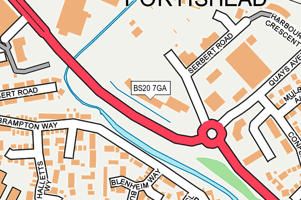
BS20 7GA is located in the Portishead East electoral ward, within the unitary authority of North Somerset and the English Parliamentary constituency of North Somerset. The Sub Integrated Care Board (ICB) Location is NHS Bristol, North Somerset and South Gloucestershire ICB - 15C and the police force is Avon and Somerset. This postcode has been in use since June 2000.


GetTheData
Source: OS OpenMap – Local (Ordnance Survey)
Source: OS VectorMap District (Ordnance Survey)
Licence: Open Government Licence (requires attribution)
| Easting | 347168 |
| Northing | 176176 |
| Latitude | 51.482058 |
| Longitude | -2.762204 |
GetTheData
Source: Open Postcode Geo
Licence: Open Government Licence
| Country | England |
| Postcode District | BS20 |
| ➜ BS20 open data dashboard ➜ See where BS20 is on a map ➜ Where is Portishead? | |
GetTheData
Source: Land Registry Price Paid Data
Licence: Open Government Licence
Elevation or altitude of BS20 7GA as distance above sea level:
| Metres | Feet | |
|---|---|---|
| Elevation | 10m | 33ft |
Elevation is measured from the approximate centre of the postcode, to the nearest point on an OS contour line from OS Terrain 50, which has contour spacing of ten vertical metres.
➜ How high above sea level am I? Find the elevation of your current position using your device's GPS.
GetTheData
Source: Open Postcode Elevation
Licence: Open Government Licence
| Ward | Portishead East |
| Constituency | North Somerset |
GetTheData
Source: ONS Postcode Database
Licence: Open Government Licence
| June 2022 | Shoplifting | On or near Serbert Road | 128m |
| June 2022 | Shoplifting | On or near Harbour Crescent | 265m |
| June 2022 | Other theft | On or near Harbour Crescent | 265m |
| ➜ Get more crime data in our Crime section | |||
GetTheData
Source: data.police.uk
Licence: Open Government Licence
| Serbert Way | Middle Bridge | 81m |
| Richmond Close | Middle Bridge | 113m |
| Blenheim Way | Middle Bridge | 125m |
| Blenheim Way (Brampton Way) | Middle Bridge | 129m |
| Richmond Close (Brampton Way) | Middle Bridge | 134m |
| Avonmouth Station | 4.8km |
| St Andrews Road Station | 5.7km |
GetTheData
Source: NaPTAN
Licence: Open Government Licence
GetTheData
Source: ONS Postcode Database
Licence: Open Government Licence


➜ Get more ratings from the Food Standards Agency
GetTheData
Source: Food Standards Agency
Licence: FSA terms & conditions
| Last Collection | |||
|---|---|---|---|
| Location | Mon-Fri | Sat | Distance |
| New Dock Road | 18:00 | 11:15 | 254m |
| Brampton Way | 17:00 | 11:30 | 368m |
| Harbour Road | 16:30 | 11:00 | 395m |
GetTheData
Source: Dracos
Licence: Creative Commons Attribution-ShareAlike
| Facility | Distance |
|---|---|
| The Hub Old Mill Road, Portishead, Bristol Health and Fitness Gym, Studio | 236m |
| Puregym (Portishead) Wyndham Way, Portishead, Bristol Health and Fitness Gym | 247m |
| St Peter's C Of E Primary School Halletts Way, Portishead, Bristol Grass Pitches | 338m |
GetTheData
Source: Active Places
Licence: Open Government Licence
| School | Phase of Education | Distance |
|---|---|---|
| St Peter's Church of England Primary School Hallett's Way, Portishead, BS20 6BT | Primary | 342m |
| Trinity Anglican-Methodist Primary School Marjoram Way, Portishead, Bristol, BS20 7JF | Primary | 647m |
| St Joseph's Catholic Primary School Bristol Road, Bristol Rd, Portishead, BS20 6QB | Primary | 677m |
GetTheData
Source: Edubase
Licence: Open Government Licence
| Risk of BS20 7GA flooding from rivers and sea | Very Low |
| ➜ BS20 7GA flood map | |
GetTheData
Source: Open Flood Risk by Postcode
Licence: Open Government Licence
The below table lists the International Territorial Level (ITL) codes (formerly Nomenclature of Territorial Units for Statistics (NUTS) codes) and Local Administrative Units (LAU) codes for BS20 7GA:
| ITL 1 Code | Name |
|---|---|
| TLK | South West (England) |
| ITL 2 Code | Name |
| TLK1 | Gloucestershire, Wiltshire and Bath/Bristol area |
| ITL 3 Code | Name |
| TLK12 | Bath and North East Somerset, North Somerset and South Gloucestershire |
| LAU 1 Code | Name |
| E06000024 | North Somerset |
GetTheData
Source: ONS Postcode Directory
Licence: Open Government Licence
The below table lists the Census Output Area (OA), Lower Layer Super Output Area (LSOA), and Middle Layer Super Output Area (MSOA) for BS20 7GA:
| Code | Name | |
|---|---|---|
| OA | E00074730 | |
| LSOA | E01014792 | North Somerset 003B |
| MSOA | E02003067 | North Somerset 003 |
GetTheData
Source: ONS Postcode Directory
Licence: Open Government Licence
| BS20 7GF | Serbert Road | 135m |
| BS20 6YX | Brampton Way | 152m |
| BS20 6YY | Blenheim Way | 161m |
| BS20 6SZ | Richmond Close | 192m |
| BS20 7GG | Serbert Road | 205m |
| BS20 6XZ | Bladen Close | 209m |
| BS20 6XY | Burford Close | 223m |
| BS20 6YT | Brampton Way | 225m |
| BS20 7BY | Wyndham Way | 247m |
| BS20 6YU | Clayton Close | 258m |
GetTheData
Source: Open Postcode Geo; Land Registry Price Paid Data
Licence: Open Government Licence