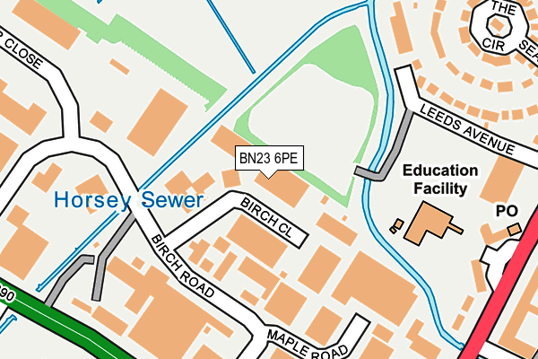
BN23 6PE is located in the St Anthony's electoral ward, within the local authority district of Eastbourne and the English Parliamentary constituency of Eastbourne. The Sub Integrated Care Board (ICB) Location is NHS Sussex ICB - 97R and the police force is Sussex. This postcode has been in use since January 1980.


GetTheData
Source: OS OpenMap – Local (Ordnance Survey)
Source: OS VectorMap District (Ordnance Survey)
Licence: Open Government Licence (requires attribution)
| Easting | 562557 |
| Northing | 101434 |
| Latitude | 50.789682 |
| Longitude | 0.304939 |
GetTheData
Source: Open Postcode Geo
Licence: Open Government Licence
| Country | England |
| Postcode District | BN23 |
| ➜ BN23 open data dashboard ➜ See where BN23 is on a map ➜ Where is Eastbourne? | |
GetTheData
Source: Land Registry Price Paid Data
Licence: Open Government Licence
Elevation or altitude of BN23 6PE as distance above sea level:
| Metres | Feet | |
|---|---|---|
| Elevation | 10m | 33ft |
Elevation is measured from the approximate centre of the postcode, to the nearest point on an OS contour line from OS Terrain 50, which has contour spacing of ten vertical metres.
➜ How high above sea level am I? Find the elevation of your current position using your device's GPS.
GetTheData
Source: Open Postcode Elevation
Licence: Open Government Licence
| Ward | St Anthony's |
| Constituency | Eastbourne |
GetTheData
Source: ONS Postcode Database
Licence: Open Government Licence
| January 2024 | Violence and sexual offences | On or near Supermarket | 422m |
| January 2024 | Shoplifting | On or near Supermarket | 422m |
| January 2024 | Shoplifting | On or near Supermarket | 422m |
| ➜ Get more crime data in our Crime section | |||
GetTheData
Source: data.police.uk
Licence: Open Government Licence
| Bus Garage (Birch Road) | Roselands | 112m |
| Brewers (Birch Road) | Roselands | 222m |
| Hawthorn Road | Roselands | 277m |
| Winston Crescent (St Anthony's Avenue) | Langney | 326m |
| Queen's Crescent (St Anthony's Avenue) | Langney | 347m |
| Hampden Park (Sussex) Station | 2km |
| Eastbourne Station | 2.8km |
| Pevensey & Westham Station | 3.2km |
GetTheData
Source: NaPTAN
Licence: Open Government Licence
GetTheData
Source: ONS Postcode Database
Licence: Open Government Licence

➜ Get more ratings from the Food Standards Agency
GetTheData
Source: Food Standards Agency
Licence: FSA terms & conditions
| Last Collection | |||
|---|---|---|---|
| Location | Mon-Fri | Sat | Distance |
| St Anthonys Post Office | 17:30 | 12:00 | 338m |
| Tesco | 17:00 | 12:00 | 414m |
| Norway Road | 17:30 | 11:00 | 672m |
GetTheData
Source: Dracos
Licence: Creative Commons Attribution-ShareAlike
| Facility | Distance |
|---|---|
| Performance Fitness Maple Road, Eastbourne Health and Fitness Gym, Studio | 307m |
| Princes Park (Eastbourne) Royal Parade, Eastbourne Grass Pitches | 912m |
| St Richards Church Hall Etchingham Road, Eastbourne Sports Hall | 959m |
GetTheData
Source: Active Places
Licence: Open Government Licence
| School | Phase of Education | Distance |
|---|---|---|
| Tollgate Community Junior School Winston Crescent, Seaside, Eastbourne, BN23 6NL | Primary | 262m |
| St Andrew's Church of England Infants School Winchelsea Road, Eastbourne, BN22 7PP | Primary | 771m |
| The Haven Church of England Methodist Primary School Atlantic Drive, Sovereign Harbour South, Eastbourne, BN23 5SW | Primary | 1km |
GetTheData
Source: Edubase
Licence: Open Government Licence
| Risk of BN23 6PE flooding from rivers and sea | Low |
| ➜ BN23 6PE flood map | |
GetTheData
Source: Open Flood Risk by Postcode
Licence: Open Government Licence
The below table lists the International Territorial Level (ITL) codes (formerly Nomenclature of Territorial Units for Statistics (NUTS) codes) and Local Administrative Units (LAU) codes for BN23 6PE:
| ITL 1 Code | Name |
|---|---|
| TLJ | South East (England) |
| ITL 2 Code | Name |
| TLJ2 | Surrey, East and West Sussex |
| ITL 3 Code | Name |
| TLJ22 | East Sussex CC |
| LAU 1 Code | Name |
| E07000061 | Eastbourne |
GetTheData
Source: ONS Postcode Directory
Licence: Open Government Licence
The below table lists the Census Output Area (OA), Lower Layer Super Output Area (LSOA), and Middle Layer Super Output Area (MSOA) for BN23 6PE:
| Code | Name | |
|---|---|---|
| OA | E00106388 | |
| LSOA | E01020951 | Eastbourne 013B |
| MSOA | E02006857 | Eastbourne 013 |
GetTheData
Source: ONS Postcode Directory
Licence: Open Government Licence
| BN23 6PD | Birch Road | 100m |
| BN23 6PH | Birch Industrial Estate | 181m |
| BN23 6NY | Maple Road | 243m |
| BN23 6LG | Rotunda Road | 245m |
| BN23 6NL | Winston Crescent | 288m |
| BN23 6NN | Tollgate Gardens | 299m |
| BN23 6LQ | Rotunda Road | 302m |
| BN23 6NJ | Seaside | 319m |
| BN23 6LF | Rotunda Road | 333m |
| BN23 6LL | The Circus | 339m |
GetTheData
Source: Open Postcode Geo; Land Registry Price Paid Data
Licence: Open Government Licence