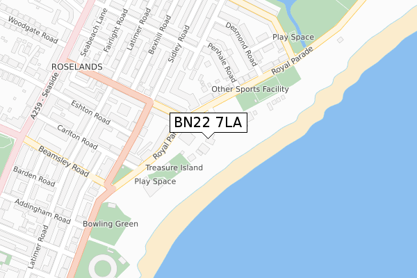
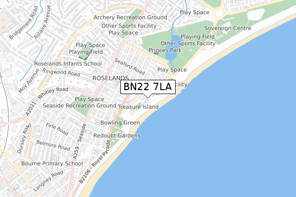
BN22 7LA is located in the Devonshire electoral ward, within the local authority district of Eastbourne and the English Parliamentary constituency of Eastbourne. The Sub Integrated Care Board (ICB) Location is NHS Sussex ICB - 97R and the police force is Sussex. This postcode has been in use since January 1980.


GetTheData
Source: OS Open Zoomstack (Ordnance Survey)
Licence: Open Government Licence (requires attribution)
Attribution: Contains OS data © Crown copyright and database right 2024
Source: Open Postcode Geo
Licence: Open Government Licence (requires attribution)
Attribution: Contains OS data © Crown copyright and database right 2024; Contains Royal Mail data © Royal Mail copyright and database right 2024; Source: Office for National Statistics licensed under the Open Government Licence v.3.0
| Easting | 562551 |
| Northing | 99988 |
| Latitude | 50.776696 |
| Longitude | 0.304186 |
GetTheData
Source: Open Postcode Geo
Licence: Open Government Licence
| Country | England |
| Postcode District | BN22 |
| ➜ BN22 open data dashboard ➜ See where BN22 is on a map ➜ Where is Eastbourne? | |
GetTheData
Source: Land Registry Price Paid Data
Licence: Open Government Licence
Elevation or altitude of BN22 7LA as distance above sea level:
| Metres | Feet | |
|---|---|---|
| Elevation | 10m | 33ft |
Elevation is measured from the approximate centre of the postcode, to the nearest point on an OS contour line from OS Terrain 50, which has contour spacing of ten vertical metres.
➜ How high above sea level am I? Find the elevation of your current position using your device's GPS.
GetTheData
Source: Open Postcode Elevation
Licence: Open Government Licence
| Ward | Devonshire |
| Constituency | Eastbourne |
GetTheData
Source: ONS Postcode Database
Licence: Open Government Licence
| December 2023 | Violence and sexual offences | On or near Channel View Road | 362m |
| December 2023 | Vehicle crime | On or near Channel View Road | 362m |
| December 2023 | Anti-social behaviour | On or near Channel View Road | 362m |
| ➜ Get more crime data in our Crime section | |||
GetTheData
Source: data.police.uk
Licence: Open Government Licence
| Fishermans Club (Royal Parade) | Roselands | 77m |
| Fishermans Club (Royal Parade) | Roselands | 94m |
| Desmond Road (Royal Parade) | Roselands | 258m |
| Desmond Road (Royal Parade) | Roselands | 258m |
| Ridings Hotel (Royal Parade) | Roselands | 293m |
| Eastbourne Station | 1.8km |
| Hampden Park (Sussex) Station | 2.8km |
| Pevensey & Westham Station | 4.6km |
GetTheData
Source: NaPTAN
Licence: Open Government Licence
GetTheData
Source: ONS Postcode Database
Licence: Open Government Licence


➜ Get more ratings from the Food Standards Agency
GetTheData
Source: Food Standards Agency
Licence: FSA terms & conditions
| Last Collection | |||
|---|---|---|---|
| Location | Mon-Fri | Sat | Distance |
| Beamsley Road | 17:15 | 11:00 | 437m |
| Redoubt Road | 17:30 | 11:00 | 458m |
| Norway Road | 17:30 | 11:00 | 774m |
GetTheData
Source: Dracos
Licence: Creative Commons Attribution-ShareAlike
| Facility | Distance |
|---|---|
| Fishermans Green Royal Parade, Eastbourne Outdoor Tennis Courts | 209m |
| Princes Park (The Oval) Channel View Road, Eastbourne Grass Pitches | 482m |
| Seaside Recreation Ground Gilbert Road, Eastbourne Grass Pitches | 574m |
GetTheData
Source: Active Places
Licence: Open Government Licence
| School | Phase of Education | Distance |
|---|---|---|
| St Andrew's Church of England Infants School Winchelsea Road, Eastbourne, BN22 7PP | Primary | 675m |
| Roselands Infants' School Woodgate Road, Eastbourne, BN22 8PD | Primary | 754m |
| Anderida Learning Centre Neville Mews, 6a Neville Road, Eastbourne, BN22 8HR | Not applicable | 898m |
GetTheData
Source: Edubase
Licence: Open Government Licence
| Risk of BN22 7LA flooding from rivers and sea | Low |
| ➜ BN22 7LA flood map | |
GetTheData
Source: Open Flood Risk by Postcode
Licence: Open Government Licence
The below table lists the International Territorial Level (ITL) codes (formerly Nomenclature of Territorial Units for Statistics (NUTS) codes) and Local Administrative Units (LAU) codes for BN22 7LA:
| ITL 1 Code | Name |
|---|---|
| TLJ | South East (England) |
| ITL 2 Code | Name |
| TLJ2 | Surrey, East and West Sussex |
| ITL 3 Code | Name |
| TLJ22 | East Sussex CC |
| LAU 1 Code | Name |
| E07000061 | Eastbourne |
GetTheData
Source: ONS Postcode Directory
Licence: Open Government Licence
The below table lists the Census Output Area (OA), Lower Layer Super Output Area (LSOA), and Middle Layer Super Output Area (MSOA) for BN22 7LA:
| Code | Name | |
|---|---|---|
| OA | E00106137 | |
| LSOA | E01020910 | Eastbourne 010A |
| MSOA | E02004365 | Eastbourne 010 |
GetTheData
Source: ONS Postcode Directory
Licence: Open Government Licence
| BN22 7GB | Royal Parade | 97m |
| BN22 7HA | Beach Road | 130m |
| BN22 7JY | Royal Parade | 133m |
| BN22 7AD | Royal Parade | 152m |
| BN22 7JQ | Wannock Road | 153m |
| BN22 7HB | Sidley Road | 163m |
| BN22 7JT | Wannock Road | 177m |
| BN22 7JN | Sidley Road | 184m |
| BN22 7JX | Penhale Road | 192m |
| BN22 7EZ | Beach Road | 195m |
GetTheData
Source: Open Postcode Geo; Land Registry Price Paid Data
Licence: Open Government Licence