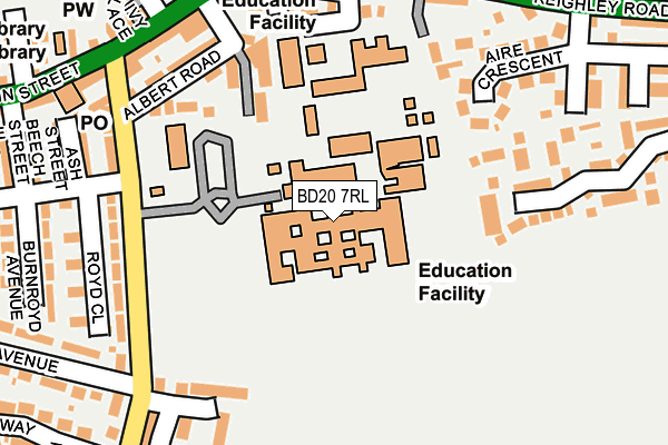
BD20 7RL is located in the Glusburn, Cross Hills & Sutton-in-Craven electoral ward, within the unitary authority of North Yorkshire and the English Parliamentary constituency of Skipton and Ripon. The Sub Integrated Care Board (ICB) Location is NHS West Yorkshire ICB - 36J and the police force is North Yorkshire. This postcode has been in use since January 1980.


GetTheData
Source: OS OpenMap – Local (Ordnance Survey)
Source: OS VectorMap District (Ordnance Survey)
Licence: Open Government Licence (requires attribution)
| Easting | 400829 |
| Northing | 444837 |
| Latitude | 53.899701 |
| Longitude | -1.988869 |
GetTheData
Source: Open Postcode Geo
Licence: Open Government Licence
| Country | England |
| Postcode District | BD20 |
| ➜ BD20 open data dashboard ➜ See where BD20 is on a map ➜ Where is Cross Hills? | |
GetTheData
Source: Land Registry Price Paid Data
Licence: Open Government Licence
Elevation or altitude of BD20 7RL as distance above sea level:
| Metres | Feet | |
|---|---|---|
| Elevation | 100m | 328ft |
Elevation is measured from the approximate centre of the postcode, to the nearest point on an OS contour line from OS Terrain 50, which has contour spacing of ten vertical metres.
➜ How high above sea level am I? Find the elevation of your current position using your device's GPS.
GetTheData
Source: Open Postcode Elevation
Licence: Open Government Licence
| Ward | Glusburn, Cross Hills & Sutton-in-craven |
| Constituency | Skipton And Ripon |
GetTheData
Source: ONS Postcode Database
Licence: Open Government Licence
| December 2023 | Violence and sexual offences | On or near Police Station | 438m |
| December 2023 | Violence and sexual offences | On or near Police Station | 438m |
| September 2023 | Shoplifting | On or near Parking Area | 291m |
| ➜ Get more crime data in our Crime section | |||
GetTheData
Source: data.police.uk
Licence: Open Government Licence
| South Craven School Grounds (East Avenue) | Cross Hills | 97m |
| South Craven School (East Avenue) | Cross Hills | 97m |
| South Craven School (Holme Lane) | Cross Hills | 182m |
| Victoria Road (Holme Lane) | Cross Hills | 192m |
| Boundary Avenue (Manse Way) | Cross Hills | 207m |
| Cononley Station | 2.5km |
| Steeton & Silsden Station | 2.9km |
GetTheData
Source: NaPTAN
Licence: Open Government Licence
GetTheData
Source: ONS Postcode Database
Licence: Open Government Licence


➜ Get more ratings from the Food Standards Agency
GetTheData
Source: Food Standards Agency
Licence: FSA terms & conditions
| Last Collection | |||
|---|---|---|---|
| Location | Mon-Fri | Sat | Distance |
| Priestbank Road | 17:00 | 10:30 | 1,072m |
| Eastburn P.o. Box | 17:15 | 11:45 | 1,322m |
| 2 Gamel View Steeton | 17:45 | 12:15 | 1,945m |
GetTheData
Source: Dracos
Licence: Creative Commons Attribution-ShareAlike
| Facility | Distance |
|---|---|
| South Craven School Holme Lane, Cross Hills, Keighley Health and Fitness Gym, Sports Hall, Grass Pitches, Studio, Artificial Grass Pitch | 0m |
| Cross Hills Tennis Club Keighley Road, Cross Hills, Keighley Outdoor Tennis Courts | 358m |
| Glusburn Community Primary School Colne Road, Glusburn, Keighley Grass Pitches | 530m |
GetTheData
Source: Active Places
Licence: Open Government Licence
| School | Phase of Education | Distance |
|---|---|---|
| South Craven School Holme Lane, Cross Hills, Keighley, BD20 7RL | Secondary | 0m |
| Sutton in Craven Church of England Voluntary Controlled Primary School Main Street, Sutton-in-Craven, Keighley, BD20 7JS | Primary | 495m |
| Glusburn Community Primary School Colne Road, Glusburn, Keighley, BD20 8PJ | Primary | 606m |
GetTheData
Source: Edubase
Licence: Open Government Licence
| Risk of BD20 7RL flooding from rivers and sea | Low |
| ➜ BD20 7RL flood map | |
GetTheData
Source: Open Flood Risk by Postcode
Licence: Open Government Licence
The below table lists the International Territorial Level (ITL) codes (formerly Nomenclature of Territorial Units for Statistics (NUTS) codes) and Local Administrative Units (LAU) codes for BD20 7RL:
| ITL 1 Code | Name |
|---|---|
| TLE | Yorkshire and The Humber |
| ITL 2 Code | Name |
| TLE2 | North Yorkshire |
| ITL 3 Code | Name |
| TLE22 | North Yorkshire CC |
| LAU 1 Code | Name |
| E07000163 | Craven |
GetTheData
Source: ONS Postcode Directory
Licence: Open Government Licence
The below table lists the Census Output Area (OA), Lower Layer Super Output Area (LSOA), and Middle Layer Super Output Area (MSOA) for BD20 7RL:
| Code | Name | |
|---|---|---|
| OA | E00140310 | |
| LSOA | E01027565 | Craven 008C |
| MSOA | E02005749 | Craven 008 |
GetTheData
Source: ONS Postcode Directory
Licence: Open Government Licence
| BD20 7LB | East Avenue | 127m |
| BD20 7LA | Rhodesia Street | 159m |
| BD20 7LD | South View | 196m |
| BD20 7RJ | Fieldhead Drive | 199m |
| BD20 7LH | Holmroyd Avenue | 200m |
| BD20 7LE | Albert Road | 209m |
| BD20 7RW | Aire Crescent | 210m |
| BD20 7LQ | Ashville Terrace | 214m |
| BD20 7RH | Prospect Street | 216m |
| BD20 8DG | Woodturners Close | 219m |
GetTheData
Source: Open Postcode Geo; Land Registry Price Paid Data
Licence: Open Government Licence