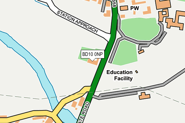
BD10 0NP is located in the Idle and Thackley electoral ward, within the metropolitan district of Bradford and the English Parliamentary constituency of Bradford East. The Sub Integrated Care Board (ICB) Location is NHS West Yorkshire ICB - 36J and the police force is West Yorkshire. This postcode has been in use since January 1980.


GetTheData
Source: OS OpenMap – Local (Ordnance Survey)
Source: OS VectorMap District (Ordnance Survey)
Licence: Open Government Licence (requires attribution)
| Easting | 419549 |
| Northing | 438130 |
| Latitude | 53.839056 |
| Longitude | -1.704404 |
GetTheData
Source: Open Postcode Geo
Licence: Open Government Licence
| Country | England |
| Postcode District | BD10 |
| ➜ BD10 open data dashboard ➜ See where BD10 is on a map ➜ Where is Bradford? | |
GetTheData
Source: Land Registry Price Paid Data
Licence: Open Government Licence
Elevation or altitude of BD10 0NP as distance above sea level:
| Metres | Feet | |
|---|---|---|
| Elevation | 60m | 197ft |
Elevation is measured from the approximate centre of the postcode, to the nearest point on an OS contour line from OS Terrain 50, which has contour spacing of ten vertical metres.
➜ How high above sea level am I? Find the elevation of your current position using your device's GPS.
GetTheData
Source: Open Postcode Elevation
Licence: Open Government Licence
| Ward | Idle And Thackley |
| Constituency | Bradford East |
GetTheData
Source: ONS Postcode Database
Licence: Open Government Licence
| June 2022 | Anti-social behaviour | On or near Apperley Gardens | 304m |
| June 2022 | Public order | On or near Apperley Gardens | 304m |
| June 2022 | Drugs | On or near Brookhouse Gardens | 388m |
| ➜ Get more crime data in our Crime section | |||
GetTheData
Source: data.police.uk
Licence: Open Government Licence
| Apperley Bridge Rail Station (Station Approach) | Apperley Bridge | 231m |
| Apperley Lane Rail Station (Apperley Lane) | Apperley Bridge | 258m |
| Apperley Lane Rail Station (Apperley Lane) | Apperley Bridge | 261m |
| Harrogate Rd Parkin Lane (Harrogate Road) | Apperley Bridge | 293m |
| Harrogate Road Apperley Rd (Harrogate Road) | Apperley Bridge | 320m |
| Apperley Bridge Station | 0.3km |
| Baildon Station | 3.5km |
| New Pudsey Station | 4.1km |
GetTheData
Source: NaPTAN
Licence: Open Government Licence
Estimated total energy consumption in BD10 0NP by fuel type, 2015.
| Consumption (kWh) | 164,774 |
|---|---|
| Meter count | 15 |
| Mean (kWh/meter) | 10,985 |
| Median (kWh/meter) | 9,248 |
GetTheData
Source: Postcode level gas estimates: 2015 (experimental)
Source: Postcode level electricity estimates: 2015 (experimental)
Licence: Open Government Licence
GetTheData
Source: ONS Postcode Database
Licence: Open Government Licence


➜ Get more ratings from the Food Standards Agency
GetTheData
Source: Food Standards Agency
Licence: FSA terms & conditions
| Last Collection | |||
|---|---|---|---|
| Location | Mon-Fri | Sat | Distance |
| Apperley Bridge Station | 17:15 | 12:00 | 353m |
| Tenterfields | 17:15 | 12:00 | 662m |
| Apperley Bridge | 17:15 | 12:00 | 903m |
GetTheData
Source: Dracos
Licence: Creative Commons Attribution-ShareAlike
| Facility | Distance |
|---|---|
| Apperley Lane Apperley Lane, Apperley Bridge, Bradford Grass Pitches | 94m |
| Woodhouse Grove School (Rawdon Meadows) Harrogate Road, Bradford Grass Pitches | 199m |
| Crag Road Utd Football Club (Closed) Harrogate Road, Bradford Grass Pitches | 313m |
GetTheData
Source: Active Places
Licence: Open Government Licence
| School | Phase of Education | Distance |
|---|---|---|
| Woodhouse Grove School Apperley Bridge, Bradford, BD10 0NR | Not applicable | 293m |
| Greengates Primary Academy 31 Stockhill Road, Greengates, Bradford, BD10 9AX | Primary | 897m |
| Co-op Academy Parkland Old Park Road, Thorpe Edge, Bradford, BD10 9BG | Primary | 1.3km |
GetTheData
Source: Edubase
Licence: Open Government Licence
| Risk of BD10 0NP flooding from rivers and sea | Medium |
| ➜ BD10 0NP flood map | |
GetTheData
Source: Open Flood Risk by Postcode
Licence: Open Government Licence
The below table lists the International Territorial Level (ITL) codes (formerly Nomenclature of Territorial Units for Statistics (NUTS) codes) and Local Administrative Units (LAU) codes for BD10 0NP:
| ITL 1 Code | Name |
|---|---|
| TLE | Yorkshire and The Humber |
| ITL 2 Code | Name |
| TLE4 | West Yorkshire |
| ITL 3 Code | Name |
| TLE41 | Bradford |
| LAU 1 Code | Name |
| E08000032 | Bradford |
GetTheData
Source: ONS Postcode Directory
Licence: Open Government Licence
The below table lists the Census Output Area (OA), Lower Layer Super Output Area (LSOA), and Middle Layer Super Output Area (MSOA) for BD10 0NP:
| Code | Name | |
|---|---|---|
| OA | E00053906 | |
| LSOA | E01010683 | Bradford 017A |
| MSOA | E02002199 | Bradford 017 |
GetTheData
Source: ONS Postcode Directory
Licence: Open Government Licence
| BD10 0NZ | The Strone | 164m |
| BD10 0NY | Apperley Lane | 195m |
| BD10 0NT | Little Park | 239m |
| BD10 0PU | Apperley Road | 252m |
| BD10 0NF | Parkin Lane | 296m |
| BD10 0NQ | Waterloo Crescent | 312m |
| BD10 0ND | Apperley Gardens | 321m |
| BD10 0NB | Harrogate Road | 345m |
| BD10 0NA | Laburnum Place | 374m |
| BD10 0NH | Brookhouse Gardens | 388m |
GetTheData
Source: Open Postcode Geo; Land Registry Price Paid Data
Licence: Open Government Licence